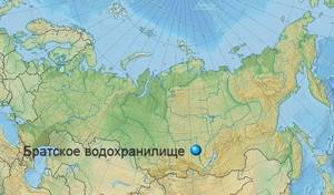
General information about the Bratsk Reservoir
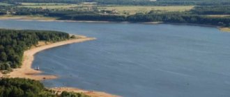
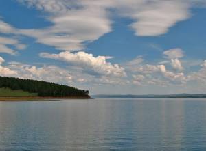
The Bratsk Reservoir is an artificial reservoir in the Bratsk district of the Irkutsk region, formed on the Angara after the construction of the second stage of the Angara cascade. The Bratsk Reservoir is considered the second largest reservoir in the world in terms of volume of accumulated water and one of the largest in area - its length reaches 570 kilometers, its width is almost 25 kilometers. The average depth of the reservoir is 31 meters, while the maximum depth at the dam itself reaches more than 100 meters. The reservoir has a unique coastline - along its entire length it is indented with small winding bays. The largest bays of the reservoir formed at the confluence of the Angara, Iya and Oka rivers.
Main characteristics
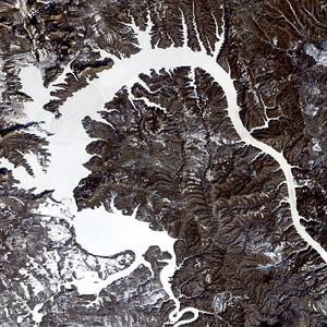
Satellite image.
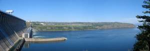
12/19/1999 The dam at the Bratsk hydroelectric power station was built in 1961, filling of the reservoir ended in 1967. The water surface area ranges from 5426 km² to 5470 km², and the volume reaches 169 km³. The useful volume of the reservoir is 35.41 km³, the average depth is 31 m, the maximum depth is 101 m, the change in level when triggered by the pumping station is 7.08 m[1][3].
The coastline, about 7,400 km long, is heavily indented; long bays have formed at the confluence of large rivers - the Angara, Oka, and others. The width of the reservoir exceeds 20 km. Altitude above sea level - 394 m. [ source not specified 630 days
]
History of the formation of the Bratsk Reservoir
The construction of the first three hydroelectric power stations of the Angarsk cascade became the construction of the century not only for the Irkutsk region, but also for the entire Eastern Siberia. The decision to build the second stage of the cascade was made in the fall of 1954, and the first preparatory work began in December of the same year. The construction of the hydroelectric power station was declared a Komsomol construction project and proceeded surprisingly quickly for such a large-scale project - in 1957, part of the Angara was blocked off from ice, and in 1961, filling of the reservoir had already begun. Filling the reservoir took almost seven months, and already in November 1961, the first unit of the hydroelectric power station produced current. The units were put into operation sequentially - the second unit was launched a week later, and already in 1966 all 18 units of the station were launched. The filling of the reservoir was completed in 1967 - in the same year the Bratsk hydroelectric power station was well received by the state commission.
Features of the reservoir
The creation of the Bratsk Reservoir occurred during the construction of the Bratsk Hydroelectric Power Station. Here in 1961 a dam was built that blocked the Angara River, and only 6 years later the reservoir was filled.
This is one of the largest reservoirs that exist in Russia. Its area is almost 5.5 thousand square kilometers. It is very deep, there are places where the depth reaches one hundred meters! This reservoir makes it possible to provide water and energy resources to nearby settlements.
It is also used to transport timber by water and launch ships.
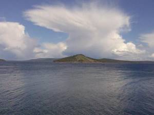
The shape of the object is quite bizarre, because it contains a large number of bays, which are formed due to the fact that several rivers flow into it at once. There are also many small rivers that also flow into this body of water, creating an indented coastline.
Previously, a large number of settlements were flooded here, as a result of which many local residents were forced to move to other settlements. The water also affected 250 thousand hectares of agricultural land, as well as forest lands.
Where is the Bratsk Reservoir located?
The Bratsk Reservoir is located in the Bratsk district of the Irkutsk region, on its banks there are such large cities as Svirsk, Usolye-Sibirskoye and Bratsk, after which both the hydroelectric power station and the reservoir were named. The reservoir is unique in its shape and consists of two parallel channels - the longest part of the reservoir runs along the Angara, while the second part of the reservoir is located on the Oka. The total length of the reservoir's coastline reaches 7,400 kilometers, of which 5,000 kilometers are on the Angara, and the remaining 2,400 on the Oka and Iya. It is worth noting that after the reservoir was filled, the depth of the rivers flowing into it increased significantly, thanks to which many of them became navigable.
Bratskoe
Bratsk Reservoir/Wikipedia
A reservoir with an area of 5470 km², located in the Irkutsk region. The total volume is 169 km³, making it the second largest artificial reservoir in the world. It was built with the aim of developing shipping, timber rafting, water supply and energy generation. The coastline is heavily indented; the shape of the reservoir resembles a dragon.
Bratsk Reservoir on the map of Russia/Wikipedia
Wood sunk during rafting heavily pollutes the water. There are 25 species of commercial fish. Along the banks there are children's camps, tourist centers and sanatoriums.
Weather at the Bratsk Reservoir
The reservoir is located in a sharply continental climate zone, so the weather here is very capricious. In winter, frosts quickly set in on the reservoir with an average temperature of up to -25 °C; in particularly severe winters, the temperature sometimes drops to -60 °C - it is not for nothing that the territory of the reservoir is equated with the regions of the Far North. In summer, the air warms up to 24 °C, but at the beginning of June and at the end of August, light frosts are possible in the mornings - therefore, on a trip to the Bratsk Reservoir you should always take warm clothes, here they will never be superfluous.
Rybinskoe

Rybinsk Reservoir/Wikipedia
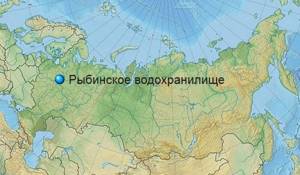
The reservoir is located in the Tver, Volgograd and Yaroslavl regions. The total volume is 25.4 km³; area - 4580 km². The creation of the reservoir had a tremendous impact on the local environment; vast areas were flooded.
Rybinsk Reservoir on the map of Russia/Wikipedia
Today it is a major water transport hub and electricity supplier. The reservoir is home to 38 species of fish.
What to do in Bratsk Reservoir?
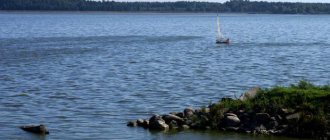
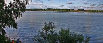
Although the reservoir is an artificial reservoir, in terms of the number of types of recreation offered, it is in no way inferior to natural ones. The water in the reservoir quickly warms up in summer to a pleasant 22–24 °C, allowing you to swim in the reservoir from the end of June. The banks of the reservoir are covered not only with taiga, but also with golden sand ideal for sunbathing. And the forest surrounding the reservoir is perfect for short walks to pick mushrooms and berries, which delight tourists already in July. Hiking near the reservoir, barbecues in the fresh air, sports games and just songs with a guitar - all this can be done on the banks of the reservoir. But the main entertainment on the shores of the Bratsk Sea was, of course, fishing - there are more than 30 species of fish in the reservoir.
Bratsk Reservoir
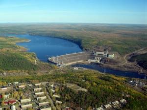
Bratsk reservoir on the river. Angara, part of the Angara-Yenisei cascade of reservoirs. Created 1961–1967 the dam of the Bratsk hydroelectric power station with a height of 190 m.
The total volume at FPL is 169,300 million m3, the useful volume is 48,200 million m3. The normal retaining level (NRL) is 402 m, the dead volume level (LVL) is 392 m. The surface area of the reservoir at NRL and LLV is 5,470 km2 and 3,133.2 km2, respectively. Length 1020 km; the magnitude of water level fluctuations up to 10 m; water exchange coefficient 0.5 (once every two years). Bratskoye is the largest reservoir in the Irkutsk region and Russia in terms of full and useful volume, the largest river reservoir in the world[*].
The significant time it takes to fill the reservoir to the design level is due to prolonged low water in the Angara-Yenisei region in the 1960s. The reservoir has a very complex morphological structure: within its boundaries there are three main regions (Angarsky, Okinsky, Geysky) and 11 characteristic hydrographic areas. The width of the reservoir in different areas varies from 1 to 25 km; the maximum depth is 150 m (at the dam), the average depth, which is influenced by numerous bays (their total area is 27% of the total water area), is 31 m. In summer, the surface layer of water (up to 1.0 m) warms up to 15– 20°C. The maximum duration of freeze-up in different sections of the reservoir in different years is up to 7.5 months a year, the maximum ice thickness is up to 1.35 m. The average annual flow volume at the dam site is 91 km3, water losses due to evaporation are 7.4 km3/year. The reservoir carries out long-term flow regulation, the flow regulation coefficient (the ratio of the useful volume to the flow at the dam site) is 0.55.
The total length of the coastline is 6036 km; characterized by abrasion, accumulative, landslide, biogenic, karst and non-eroded shores. The length of the collapsing shores is 35% of the coastal perimeter (about 2100 km). The maximum displacement of the collapsing banks in many areas reaches 80–160 m over a 40-year period of operation, and the width of the coastal shallows is 50 m. In a number of sections of the coastal zone of the reservoir, due to the processing of the banks, large sand and pebble spits have formed up to 160 m long and up to 150 m and a height of 4–8 m. The influence of the reservoir on the relief of the coastal area (karst, landslides) can be traced at a distance of up to 4–6 km from the water’s edge.
The maximum speed of currents in the surface layer reaches 0.8–1.0 m/s, the speed of bottom currents is 0.01–0.10 m/s, and the height of wind waves is up to 3.0 m.
Phytoplankton is dominated by diatoms; their biomass during the growing season ranges from 0.5 to 12.8 g/m3. The average biomass of zooplankton is extremely low - 0.6 g/m3, the average biomass of food zoobenthos used by fish is 5.3 g/m2.
The reservoir is characterized by low water mineralization, varying from 104 to 144 mg/l; water belongs to the hydrocarbonate class. The dissolved oxygen content is high - 6.4–14.0 mg/l, water transparency is also high - up to 8.0 m in the dam part of the reservoir; The color of the water is low.
The reservoir is home to 25 species of fish, of which ten species are commercial. The share of valuable fish species (sturgeon and salmon) in various catches before the creation of the reservoir was 55%; currently it does not exceed 1%. The most valuable species - sturgeon, taimen, lenok, East Siberian whitefish, tugun, grayling - live only in the zone of pinching out of the backwater (in the upper part of the reservoir) with spawning upstream of the Angara. During the existence of the reservoir, a typical lake ichthyocenosis was formed in it, represented by relatively low-value partial species, such as perch, roach, bream, pike, ruff, small bream, and sorog. Total commercial catches in the reservoir, taking into account recreational fishing in 2000–2009. amounted to 800–1000 tons, more than 90% of the catch was small particles. The fishing productivity of the reservoir is apparently the lowest in the world among large artificial reservoirs and is only 1–2 kg/ha, which is 10–15 times lower than the design value. A significant (possibly by an order of magnitude) increase in fish productivity is possible on the basis of a whole system of general ecological, environmental and specialized fishery measures aimed at creating and ensuring a stable state of valuable commercial ichthyocenoses through artificial reproduction in fish hatcheries. All these activities are capital-intensive, and their real effectiveness appears only after 5–10 years. The current situation is typical and natural over the last twenty years not only for the Bratsk Reservoir, but also for many other large reservoirs in Russia.
The reservoir is used comprehensively for hydropower, water transport, water supply, timber rafting, fisheries and recreation. The installed capacity of the Bratsk hydroelectric power station (20 hydraulic turbines) is 2,400 MW, the annual electricity generation in different years varied from 14.4 to 22.7 billion kWh. This hydroelectric power station provided the cheapest electricity in the USSR (and possibly in the world). According to technical and economic criteria for assessing the cost effectiveness of design, construction and operational work, the costs of creating the Bratsk hydroelectric power station were recouped at least 5 times by 1992, i.e. 35 years after the creation of the reservoir. In recent decades, problems associated with the quality of water in the reservoir have worsened, since its formation is significantly influenced by anthropogenic factors, primarily industrial and economic activities in the cities of Irkutsk, Angarsk, Usolye-Sibirsk, Svirsk, Bratsk. At the entrance to the reservoir, the water quality according to the pollutant index is assessed as the second class (clean), then as it approaches the dam in a number of areas, the water environment is assessed in the range from the third (moderately polluted) to the fifth (dirty) class. The priority pollutants are petroleum products, toxic compounds of heavy metals, phenols and a number of organic compounds. This is due to the supply of large volumes of insufficiently treated wastewater from chemical, forestry and municipal enterprises. The strongest impact on water quality is exerted by the decomposition of floating and submerged wood, which in the harsh Siberian climate occurs over many decades (low constants of biochemical reactions in combination with slow water exchange and low heating - no more than 10–12 ° C in the surface three-meter layer) . There is a high level of contamination of the bottom sediments of the reservoir with mercury compounds, the concentration of which in some areas exceeds the background by 100 times. The concentration of mercury in the tissues and organs of fish exceeds permissible standards by 2–10 times. More than 16% of the fish stocks of the Bratsk Reservoir (in the area from Usolye-Sibirskoye to Balagansk - more than 50%) contain mercury in concentrations exceeding the MPC. At the end of the 1990s. The question of suspending fishing in several areas of the reservoir was raised.
The cluttering of many bays of the reservoir with sunken and rotting wood causes phenolic pollution of the aquatic environment and provokes intense algal blooms. At the bottom of the reservoir and in the bays there is up to 25 million m3 of submerged and floating wood. Completely clearing the reservoir of wood requires almost a century. The bulk of usable orphan wood is located on the shore and in numerous bays of the reservoir. Freeing a reservoir from submerged wood in water areas more than 10 m deep is problematic in terms of technical and economic indicators; Every year, new volumes of wood enter the reservoir, which is due to the processes of destruction of the banks and losses during timber rafting.
By the beginning of the 1990s. The volume of annual freight traffic on the reservoir reached 5 million tons, passenger traffic - up to 250 thousand people, and the volume of timber floating more than 4 million m3/year. The reservoir has two cargo ports, a specialized timber port and 40 berths; the duration of the navigation period in different sections of the reservoir in different years is from 5 to 8 months.
The reservoir is used for domestic drinking and industrial water supply; large water intakes are concentrated in the cities of Svirsk, Cheremkhovo, Bratsk, Balagansk.
When creating the reservoir, about 250 thousand hectares of agricultural land were flooded, as well as about 300 thousand hectares of coniferous and deciduous forests of various grades with an operational supply of wood from 30 to 100 m3 or more per hectare. When preparing the territory for flooding, the implementation of the required volumes of forest harvesting and forest clearing could not be achieved due to the technical and economic realities of that period, since the main task was to quickly bring the hydroelectric power station to its design capacity. About 75 thousand people were resettled, while seven settlements were expanded outside the flood zone and 14 were newly built.
Despite all the contradictory large-scale positive and negative consequences, the creation of the Bratsk reservoir is one of the heroic and bright pages in the development of Soviet hydropower. The construction of the hydroelectric power station and the preparation of the reservoir did not stop even in the harsh conditions of the Siberian winter; volunteers came to the construction site from all regions of the country; in the first years they had to live in tents and barracks. The damming of the Angara by the Bratsk Hydroelectric Power Station aroused enthusiasm and admiration no less than the launch of the first artificial Earth satellite and the space flight of Yu.A. Gagarin.
V.P. Saltankin
Sanatoriums and recreation centers on the Bratsk Reservoir
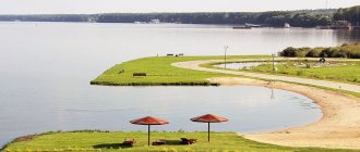
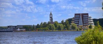
The Bratsk Sea is considered the main vacation spot for residents of the Bratsk region and, of course, attracts many vacationers from other regions of the country to its shores. Near the reservoir there are several tourist centers and recreation centers for every taste and budget. The recreation center "Fisherman's House", for example, is ideal for a relaxing family holiday - here couples can stay in small cozy houses or settle in a tent right on the shore of the reservoir. Especially for those wishing to improve their health, the Bratskoe Vzmorye sanatorium was opened - the sanatorium is located on the shore of a reservoir among the picturesque taiga. There is a mineral spring on the territory of the sanatorium and there is everything you need for a comfortable holiday in nature. In addition, the tourist bases “Golden Sands” and “Ust-Osa” are popular among tourists, offering accommodation in both houses and tents.
Where to relax on the Bratsk Sea: recreation centers
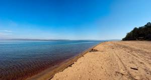
Beautiful Siberian nature, pine forests, expanses of water, sandy beaches, and the possibility of a secluded “wild” holiday attracts numerous tourists to the shores of the Bratsk Reservoir in the summer months. The most famous beaches of the Bratsk Sea are located in the Osinsky district, which locals call “Golden Sands” .
The recreation center located here also bears the same name. Golden Sands is located 192 km from Irkutsk along the Aleksandrovsky Highway. To get to the beach, you should go in the direction of Maysk, and then from there to Ust-Altan and the village of Rassvet. The last kilometers of the route can be difficult to navigate in rainy weather. On Golden Sands, tourists are offered summer houses and a campsite. The cost of parking a car is 250 rubles. per day. Rent of 2-4-bed houses with all necessary amenities - from 1700 to 3800 rubles. per day. The cabins have electricity and bedding, and the toilet and outdoor shower are located outside. On the territory of the base there is a shop and a cafe.
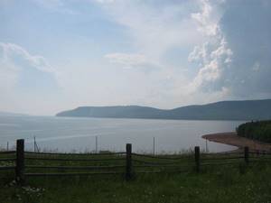
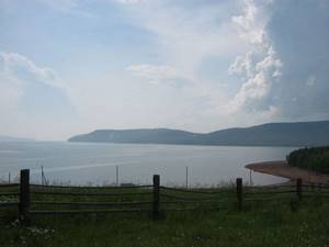
Recreation center in the vicinity of the reservoir, © Ksenia Usova
Another popular recreation center on the Bratsk Sea - “Bear Corner” is located in the Bokhansky district on a picturesque cape with a huge sandy beach. Here tourists are offered two accommodation options - in houses and on the “wild” beach in tents. The houses are equipped with amenities and gazebos; on the territory there is a bathhouse, a pier, a volleyball court and a cafe.
Vacationers on the beach in tents are allocated space for a car. Parking cost 400 rubles. per day. The payment includes the opportunity to use a source of drinking water and firewood. The most convenient way to get to the recreation center from Svirsk is first by ferry to Kamenka, then along the gravel road towards Morozovo, Kazachye, Seredkino. In rainy weather, the section of the road between the Medvezhy Ugol base and the neighboring village of Seredkino can become a real test of your car’s cross-country ability.
All hotels and recreation centers on the Bratsk Reservoir
Golden Sands near the village of Rassvet (Osinsky district), © Alexander Shmelev
In the Bratsk area, in the area closest to the hydroelectric power station, there are many other bases and holiday homes: “Zharok”, “Sobolek”, “Druzhba”, “Cape Bull”, “Yubileiny”, “At the House”, “Bely Bereg”, “Solnechny” ", "Prostokvashino", "Teremki". On the other side is the Bratskoe Vzmorye sanatorium. The base “Fisherman’s House” is famous in Balagansk.
Fans of unorganized tourism who prefer an independent “wild” holiday will also find many deserted secluded places with beautiful nature on the shores of the Bratsk Sea in the bays in the area of Bratsk, Balagansk, Kaltuk, Kuvatka, Svirsk and others.
Rest on the Bratsk Reservoir as a “savage”
Of course, staying at a tourist base is not suitable for everyone, because sometimes you want to be a “savage” - stay somewhere with a tent far from civilization and other tourists. The Bratsk Reservoir is ideal for such a holiday - you can always find a free place on its banks. The most convenient place for relaxing with a tent on the Bratsk Sea is considered to be the Golden Sands beach. The beach is covered with soft golden sand and surrounded by taiga - on the border of forest and beach and you can conveniently camp a tent while remaining at a distance from the nearby tourist base. Vacationing as a “savage” on the Bratsk Reservoir is a matter of experience; only after several trips can you find a place that suits you in everything.
Sights: Irkutsk region, Lakes, reservoirs
Pages: 1 >
Agul Lake
| Location: Irkutsk region look on the map Agul Lake is located in the Eastern Sayan Mountains in the Nizhneudinsky District in the west of the Irkutsk Region. On the western and eastern sides, the lake is sandwiched by taiga-covered mountains, steeply descending to the water with rocky ledges. | |
| Read completely |
Bratsk Reservoir
| Location: Irkutsk region look on the map The Bratsk Reservoir is an artificial reservoir in the Irkutsk region, formed on the Angara River as a result of the construction of the Bratsk Hydroelectric Power Station. The shores of the Bratsk Reservoir are a favorite vacation spot for tourists and fishermen. | |
| Read completely |
Aya Bay
| Location: Irkutsk region look on the map Aya Bay is one of the best places to relax on Lake Baikal. Aya Bay is a sandy beach that juts out into the mainland, 800 meters long. Not far from the pier, to the northwest, on the marble plateau of the cape of the same name, at an altitude of 200 meters, there are petroglyphs. | |
| Read completely |
Zuun Hagun Bay
| Location: Irkutsk region look on the map Zuun-Khagun Bay is located in the Maloe More Strait, in the most picturesque place of Mukhor Bay (the largest of the Maloye More bays); it is the most interesting and remarkable among the large number of bays in the strait. | |
| Read completely |
Peschanaya Bay
| Location: Irkutsk region look on the map Peschanaya Bay is one of the most famous places in Lake Baikal, a very interesting and beautiful place. Apparently, the Creator of Lake Baikal felt inspiration here and sculpted the rocks, mountain slopes and the oval of the beach of Peschanaya Bay with special beauty, placing them on a small space on the shore of Lake Baikal. | |
| Read completely |
Lake Baikal
| Location: Republic of Buryatia, Irkutsk region look on the map Baikal (Bur. Baigal Dalai, Baigal Nuur) is a lake of tectonic origin in the southern part of Eastern Siberia, the deepest lake on the planet, the largest natural reservoir of fresh water. The lake and coastal areas are distinguished by a unique diversity of flora and fauna. Local residents and many in Russia traditionally call Baikal the sea. | |
| Read completely |
Lake Nuhu-Nur
| Location: Irkutsk region look on the map Lake Nuhu-nur is considered sacred. Currently, the lake is fenced off to keep the shores and water clean. The mud of Lake Nuhu Nur is in great demand among local residents and visitors. They take dirt from the lake in compliance with local traditions in the presence of a shaman. Once every three years a large prayer service is held on the lake. | |
| Read completely |
Lake Oron
| Location: Irkutsk region look on the map The lake is flowing, two large rivers flow into it - Sygykta and Kultushnaya. The lake is connected by a small channel to the Vitim River, forming an extension of up to 2.5 kilometers with numerous islands and shoals, called Oron shoals. The area, especially in the southern part of the lake, is very beautiful due to the high picturesque chars, overgrown with forest and thickets of elfin cedar, surrounding the shores of the lake. | |
| Read completely |
Lake Hankhoy
| Location: Irkutsk region look on the map Lake Khankhoy is located in the middle part of the western coast of Olkhon Island. Lake Khankhoy is known for its very warm water and abundance of fish. From the north, Lake Khankhoy is separated from Lake Baikal by a powerful rocky ridge that falls steeply into Baikal, but smoothly descends to the lake; from this ridge a picturesque view of the Maloye More Strait, the Maloye More Islands and the Primorsky Range opens up. | |
| Read completely |
Lake Shara-Nur
| Location: Irkutsk region look on the map Lake Shara-Nur is the only lake on Olkhon Island in the Irkutsk region, located in the mountains, translated from the Mongol-Buryat language means “Yellow Lake”. Since ancient times, Lake Shara-Nur has been valued by local residents for its healing mud, which has a beneficial effect on the cardiovascular system, and especially for diseases of the musculoskeletal system. | |
| Read completely |
Pages: 1 >
Fishing on the Bratsk Reservoir
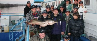
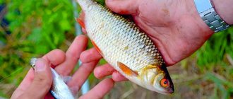
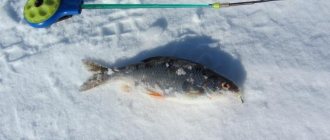
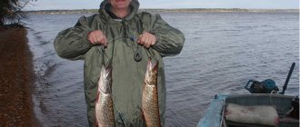
The Bratsk Reservoir is considered a paradise for fishing lovers - both beginners and experienced fishermen will find a catch here. In the reservoir, a fishing rod can catch pike, carp, crucian carp, roach and even omul. But the main catch of the reservoir is considered to be perch - the reservoir is famous for its huge perches weighing more than a kilogram. The water of the reservoir is an ideal ecological system for perches - there is plenty of food for them, which is why the size of brotherly perches impresses even experienced fishermen. It is worth noting that fishermen can count on a good catch in any season of the year - both in summer and winter the reservoir is full of fish, you just need to find out all the fishing spots in advance. Fishing tours are often sent to the Bratsk Reservoir; in addition, fishing competitions are often held here - whoever has the most catch is the winner.
Vilyuiskoe
Vilyui Reservoir/Wikipedia
The reservoir is located in Yakutia. The total volume is 40.4 km³; area - 2360 km². The reservoir was created for the purpose of developing navigation, hydropower and obtaining fresh water. This is a unique structure, built in permafrost conditions.
Vilyui Reservoir on the map of Russia/Wikipedia
The shoreline of the reservoir is heavily indented, with flat areas giving way to cliffs. The climate in the reservoir area is sharply continental. Under the influence of thermal pollution, permafrost thaws, as a result of which the banks of the reservoir are destroyed.
How to get to the Bratsk Reservoir?
You can get from Irkutsk to the Bratsk Reservoir both by personal and public transport. You just need to follow the regional highway R-255 to Bratsk. The path to Bratsk will pass by such settlements of the Irkutsk region as Usolye-Sibirskoye, Cheremkhovo, Zima, Kuitun and Tulun. The distance from Irkutsk to Bratsk is 619 kilometers, travel time can take up to 10 hours. Shuttle buses depart regularly from the Irkutsk bus station to Bratsk. Bratsk is located on the very shore of the reservoir, so it is from this city that it will be most convenient to get to any point on the reservoir. The Golden Sands beach, for example, can be reached by minibus from Bratsk to the village of Osa, and from Osa - directly to the beach.