Water resources
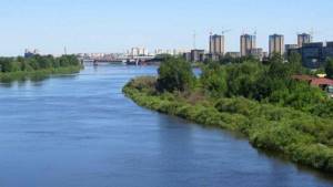
Tura River in Tyumen
Most of the rivers in the Tyumen region can hardly be called such; for the most part they are small rivulets and streams. In addition to them there are ponds, lakes, and swamps.
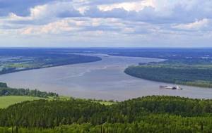
Large rivers in Tyumen are predominantly calm. Their channels are deep and the current is slow. 90% of the streams carry water into the Kara Sea. The main waterways of the region that supply the population and industry are the Irtysh and Pyshma.
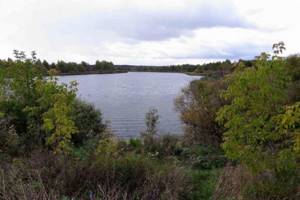
Lakes
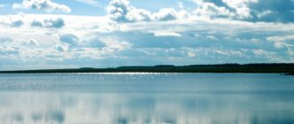
Salt Lake - locals jokingly call it the “dead sea”. The water is so salty that it lacks flora and fauna. The mud and water of the salt lake have healing properties. People come here to treat skin diseases and pathologies of the musculoskeletal system. Monastic Lake - located near Ermak Hill, a natural monument of the region. The name remains from past centuries, when the reservoir was one of the economic objects of the Tobolsk Monastery. Today the shores are open to tourists. But gatherings with a fire and barbecue are prohibited.
Ponds
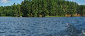
In addition to large lakes, the Tyumen region has several thousand ponds. Many are located in villages or remote taiga, and therefore are little known among the population and tourists. But there are two places that attract residents and visitors to the region. The main reason is fishing.
Chervishevskie ponds are located 20 km from Tyumen. They are in demand among fishermen and simply recreationalists. The waters are inhabited by rare species of fish - chebak, mirror carp, grass carp.
Kostylevsky ponds are privately owned. During the warm season, tenants release many different species of fish into the water. Fishing in the ponds is subject to a fee. From Tyumen to the ponds it is approximately 50 km.
Rivers in the Tyumen region
- The Irtysh channel covers the territory of China, Kazakhstan and Russia. At the Irtysh, the length of the water flow is over 4000 km; on Russian soil the river stretches for 2010 km. The distance between the banks is 500-700 meters, in some places in the north up to 1 km. In the spring, when snow and ice melt, the water level rises significantly. But floods practically never happen—hydroelectric power plants located on the river begin to actively stock up on water for the period of summer drought. From October to April, ice cover appears on the surface. The Irtysh is a tributary of the Ob, and what is most interesting is that its length is greater than the length of the main Ob River. The Irtysh is navigable and provides water communication with Kazakhstan. Only navigation does not last long, 3-3.5 months a year;
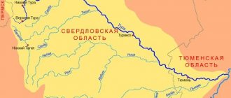
- Pyshma - flows in the Sverdlovsk and Tyumen regions of Russia. The area of the basin is over 19,000 square kilometers. It is distinguished by interesting places along the flow - many rocks, caves, grottoes. In the warm season, Pyshma welcomes hundreds of fans of water rafting and hiking. The Beloyarsk Reservoir and the Beloyarsk Nuclear Power Plant were created on the river. Due to the active work of industrial enterprises, the ecological condition of Pyshma has been shaken. But most fish species still live in the waters;
- Iset - flows in the Sverdlovsk, Kurgan, Tyumen regions. The channel has a different character: in the upper reaches it is a kind of cascade, consisting of several ponds, many working and abandoned dams. Then a series of rapids begins. One of them, the famous Howler, is a terror for rafters who prefer to get around it on foot. Natural monuments have been preserved on the banks - stone gates, caves, grottoes, basalt cliffs;
- Ishim is a 2,500 km long river that flows in Kazakhstan and Russia. It is a tributary of the Irtysh. The source is located in the Niyaz mountain range, so in the upper reaches the channel exhibits the typical character of a mountain stream. The Sergeevskoye and Vyacheslavskoye reservoirs are located on Ishim, providing water to cities and agricultural areas;
- Klyuchi is a small river in Tyumen that flows within the city limits. Rumor has it that at the beginning of the 20th century a beach with a park grove was built on it. When talking about what other river there is in Tyumen, one can remember the Klyuchi.
Klyuchi River in Tyumen
Swamps
In general, about half of the territory of the Tyumen region is occupied by swamps. Some are still at the formation stage. Many taiga lakes have become swampy. The swamps in Tyumen are distinguished by rich flora. There are representatives of northern berries, mushrooms, mosses and lichens, swamp pine, etc.
The Vasyugan swamps have a total area of over 53,000 square kilometers, but the Tyumen region accounts for a small part of them. To be more precise, they are located in the Khanty-Mansiysk Autonomous Okrug. This is a source of fresh water for the surrounding settlements; many rivers and streams originate here. The Vasyugan swamps are a source of peat; the maximum depth of the deposits reaches 10 meters. The wetlands are home to native fauna. Endangered representatives of the animal world have been preserved here: reindeer, peregrine falcon, shrike, and eagle. But due to active development of oil and gas fields, the ecology of the Vasyugan swamps is suffering, and the future of flora and fauna is under threat.
Tarman swamps - run along the Tura riverbed, the length is 136 km, the width varies from 7 to 40 km. Tarmans are rich in peat deposits, the thickness of the layers is from 2 to 7 meters. A significant part of the swamp territory is used for pastures and hay meadows. These are areas that were previously drained for the purpose of peat extraction. Before development began, the swamps numbered fifty lakes. Ancient settlers at one time connected them with artificial canals to local rivers for economic and communication purposes.
The groundwater
The volume of groundwater in Tyumen and the region is over 5000 cubic meters. The region is also rich in underground artesian springs. The total reserve should be enough for 30 years for residents of Tyumen and the region, subject to continuous use and complete abandonment of river water. Today, the Aptian-Cenomanian, Neocomian and Jurassic complexes are promising. They lie at a depth of more than 1000 meters.
Minerals of the Tyumen region
The Tyumen region has the largest accumulation of peat and iron phosphate. Wood reserves and saprel deposits are concentrated. The largest natural reservoirs of mineral and fresh water in Russia and the world.
Oil and gas
The main value deep in the earth is oil and gas fields. The largest deposits are located in the Uvat region. The deposits are classified as small and medium, complex in geological structure.
River in Tyumen
The city is the administrative center of the Tyumen region. On what river is Tyumen located? — The city is located on the banks of the Tura (a tributary of the Tobol).
When discussing which river flows through Tyumen, one cannot fail to mention the Tyumenka River. In the distant gap, it was along its bed that the first buildings of the future metropolis began to be erected. Mention of the river was found on a map of 1683 - next to the designation of the fortress there is the inscription “Riviere de Tumenka”. The first water mill in those parts was built on the bank of Tyumenka, which served the peasants for more than 100 years.
Before the appearance of the urban settlement, it was a turbulent river that carried its waters to Tura. Today, Tyumenka mostly passes through underground pipes to its confluence with the Tura. The reason is massive clogging of the riverbed with household and industrial waste, the release of toxic chemicals, and the entry of agricultural waste into the water. A stinking stream now flows under the Nikolsky Bridge - a river in Tyumen, the name of which played a role in the naming of the city.
About the Tura River
The main river in Tyumen, one of the largest water flows. In some places the Tura is navigable (600 km to the mouth) and is popular among raftsmen.
The river is also rich in attractions, both natural and architectural. Within walking distance from the Tura embankment there is the famous monument to the postman. Walking along the shore, you can see the Church of the Savior - Tyumen is rich in churches built in past centuries. Also across the river is the Bridge of Lovers, popular among tourists and young people of Tyumen.
The waters of Tura are used for the needs of the large population of Tyumen and enterprises in the region. There are three large reservoirs and the Verkhoturinskaya hydroelectric power station on it. Due to the heavy industrial load, the ecology of the river suffers. The human factor plays an important role in pollution.
Short description
Tura belongs to the Irtysh basin. The source is located in the mountain range of the middle Urals. The total length of the water flow is 1030 kilometers, more than half of which is in the Sverdlovsk region. The width of the riverbed in some places reaches 200 meters.
The water regime of Tura is clearly divided by season. In the spring, due to melting snow, floods are observed, followed by low water, which lasts until the end of October. In autumn, the water level rises, again due to rain. In winter, an ice cover is established on the surface of Tura.
Story
The name of the river comes from the Tatar “fortress, house, structure.” It was Tura who witnessed a major historical event - the beginning of Ermak’s conquest of Siberia. Having sailed hundreds of miles downstream, the army saw that there was plenty of land here, and the local population received the strangers quite friendly. The first Russian-speaking village on the banks of the Tura appeared in the 17th century.
The Sovereign’s Road, famous in those days, also ran along the riverbed. This was the main trade and passenger route until the construction of the Siberian Highway. On the banks of the Tura, the ancient city of Verkhoturye was built, the current cultural and religious center of the Sverdlovsk region.
Settlements
Looking at the map of the city of Tyumen, in order to determine which river it is on, Tura catches the eye. But on its banks, in addition to the administrative center, there are other famous settlements:
- Ust-Salda;
- Turinskaya Sloboda;
- Krasnogorskoe;
- Bolotovskoe;
- Sonkino;
- Kamenka;
- Chiccha.
Minerals
Deposits of gold and platinum were discovered in the river valley in the 19th century. At the same time, the workers' settlement of Konyukhovo was quickly founded. A gold rush began; at the beginning of the 20th century, up to 80% of the total reserves of gold and platinum were removed from the depths. Currently, artels working on a rotational basis wash the residues at the mines.
Other minerals: brick clay, sand, marble, iron, vanadium and mercury ore, brown coal. In some places there are deposits of bauxite.
Traveling around Tours
The Tura River in Tyumen attracts water and hiking tourists. Due to the extreme climate, travel by water does not last long, from about May to September.
You can raft along the most popular route, which starts in the Nizhnyaya Tura area and ends in Verkhoturye. The nature of the current is mountainous, there are rapids and rifts. In some sections the river is divided by islands into separate branches. The best time for rafting is spring; the Tura is full of water due to melted ice and snow.
You can start the journey from the city of Turinsk, it will take 4-5 days. People call this route “in the footsteps of Ermak” - it was on this section that the army decided to settle on new lands and complete its further advance deeper into Siberia. Along the way you can see ancient temples and ruins of ancient settlements. The journey ends near the village of Kulakovo.
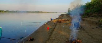
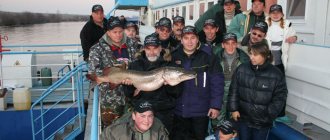
Fishing in rivers
There are many large and small rivers in the region. The Ob, Irtysh and Tura are considered the deepest. Most often, fishing lovers from Tyumen go to the Tura River. It divides the city into two parts. The following types of fish can be found in the river:
- pike,
- perch,
- nelma,
- sterlet,
- bream,
- burbot,
- roach,
- bleak.
It is worth remembering that nelma is considered an endangered species, so when caught, it must be immediately released. Failure to do this may result in a serious fine.
Some areas along the river are leased and fishing is prohibited there. Therefore, before your trip, be sure to study the map. Within the city limits you can fish in front of the architectural institute. There are wintering pits in which there are a lot of fish. A section of the river located near the settlement of Chikcha is considered to be a rather promising place not far from Tyumen. You can get there in half an hour, since you need to cover only 30 kilometers from the city. Some fishing enthusiasts are ready to travel a greater distance from Tyumen. They visit the following places:
- confluence of the Pyshma and Mezhnitsa Rivers,
- village of Sozonovo,
- Usalka village,
- places near the Salair Bridge.
Lovers of trophy specimens always go to the Salair Bridge area. A very large hole with a depth of 18 meters is known among fishermen. It is famous for the presence of very large pikes and perches.
Fans of feeder fishing most often go to the lower reaches of the river. It is there that you can catch a lot of bream, roach, perch and crucian carp. Fishermen use worms and maggots as bait. Many amateurs make their own bait. They don't tell other fishermen their secrets. Also popular among fishermen are complementary foods sold in special stores. Before use they are flavored with vanillin.
In the fall, most fishermen begin to hunt burbot. This species bites well only with the arrival of the first cold weather. Burbot most often hides near snags and stones. It's quite difficult to lure him out. Many fishermen burn large fires on the shore to force the burbot to come out to the clean part of the reservoir. They also actively feed the fish. Burbot bites best on live bait. That is why fishermen have to catch minnows and ruffs first.
The Pyshma River is also popular among fishing enthusiasts in the Tyumen region. It is one of the tributaries of the Tura. Most often, fishermen go to the following places:
- The section of the river between the villages of Uspenka and Perevalovo. There you can catch pike, perch, bream, burbot and ruff. Particularly successful anglers manage to go home with a catch of crucian carp and rotan.
- The village of Vinzili. There are a lot of predators in this section of the river. Anglers go home with pike and striper.
- Village Iron Bust. Fishermen from nearby settlements come there. Pike, bream, ide, perch and rudd bite well in this place.
- Plot outside the village of Chervishevo. Not far from this settlement there is the famous “betonka”. It is there that you can ensure a good fish catch all year round.
The Tobol River also attracts fishing enthusiasts in the Tyumen region. This is where you can catch large tench. In the river there are specimens whose weight exceeds 6 kilograms. There is also a lot of carp, bream, roach and rudd in this river .
Fishing
Tura does not disappoint in terms of fishing. The river is home to pike, ide, chebak, pike perch, river perch, ruffe, sterlet, and other less “favorite” representatives of the aquatic fauna among fishermen. Success does not depend on the weather or season - you won’t be able to leave empty-handed, despite the fact that the number of fish has decreased significantly recently.
In the Tyumen region, many fishing spots are leased, where fishing is carried out on an industrial scale. To avoid troubles, before going fishing, it is recommended to find out detailed information about the place you like.