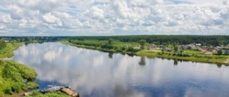
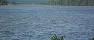
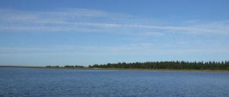
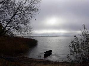
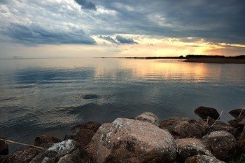
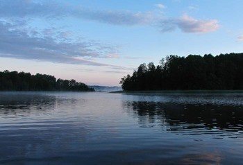
Location of Lake Peipsi
Lake Peipsi is located on the territory of two countries: the eastern shore belongs to the Russian Federation, the western and back shore belongs to the Republic of Estonia, where it is called Peipsi. The reservoir is part of the Chudsko-Pskov lake complex. Coordinates of the object on the map: latitude – 58°38′16″, longitude – 27°30′12″.
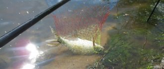
In summer and winter, the lake attracts fans of fishing; common prey is:
- mirror carp;
- ruff;
- pike;
- perch;
- zander.
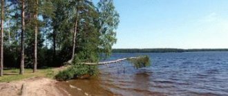
On the coast of the lake there are tourist bases (the most popular are “Chudskoye Podvorye”, “Prichudye”, “Far Away Kingdom”), clean water and a sandy bottom attract tourists who prefer a relaxing holiday.
Main attractions of the region:
- Cathedral of the Icon of the Sovereign Mother of God;
- Gdov Fortress;
- Museum "Samolvovo Barn";
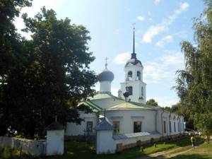
- Church of St. Trinity, Peter and Paul, St. Nicholas.
Route options:
1. From St. Petersburg (direction – the city of Gdov):
- by car, driving along the E20, E360 highways, distance – 250 km, travel time – 4 hours;
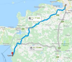
- by bus from the Obvodny bus station, trip duration – 4 hours 30 minutes;
- by train “St. Petersburg-Gdov”, departing from the Baltic station, travel time is 4 hours.
2. From Moscow to Pskov by train, departing daily from Leningradsky Station (journey duration - 5 hours), then to your destination by public transport or taxi (1 hour drive).
3. From Tallinn to the city of Tartu (distance - 200 km), then by bus to the port of Laiksaare (150 km). The average travel time is 5 hours.
Islands of Pskov Lake
Islands of Pskov Lake. Two trips of the Eeyore traveler to the islands: Kolpina - 2018 and Talabskie - 2021.
Table of contents
Islands of Pskov Lake. Kolpina – you won’t get it the first time
Kolpina Island is located in Lake Pskov, in the Russian border zone, half a kilometer from the Estonian shore. For some reason, once again I succeed the third time... I’ll tell you in order, so that my followers know what traps and pitfalls lie in wait for them (it’s unlikely that things have gotten better there...). I issued a pass to the border zone without any problems through State Services, they sent it by mail directly to my mailbox. I asked for 3 summer months, because... I didn’t know exactly when I would go. They gave me a year - it was like looking into water. The first attempt took place in June. Materials on the Internet were studied, incl. ferry schedule. We arrived in Kulje... There is no ferry and there won’t be one, we didn’t have time to issue any permits for navigation. It is curious that private owners do not take boats for money, although there are boat owners in the village; we met, it seems, a dozen. Everyone made an excuse... They advised me to find out about the prospects in the administration - this is in the village of Krupp, just in case, telephone2 (almost useless, as it turned out).
Islands of Pskov Lake. Kolpina – second and third attempts
In September we were going to Belarus, why not try to stop by an island along the way (100 miles is not a detour)? I called the Krupp Rada, they told me that the ferry was running and gave me the current schedule (Thursday - in Medli and Saturday - in Shartovo). We have booked an overnight stay in Pskov and are leaving in a week. Something pushed me off the road to call again.
It turned out that the Saturday ferry we were going to was canceled from tomorrow due to shallowing of the harbor in Shartovo. Positive – they gave the ferry captain’s phone number: +7 911 8981264, name is Mikhail. I called him and he said that he had applied (I don’t know where) for flights until the end of November, but it was better to call the day before. I figured out my work schedule, the only available Thursday was October 25th. I started calling the captain on Monday - the answer was: they will bring fuel - there will be a flight, if they don’t bring it - no... Finally, on Wednesday at 15:30 (!) the captain reported that the fuel had arrived. I quickly booked an overnight stay in Pskov, packed up and headed off. You need to leave Pskov at 7 am, because... The ferry is at 9 and there is no one waiting. We arrived in Kulje. The ramp on the ferry is almost vertical, it doesn’t matter to tractors and the auto shop (the main traffic), I could barely get on the Logan with the help of swear words and boards.
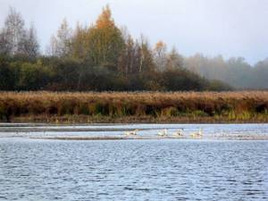
Islands of Pskov Lake. Kolpina
The landscapes in these places are very sparse, unlike the Gdov coast. But there are a lot of birds: white herons in the reeds,
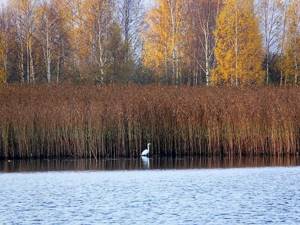
swan puppies...
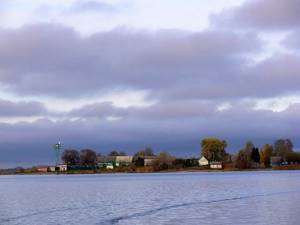
We arrived in Medli and somehow made it to land. From the water, Medli looks like this, with the dominant feature at the border post:
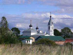
Why did I even go there? Behind the Transfiguration Church from the time of Ivan the Terrible.
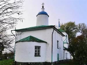
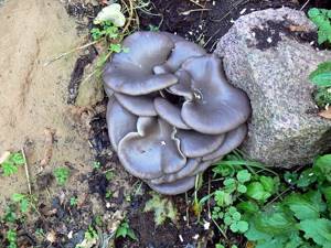
in the village of the same name as the island. The bell tower, refectory and apse are the creations of craftsmen of the 19th century, who significantly distorted the appearance of a good temple. I don’t even know whether to advise overcoming the border zone, ferry and relative impassability for such eclecticism... The entire population, in general, also looks very boring, and the whole island is almost completely overgrown fields and weed forest. But there were some spectacular mushrooms:
At the same time, we also stopped in Shartovo - there, in addition to no chapel, we got a picture that conveys the general mood of the trip...
Return ferry is at 15:00 (the journey takes about an hour).
Islands of Pskov Lake. Talab Islands. How to get there
With the Talab Islands, everything is much simpler, this is also Lake Pskov, but not a border zone and generally a lively place. We used the services of the company https://talaby.ru/talaby-weekend.html and did not regret it. The boat leaves at 11.40 from the village. Crowd. Payment either in Pskov on Lenin Square 1 (Senden store) before the bus departure, or prepay 50% of the trip cost to the card, and pay the rest during lunch at a restaurant on the island. Flooded. If you drive your own car to Tolba, the cost of the excursion is 1600 rubles per person.
Talab Islands. Temples
Why did I even go there? First of all, behind the Church of Peter and Paul on the island. Verkhny (aka Belova).
The main quadrangle is interesting - traditional Pskov architecture, but built in 1710.
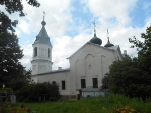
The crypt has been preserved from an older church (1470), destroyed by the Swedes.
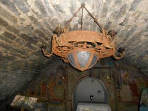
The rest of the parts are later and boring. On the neighboring island of Talabsk (aka Zalita) there is the Church of St. Nicholas the Wonderworker (1792). It became famous thanks to the activities of Elder Nikolai Guryanov, who was its rector from 1958 until his death in 2002. The never-ending pilgrims enliven the landscape and contribute to the well-being of local residents. The church itself is tacky, the chapels and bell tower are very spoiled.
There are two more historical chapels on the island of acceptable architecture.
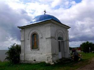
Near the second of them they sell delicious cheap smoked fish from the local catch, don’t miss the bream!
Talab Islands. XX century
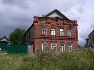
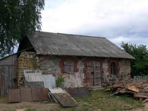
In general, the Talab Islands were, unlike Kolpin, a very prosperous place. Suffice it to say that out of 3,500 inhabitants in 1918, the adventurers Zalit and Belov (whose names were assigned to the islands by the Soviet authorities) managed to find a cell of the village poor numbering as many as 16 people... Many people died in the Civil War and in 1937. During the Great Patriotic War, the Germans drove the remaining working-age population to Germany and set fire to their houses. Almost everything wooden on the islands burned down, some stone remains: the fishmonger’s house,
bakery,
but basically all the houses are post-war. Now about 100 people live there permanently. That's about it. Maybe it will be useful to someone. All Eeyore travels are here.
The origin of Lake Peipus and its name
There is a version that the reservoir owes its name to the Finno-Ugric peoples who lived on its northwestern coast. The Slavs called them “chud” because of the intricate dialect. Estonian “names” – Peipsi, Peipus (translated as “lake”).
The water body is of glacial origin; the basin was formed on the site of a large ancient reservoir that arose after the retreat of eternal ice, as evidenced by millennia-old deposits of clay, limestone, and sandstone, reaching 200 m in thickness.
Study and development of Lake Peipsi
A detailed study of the lakes of the Pskov region began in the middle of the 19th century. Researchers, their contribution to the development of the reservoir.
| Researchers | Work period | Achievements |
| K.M. Bare | 1851-1852 | 1. Establishing the reasons for the decrease in fish catches (the use of fine-mesh nets that caught fry, the use of harmful tools, blocking the path to spawning sites). 2. Study of shores, soil, depths. |
| G.P. Helmersen | 1861-1862 | Description of the coast, regime, currents. |
| I.E. Spindler | 1895 | Measuring depths. |
| I.D. Kuznetsov | 1912 -1913 | 1. Study of meteorological, hydrological regime, ichthyofauna. 2. Collection of information about winter trolling of fish (a form of recreational fishing for predatory specimens). |
Physiographic characteristics of Lake Peipsi
Lake Peipus on the map of Russia is located 2 km from the city of Gdov, 10 km from Pskov. The water body belongs to the Baltic Sea basin of the Atlantic Ocean.
Geographical features
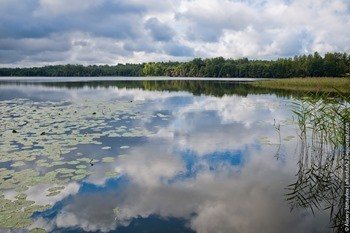
The reservoir is characterized by a flat coastal zone, with the exception of winding areas in the southwest, south, and southeast. The western territory is lowland, there are swampy areas that are prone to flooding in the spring season. The eastern landline is more elevated, although wetlands alternate with sandy hills.
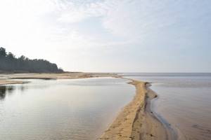
The relief of Lake Peipsi is not very diverse; it is flat or slightly wavy (relative heights do not exceed 0.5-0.7 m), the bottom rising to the shores is predominantly sandy or muddy.
Main characteristics:
| Square | 2613 |
| Length | 96 km |
| Width | 50 km |
| Maximum depth | 12.9 m |
Climate
The climate of Lake Peipsi is humid and moderately cold. The average annual temperature varies from 2 to 4 degrees above zero.
Winter in the region lasts from November to early April. Ice about 70 cm thick covers the entire area of the reservoir. The surface temperature of the water is 0°C, at the bottom it reaches +2°C. Severe frosts (up to -40°C) are quickly replaced by thaws. The ice drift phase begins at the end of April – beginning of May.
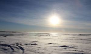
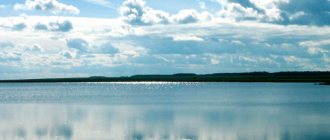
Lake Peipus freezes in winter
The summer season lasts 130 days (from the final spring to the first autumn frosts) and is characterized by frequent heavy but short-term rains. In July (the hottest month) the water can warm up to +25°C.
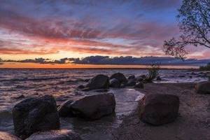
A feature of the area is increased cloudiness; there are 170-220 days of precipitation per year, their predominant share falls on the spring and autumn period. The region is dominated by southwestern winds, the average speed of which is 3.2-4.1 m/sec, with maximum gusts reaching 29 m/sec. Significant unrest occurs in the autumn months (October, November).
Flora and fauna
Representatives of the flora and fauna of Lake Peipsi:
| Flora | Fauna | ||
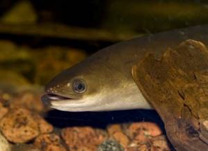
| Air-water | - common reed; - large manna; — lake reed; - riverine horsetail; - common arrowhead. | Fish | - Chud whitefish; - vendace; - smelt; - pike perch; - bream; - pike; - eel. |
| Water | - pondweed; - mulberry; - Canadian elodea; - yellow capsule; - spicate urut. | Waterfowl | — black-throated loon; - great cormorant; - swans; - geese; — river diving ducks; - mergansers. |
| Coastal | - willow; - seaside rank; - seaside sorrel; — dandelion littoral; - red pigweed; - common coltsfoot; - horse sorrel. | Mammals | - elk; - bear; - boar; - roe deer; - mink; - beaver; - fox. |
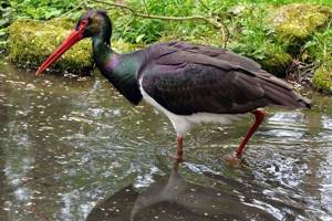
The Pskov-Chudskaya lakeside lowland is home to birds listed in the Red Book of Russia:
- black stork;
- osprey;
- white-tailed eagle;
- golden eagle;
- great snipe;
- landrail.
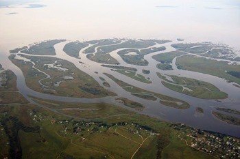
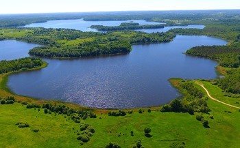
Islands
Lake Peipsi on the map is located on the border of Russia and Estonia; to visit some coastal areas you need a pass to the border zone. The reservoir includes about 20 islands, the largest being Piirisaar (Zelachek). The name translates as “borderline”. The official language is Estonian, the native language is Russian. The first settlement was formed during the Northern War (1700-1721).
The island's population is about 100 people, the majority of whom belong to the Pomeranian community of Old Believers. The outflow of residents is associated with high unemployment. The main activities include fishing and agriculture (in Tsarist Russia and in Soviet times, Chud onions were in great demand).
The island lacks infrastructure; attractions include the private Museum of the Old Believers and the Apostolic Orthodox Church. The remaining areas of land are uninhabited and low-lying (they rise above the water surface by an average of 1-2 m, and therefore are often flooded).
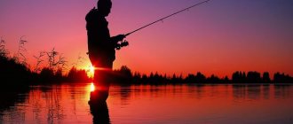
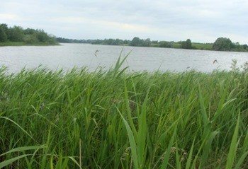
Free fishing in the Pskov region
The Pskov region is a great place for fishermen, as there are about four thousand rivers and lakes there, but you don’t really want to go without choosing a suitable place. Winding rivers and quiet lakes with dense forests create their own cozy atmosphere, which attracts fishermen. There are more than 4,000 rivers and lakes, small and large, on the territory of the Pskov region. So which place will allow you to enjoy fishing for free?
Here are the TOP 10 best places where you can fish for free in the Pskov region:
Lake Peipsi
Description, what kind of fish is found, how to get there:
This lake is one of the main ones in terms of size and popularity in the EU. One part of it is located on the territory of Estonia. It is also 150 kilometers long and 50 kilometers wide. The lake is incredibly large, but the depth is extremely shallow. Near the shore the depth reaches three, sometimes four meters. There is a large amount of plankton here, and therefore the fish that feed on them. This place is also very rich in fish - there are about 42 species of fish, such as walleye, bream and even perch and roach. By the way, the famous sonnet is found here. This place is suitable for both spinning anglers and those who like to fish with a float. The water on this lake warms up very quickly and immediately cools down, the current is weak, as is the transparency.
GPS coordinates: 58.65219, 27.45645
Mouth of the Velikaya River
Description, what kind of fish is found, how to get there:
From the new bridge under construction near the village of Khotitsy, in the Pskov region, and downstream to Pskov Lake itself. There are still a lot of fish here too. In the pits you can find and catch large pike perch up to 7-8 kg, and meet a huge catfish weighing 20-30 kg. But the capture of such trophies is quite rare, although it happens every year and repeatedly. Right now, on warm white nights, my friends from boats successfully catch not giants, but decent catfish (2 – 4 kg) and pike perch (up to 2 kg) using “sliced fish” (pieces of white fish). Well, there have never been any problems with perch and roach at the mouth. There are also ide, bream, and tench, but these are already in the bycatch.
GPS coordinates: 57.15161, 28.54086
Sebezh lakes
Description, what kind of fish is found, how to get there:
The Sebezh region is a real lake region: there are about 75 large reservoirs alone, and countless small ones. The nature here is incredibly beautiful, and if you suddenly have no luck fishing, you definitely won’t leave here disappointed. This is definitely where eel fishing lovers should go. There is more of it in Sebezh lakes than anywhere else. An eel, as a rule, covets an ordinary worm from a bottom fishing rod or a “sliced” white fish; no special exotics are required.
GPS coordinates: 56.26531, 28.50131
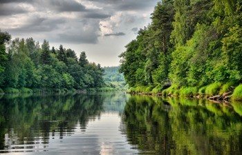
Pskov Lake
Description, what kind of fish is found, how to get there:
One of the greatest lakes in the Pskov region. It is located in the south and has an area of just over 700 m2. There are no problems finding interesting ichtofauna here. This area is notable not only for the fact that it is full of fish, but also for its incredibly beautiful nature. The Talabovsky Islands are rich in pike perch and pike perch. Sometimes the boat cannot fit here due to the great number of other fishermen.
GPS coordinates: 58.03007, 27.89039
5. Lake Klyazhe
Description, what kind of fish is found, how to get there:
The most famous Pskov fisherman Mikhail Vasilyevich Titov calls this lake the pearl of the Pskov region. And for good reason. The picturesque forest shores attract tourists, and the abundance of fish found there attracts fishermen. The most exciting July fishing is here at night - you can catch magnificent specimens of bream using rubber. And during the day, in the coastal reeds, both roach, perch, and bream bite regularly. And the residents of Usvyatichi not only love their lake, but also zealously protect it from the encroachment of poachers, both their own and those visiting. You will never see a single fishing net on this lake, neither in winter nor in summer. Well done Usvyatichi.
GPS coordinates: 55.78291, 30.52771
6. Lake Lokno
Description, what kind of fish is found, how to get there:
The depth of this lake is 6 meters. Fish is plentiful. If you prepare carefully, you can go fishing. Most fishermen come here to catch rudd and bleak, but experienced fishermen also come here for predators like pike or perch, but there are also peaceful fish in the lake.
GPS coordinates: 57.46833, 29.60805
Lake Gorodnovskoye
Description, what kind of fish is found, how to get there:
This is a small lake near the Dedovichi district, which is very famous among fishermen. It is about five meters deep, but the best catch is in holes with a depth of eleven meters. The fish is very diverse: from bream to spined fish.
GPS coordinates: 57.51678, 29.59495
Lake Myachkovskoye
Description, what kind of fish is found, how to get there:
Located near Gorodnovsky, but also popular among fishermen. The average depth is half a meter higher, which makes it very promising for fishing. The lake has a variety of fish, both peaceful and predatory.
GPS coordinates: 57.45664, 29.50216
Lake Kisloye
Description, what kind of fish is found, how to get there:
A large number of tourists are attracted here by the magnificent nature and incredible amount of fish. You can often catch pike, crucian carp and pike perch, and even burbot. It is very rare to catch the endangered species of peled here. By the way, seasonal stocking of fish takes place in the reservoir, so the number of fish is gradually growing. Fishermen come here for big carp and crucian carp. It is recommended to use bloodworms or maggots as bait.
GPS coordinates: 56.37666, 30.36111
10. Plyussa River
Description, what kind of fish is found, how to get there:
The best time for fishing in this river is summer, since in the summer the bottom is filled with algae and a large number of living creatures appear on the bottom. Areas with fast currents are full of bleak and roach. Fishing is possible both on the shore and by boat.
GPS coordinates: 58.52741, 29.22083
Do you know any other good places for fishing in the Pskov region - write in the comments