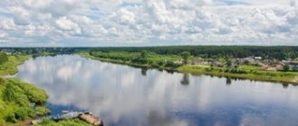
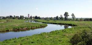
Historically, the territory of the Ivanovo region belongs to the Caspian Sea. The rivers here are thick with many branches. Most of the water flows lie on the plains, their flow is calm, and the slopes are minimal. Next to them are glacial deposits into which the valleys flow. Almost all rivers of the Ivanovo region are high-water.
The diet is predominantly mixed; less common are watercourses that grow due to the melting of snow deposits. Due to the latter process, spring floods are often observed. In summer, natural reservoirs are fed by rain. In autumn, the rivers of the Ivanovo region receive sufficient groundwater. Judging by the observations of hydrologists, the water flows of this area begin to be covered with ice in November, and ice breaks up in April.
Vyazma
The length of Vyazma is only 86 km. It has several tributaries, including such as Peja and Podoxa. The city of Teykovo is located on the banks. The water flow begins in the Shinilovo swamp. It flows in the direction of the southeast, very close to Ukhtokhma.
The width of Vyazma varies from 5 to 15 m. In some areas the banks are covered with forests, and sometimes there are wetlands.
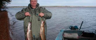
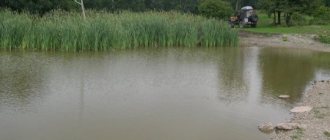
Fishing on Unzha
The Unzha River is also popular among residents of Ivanovo. The following fish species live in this river:
- pike,
- ide,
- perch,
- bream,
- zander,
- burbot,
- roach,
- silver bream,
- asp.
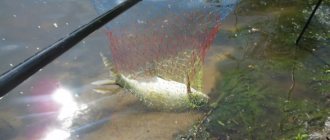
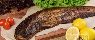
For fishing, it is best to choose places where the river changes its topography, as small holes are formed there that are attractive to some species. In the summer, fishermen go to Unzha for pike and perch. Of course, you won’t be able to catch large specimens here; the average weight of perches does not exceed 500 grams. In the evening, pike perch bite well. But it quickly goes deeper, so experienced fishermen can catch it.
Unzha is not famous for the abundance of catfish , but many fishermen managed to catch them with fishing rods. Individuals of this species choose holes and snags, so amateurs should look for such places. Bream and roach bite very actively if you use bait. However, it must be mixed with soil. This is necessary so that the bait is slowly washed away by water and attracts more fish.
In winter, fishermen go to Unzha for burbot and ide. The main difficulty is that you need to constantly change the locations of the holes. If you managed to catch a couple of fish, it is better to move to another place and drill several new holes.
Danilovka
The non-navigable Danilovka, 26 km long, has a completely different name in the upper part - Kichma. The water flows into Ukhtokhma and belongs to the Caspian Sea basin. The source can be called the Ilyinsky district. This place cannot be found on the map, since the reservoir begins at the junction of two regions - Ivanovo and Yaroslavl. The drainage basin has an area of 100 square meters. km.
Irmes
The Irmes River immediately flows in the Ivanovo region and in the Vladimir region. The mouth is the Nerl. The length of the water flow is 72 km. On the left side there is a village. It was opened in 2001. Scientists from the Suzdal detachment found that people lived here in the 9th-10th centuries, as well as in the 12th-13th centuries. The drainage basin area reaches 662 square meters. km.
Rich places
The unique Holy Lake (Ivanovo region) is distinguished by the rarest variety of representatives of the aquatic world. Fishing will bring unprecedented pleasure even to beginners, not to mention professionals. Here you can easily catch crucian carp, ruffe, perch, roach, and bleak. Pike, ide, silver carp, and burbot are often caught on the fishing rod.
The fauna of the lake region is also listed in the Red Book. Her lists included such representatives as swallowtail, willow moth, lesser night peacock, Gero's haybird, female bear and others.
Klyazma
The length of Klyazma is 686 km. The water flow is fed mainly by snow waters. At the end of autumn it freezes, and closer to summer it begins to open. The source is located in the area of one of the hills in this area. Near the village of Cherkizova there is a sharp turn in the waters - the river begins to flow to the east. After the confluence with the reservoir, the width of the Klyazma reaches 12 meters. It flows through a lowland, in some parts the bank on the right side is lower than the left.
The river bottom is mainly covered with sand, sometimes there are areas with clay. It is worth clarifying that 12 meters is not the maximum width of this stream. In some areas this figure increases to 200 m. The depth is no more than 8 m, but the dominant indicators are still 1-2 m.
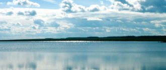
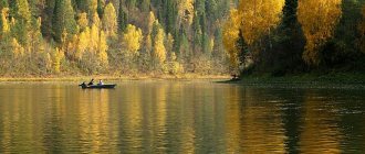
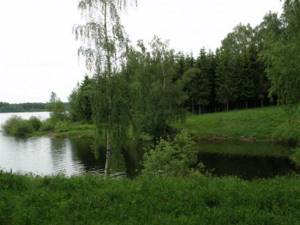
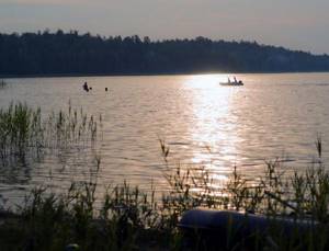
Rest on Lake Svyatoe in the Ivanovo region
The main thing that is written about in almost every review is the purity of the water. On Svyatoy it is truly transparent, since the reservoir is fed by springs. True, they say, it used to be even more transparent, but since peat mining began in its vicinity in 1939, the situation has worsened. For development, water was used from both the lake and the Lukh River. As a result, the reservoir was polluted with peat masses, silt appeared, and most of the springs silted up. Currently there are only two sources available.
Despite its glacial origin and supply of cold springs, the water in Svyatoy warms up well. This is facilitated by the shallow depth, averaging 3.7 meters, and large coastal shallows.
According to the testimonies of those vacationing on the Svyatoy, you can walk 50 meters to the middle of the lake and still keep your head above the waves while standing at the bottom. This place is ideal for families with children. Moreover, the bottom is sandy, silt begins only at depth.
Choosing a place on the shore to relax is easy. The lake stretches from west to east, its length (maximum 1.95 km) is approximately twice as wide as its width (maximum 0.84 km). The village of Mugreevsky is located almost in the middle of the southern coast. If you draw a straight line from it to the north, the lake will be divided into two parts. The areas to the right of the border are suitable for accommodation and swimming. Everything on the left is the western parts of the northern and southern banks, as well as the western side - swamps, peat bogs, silt, thickets of reeds and sedges without convenient and safe approaches to the water.
© VLAD 19
There are two beaches here, and both are located on the shores of the left side of the lake. One is located at the exit of the village to the water, and you can get to it by simply passing through Mugreevsky along Sovetskaya Street, which is a continuation of the asphalt road leading to the village. There is a tower on the beach with 3 levels of height from which you can dive into the lake. Two wooden floorings were installed, extending approximately 20 meters into the reservoir. There is even an imitation volleyball net with a pair of ropes stretched between the pegs. There are lifeguards on duty in the recreation area.
The second beach is located on the north side opposite the rural beach. It is not developed, but the shore and bottom there are also sandy and smooth. To get there, you need to go around the lake along a dirt road on the east side.
It is necessary to remember the special rules for staying near Lake Saint, which have appeared since the reservoir was recognized as a natural monument of regional significance in 1965. In particular, it is prohibited to make fires, collect and burn branches, pour waste into water, and leave garbage on the shore or in the lake. Cars can be parked no closer than 50 meters from the water. In reality, these rules are not always followed; patrols that have the right to fine violators rarely come here.
Some come to these places for several days and stay in tents. You can also rent housing in the village. In addition, in Mugreevsky there is a large guest house with double rooms. Accommodation in them costs about 2 thousand rubles per day; For a small surcharge, set breakfasts and lunches will be included in the price. The owners of the guest house organize berry and mushroom tours for guests. You can also go boating and horse riding.
Teza
The Teza River is a tributary of a larger watercourse - the Klyazma. The length of the reservoir is about 192 km. On its banks there are several villages and one city. Over time, it was noticed that the Teza River in the Ivanovo region is constantly increasing its flow level, and the banks are rising. The channel has a winding type. The width of the water flow is constantly changing: it varies from 6 to 30 meters (depending on the current).
Colorful flora
The flora and fauna of the lake district are rich and diverse. Holy Lake (Ivanovo region) is surrounded not only by plants typical of the local climate zone. There are rare specimens here that do not grow in other Russian forests; many of them are included in the Red Book of the region. Unique plants include swamp chin, Borbash's carnation, bulbous rush and many others.
The coastal sandy area attracts mushroom pickers with a myriad of different specimens. About two dozen species of mushrooms are considered rare; they are also noted on the pages of the Red Book.
Tunoshonka
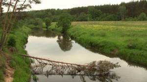
Tunoshka (or Tunoshonka) is a river that flows in two regions at once. It captures the areas of the Ivanovo and Yaroslavl administrative centers. Most of the reservoir is located on the territory of the latter. The source covers the Komsomolsky district. We are talking about a tract called Podozerye. It’s nice to think of a reservoir as an estuary. The river has several large tributaries, all of them are on the left side. There are more than 10 settlements near the reservoir. In one area, Tunoshonka crosses a railway, in another – a road.
Raskolina
This river is known by three names. Her official name is Raskolina. Among local residents it is better known as Raskolikha. And on some maps the water flow is signed by Sabelka. The length of the reservoir is 10 km. The mouth of the river is Inveshka, it is a left tributary. The source is located near the village of Zavrazhnevo (village). The river flows towards the west.
Several years ago, the state created a small reservoir here. Its area is 31 hectares, and it is located near Peshcheny (this is a village). The water flow is not navigable, as it is very shallow or swampy (depending on the area of a particular site).
Lake Zaborie
The lake is located 5 km southwest of the village of Mosta, between Lake M. Rassohi (in the northeast) and Lake Kosikovsky (in the southwest) and is connected to them by channels. The road to the lake is passable at any time of the year (except for snowstorms and spring thaw). The name of the lake answers the question: “Where is it?” - behind the forest, the famous Yaropolch forest. The length of Lake Zaborye is over 2.5 km, its width is 200-300 m, its area is 40.4 hectares.
The clean, transparent water of the lake has an intense golden, reddish-orange color, due to the presence of water flowing into it from a vast peat swamp. The lake may be of karst origin, although the direction of its elongation can also be explained as a consequence of glacier activity; perhaps the lake served as a drainage of glacial waters into Klyazma. There are three springs in the lake. The depth of the lake is 2.5–4 m, according to local residents, in some places it reaches 12 m. The shores of the lake are 95% covered with forest. Pine forests predominate on sandy soils. In the southern and northern parts along the Istok stream there are spruce forests. In the northern part and in the east, aspen trees approach the shore. Birch forests, sometimes swampy, approach the western and northwestern shores. An area of overmature pine forest remains on the western shore. Linden trees also grow here. The lake is flowing; the Verkhniy Istok stream flows into it from Lake Rassokha. The Nizhny Istok stream flows out of the lake and flows into the Klyazma.
The lake is inhabited by ruffe, burbot, tench, bream, crappie, roach, pike, bleak, ide, sabrefish, and crayfish. This is the fishiest lake in the Yuzhsky municipal district. The lake is home to beaver, muskrat and muskrat. Wood grouse and black grouse, hazel grouse, as well as elk, wild boars, and wolves live near the lake.
lake Zaborie