Lake Shaksha (Shakshinskoye) is the second largest body of water from the Ivano-Arakhlei group of lakes (Beklemishevsky or Chita lakes) in the southeast of the Vitim Plateau in the Trans-Baikal Territory. It is located at an altitude of 964 m above sea level, on a marshy watershed between the basins of the Khilok and Vitim rivers, not far from the largest lake in the system - Arakhleya.
Geographically, the object belongs to the state reserve of regional significance formed around the Chita Lakes in 1995. In addition to the lake Shakshi, the natural park with an area of 210,000 hectares includes lakes Arakhley, Tasei, Ivan, Bolshoi Undugun and Irgen, several small reservoirs, forests and agricultural lands. Also within the specially protected zone are eight settlements, including the villages of Shaksha and Beklemishevo, located on the southern coast of Lake Shaksha.
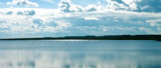
© Evgeniy
Weather
The climate in the Shaksha Lake area is predominantly sharply continental, with little precipitation throughout the year. The winter months are long and cold, the air temperature ranges from -18⁰ C to -38⁰ C. Summer is warm (+13⁰ C - +21⁰ C), with a low humidity coefficient. The water in the lake warms up the most in mid-July - early August. The average water temperature during this period is +22.5° C.
Weather in the village Shaksha for today, week and 10 days
Freeze-up on the lake lasts about 220 days, from October to May. The greatest thickness of the ice cover is typical for the end of winter - beginning of spring. In March, the spring bite already begins.
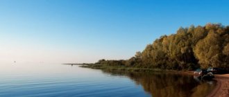
© Ilya Kuzmin
Weather on Lake Ivan
Very frosty winters and comfortable summers - this is how local residents describe the weather on Ivan Lake. On average, in summer the ambient temperature is approximately 20°C, but on the hottest days it can reach +33...+35°C. But there are few such hot days a year.
Fog over the water surface, © Mikhail Terentyev
In winter, extreme frosts are not uncommon in the region - down to minus 40°C. If you are planning to go winter fishing, take this factor into account.
The weather in this part of the Trans-Baikal Territory allows you to relax comfortably with your family and children in the warm season. However, before you go on vacation, you should check the weather forecast on one of the specialized sites.
Weather on Lake Ivan (in the village of Ivan-Ozero) for a week, 10 days - Gismeteo
Recreation center on Lake Shaksha
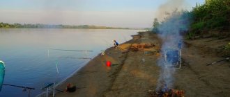
The reservoir is located just 40 km from Chita, which makes it especially popular among city residents. Throughout the year on Lake Shaksha there is the opportunity to stay at a recreation center in the village of Beklemishevo. This is a wonderful place for family and corporate pastime. Vacationers are offered guest houses of varying sizes with everything they need for a comfortable stay.
For lovers of water treatments, the south-eastern side of the reservoir is more suitable. There are open areas where you can play football and volleyball. The coastline is covered with sand and pebbles. Near the coast it is quite shallow, but the depth increases quickly. The bottom is uneven - made of silt and clay.
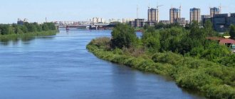
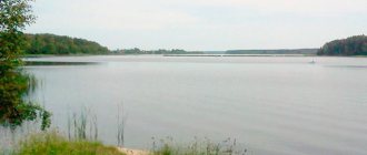
On the left is Shakshinskoye, on the right is Arakhley, © Alexey Zadonsky
There is no infrastructure; there are no cafes, toilets, or equipment rentals nearby. Fans of more active recreation are better off going to the equipped beaches of Lake Arakhlei, where you can ride a catamaran, trampoline, boats and water skis. The choice of recreation centers there is much richer.
Geographical information
The lake is located southwest of Lake Arakhlei, from which it is separated by a low isthmus 1.2 km wide. Belongs to the Selenga River basin. Water surface area - 52.5 km², water volume - 0.206 km³, length - 10.8 km, maximum width - 6.6 km. The greatest depth is 6.2 m.
The water's edge is located at an altitude of 964 m above sea level. The volume of enclosed water is 0.21 km³. Shaksha is the 4th lake in the Trans-Baikal Territory (2nd freshwater after Lake Arakhley) and the 231st lake in Russia in terms of water surface area.
The catchment area is 439 km². During floods, Lake Shaksha is connected by the Kholoi stream to Lake Arakhley, from which it receives water. The Khilok River, the right tributary of the river, flows out of the lake. Selenga.
The lake is oval in shape, stretching from north-northeast to south-southwest. It is surrounded on all sides by larch taiga with areas of forest-steppe and meadow formations. The western and eastern banks are high (6-10 m), unforested, in places covered with bushes and isolated trees. The northern shore is low, turning into a swamp, overgrown with meadow grass and sparse bushes. The coastline is slightly indented. The depth near the shore increases rapidly, the deepest places are located in the eastern part of the lake, approximately 1 km from the shore.
The lake bottom is uneven. The coastal zone is predominantly sandy with pebbles; At depths of 1-2 m, silt and clay appear. The top layer is represented by dark gray, sometimes black silt (5-45 cm thick) with the smell of hydrogen sulfide. The silts turn into dense, relatively dry clay.
Ice on the lake sets in mid-to-late October. The duration of freeze-up is 195-225 days. In the period 10-15 days after freezing, an intensive increase in ice thickness is observed - 8-10 cm per five-day period, then the intensive increase slows down, and by the end of February it completely stops. The greatest thickness of ice (1.2-1.5 m) is observed at the beginning of spring. The destruction and melting of ice begins at the end of March - the first half of April; The lake opens in mid-May. Complete clearing of ice usually occurs in the first half of June, but by the end of the month the water temperature near the coast reaches 20°C. The maximum water temperature of 22.5°C was recorded in mid-July - early August. Thanks to its shallow depths, the lake warms up well throughout the entire thickness of the water column. During this period, summer heating ends and the period of autumn cooling of water begins.
The water in the lake is relatively clean, fresh, mineralization is 100-200 mg/l. In the bottom layers, due to the high oxidation of organic matter, the oxygen content is low. According to hydrochemical indicators and the level of primary productivity of the lake. Shaksha belongs to the category of eutrophic reservoirs.
Along the coast there are thickets of higher aquatic plants; There is a massive development and bloom of green and blue-green algae. The benthic fauna is dominated by red-colored bell mosquito larvae. Benthic invertebrate communities are mainly represented by pelophiles.
On the southern coast of the lake are the villages of Shaksha and Beklimishevo.
Lake Shaksha is located within the Ivano-Arakhleisky State Natural Landscape Reserve of regional importance, created in 1995, with an area of 210 thousand hectares.
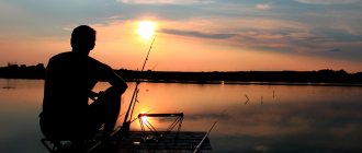
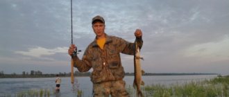
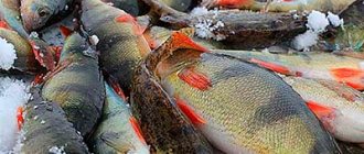
Fishing
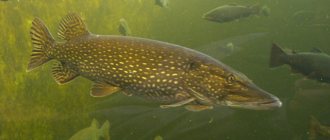
In the 1960s The reservoir was considered one of the most fishing places in Transbaikalia, but in subsequent years the fish catch decreased sharply. The lake is of great interest to anglers even today; there are almost always a lot of boats there. The reservoir is home to roach (chebak), perch, dace, omul, crucian carp, broadhead, peled, bream, carp, and catfish. Pike, according to reviews, is always large. Currently, the lake is stocked with fry of carp, omul and peled.
In winter, the lake shores attract ice fishing enthusiasts. Fishing rods with handles are popular among fishermen as fishing gear. There is a fine for using a hook, net, seine, or spear.
© Irina Gorbulko
Geographical and natural characteristics
Lake Shaksha arose at the bottom of the Beklemishevskaya intermountain basin. According to one version, the reservoir appeared relatively recently as a result of glacial activity; according to another, it is the remains of an ancient freshwater lake.
The shape of the reservoir resembles an oval, elongated from northeast to southwest. The area of the water surface is 52.5 square meters. km, length - 10.8 km, maximum width reaches 6.5 km. The average depth of the lake is 3.9 m, the deepest areas (up to 6.2 m) are concentrated in the eastern part of the lake. Due to the shallowness of the water, the reservoir warms up well.
The western and eastern banks are high (up to 6–10 m), partially covered with bushes and sparse trees. The northern part is lower, in some places it turns into a swamp. Thickets of green and blue-green algae are observed along the coast. Bell-bellied mosquito larvae predominate in the bottom mud.
Lake Shakshinskoye is separated from Arakhlei by a piece of land only 1.2 km wide. During flood periods, the reservoirs are connected by the Kholoi stream. The river flows from the southwestern side of Shakshi. Khilok is the right tributary of the Selenga. A little further north the river flows into the lake. Stream (Urucha), which is formed by the confluence of two rivers Khara-Gorus and Tsagan-Gorus.
© Evgeniy
The water in Shaksha is fresh, slightly mineralized. According to hydrochemical studies, the lake is classified as eutrophic reservoirs, which means an abundance of vegetation, plankton and “blooming” of water. The process of eutrophication especially intensified due to a decrease in water levels in 2000.
More than a hundred species of birds live in the vicinity of the reservoir, including black storks, gray herons, cranes, golden eagles, white-tailed eagles, bustards, eagle owls and other representatives of rare winged birds.
Fish biting forecast in the Trans-Baikal Territory, Chita
| Weather forecast and fish bite | Chita, from 02/17/2021 to 02/19/2021 | |||||||||||
| SR | Thu | PT | ||||||||||
| Times of Day | Night | Morning | Day | Evening | Night | Morning | Day | Evening | Night | Morning | Day | Evening |
| Cloudiness, precipitation | Clear | Clear | Partly cloudy | Mainly cloudy | Mainly cloudy | Mainly cloudy | Mainly cloudy | Mainly cloudy | Mainly cloudy | Partly cloudy | Partly cloudy | Clear |
| Temperature °C | -24 | -30 | -28 | -17 | -18 | -16 | -11 | -3 | -7 | -13 | -20 | -13 |
| Pressure, mm. | 774 | 780 | 778 | 771 | 767 | 762 | 762 | 757 | 756 | 756 | 760 | 756 |
| Direction, | Wind northwest | Wind northwest | South wind | Wind southwest | Wind southeast | Wind southwest | West wind | West wind | Wind southwest | West wind | West wind | Wind northwest |
| wind speed | 1 m/s | 0 m/s | 0 m/s | 1 m/s | 1 m/s | 1 m/s | 3 m/s | 5 m/s | 2 m/s | 4 m/s | 3 m/s | 4 m/s |
| According to the forecast, they will bite on: bloodworms crucian carp | 0% | 60% | 60% | 45% | 0% | 55% | 55% | 45% | 0% | 60% | 60% | 50% |
| According to the forecast, they will bite on: bloodworms Carp | 0% | 25% | 25% | 20% | 0% | 20% | 20% | 20% | 0% | 25% | 25% | 25% |
| According to the forecast it doesn't bite Carp | 0% | 0% | 0% | 0% | 0% | 0% | 0% | 0% | 0% | 0% | 0% | 0% |
| According to the forecast, the fish will bite on: live bait (jigs), winter spinners, balancers Pike | 10% | 60% | 60% | 65% | 10% | 75% | 75% | 65% | 25% | 60% | 60% | 50% |
| According to the forecast, they will bite on: bloodworms, winter spoons, balance beams Perch | 0% | 70% | 70% | 55% | 0% | 65% | 65% | 55% | 0% | 70% | 70% | 60% |
| According to the forecast, the fish will bite on: live bait, winter spinners, balancer Zander | 60% | 70% | 50% | 55% | 40% | 65% | 45% | 55% | 55% | 70% | 50% | 60% |
| According to the forecast, they will bite on: bloodworms, maggots, bark beetles, burdocks Dace | 45% | 60% | 60% | 40% | 20% | 50% | 50% | 40% | 35% | 60% | 60% | 50% |
| According to the forecast, they will bite on: bloodworms, maggots, bark beetles, burdocks Ruff | 45% | 60% | 55% | 40% | 20% | 50% | 45% | 40% | 35% | 60% | 55% | 50% |
| According to the forecast, the fish will bite on: bloodworms, spoons, balance beams Trout | 0% | 70% | 55% | 40% | 0% | 60% | 45% | 40% | 0% | 70% | 55% | 50% |
| According to the forecast, they will bite on: bloodworms, oparish, spinners Grayling | 0% | 70% | 55% | 40% | 0% | 60% | 45% | 40% | 0% | 70% | 55% | 50% |
| Bait: maggot, bloodworm Bream | 65% | 60% | 50% | 40% | 35% | 50% | 40% | 40% | 55% | 60% | 50% | 50% |
| Bait: worm, live bait, spinner Burbot | 70% | 60% | 30% | 80% | 70% | 80% | 50% | 80% | 90% | 60% | 30% | 60% |
| Bait: maggot, bloodworm Roach | 0% | 70% | 60% | 55% | 0% | 75% | 65% | 55% | 0% | 70% | 60% | 50% |
| Bait: maggot, bloodworm, bark beetle Ide | 0% | 50% | 40% | 30% | 0% | 40% | 30% | 30% | 0% | 50% | 40% | 40% |
Fish biting forecast in Transbaikalia and other areas of the Chita region: Akshinsky, Alexandrovo-Zavodsky, Baleysky, Borzinsky, Gazimuro-Zavodsky, Transbaikalsky, Kalarsky, Kalgansky, Karymsky, Krasnokamensky, Krasnochikoysky, Kyrinsky, Mogochinsky, Nerchinsky, Nerchinsko-Zavodsky, Olovyanninsky, Ononsky , Petrovsk-Zabaikalsky, Priargunsky, Sretensky, Tungiro-Olyokminsky, Tungokochensky, Uletovsky, Khiloksky, Chernyshevsky, Chitinsky, Shelopuginsky, Shilkinsky.
Meanings of symbols and colors of the bite forecast table
| Mon | Monday |
| Tuesday |
| Wednesday |
| Thursday |
| Friday |
| Saturday |
| Sunday |
| Probability of a bite in % (from 0 to 100) |
How to get there
You can get to Lake Shakshinskoye by public transport. Bus No. 219 runs to the village of Beklemishevo every day at 17:30. Travel time takes two hours. The route passes through the lakes: Mongoy, Sirotinka, Ivan, Tasei, Arakhlei.
The most convenient way to get to the reservoir is by car. If you drive from Chita, you need to take the federal highway P258 “Baikal” (Irkutsk - Ulan-Ude - Chita), then in the area of the village. Domna must turn right.
You can get to Lake Shaksha from the other side, along the P436 highway (Ulan-Ude - Romanovka - Chita), similar to the bus route. The landmarks are the villages of Beklemishevo and Shaksha, which have practically merged with each other; they are separated only by the Zhipkovshchina River.
You can also get to any desired place on the reservoir by taxi using the mobile application Uber, Gett, Maxim and Yandex. Taxi.
In the video, Lake Shaksha (right) and Arakhlei