Published: 12/29/2019 Category: Author's essay
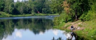
The Lovat River forms a narrow plain, which in the Novgorod region very smoothly levels out with the Ilmen lowland. During the entire journey the floodplain goes down very smoothly. Only in the middle section there is a sharp difference in heights (several dozen thresholds). From time immemorial, the water artery connected northern Polesie with Novgorod Land. That is, it was strategic. And therefore she left many reminders of herself in historical documents. Today it is an attractive recreational area for us.
general description
The Lovat River is 530 km long. Its pool is 21,900 sq. km. Maximum width 2,700 m (Vorokhobskoe extension). Depths up to 6 meters (in the area of whirlpools). The reservoir flows through the Vitebsk region of Belarus, as well as through the Pskov and Novgorod regions of the Russian Federation. The slope is average. North direction. The average long-term water consumption is 169 cubic meters per second. Mixed feeding (rain and snow). Freeze-up lasts from late November to mid-March. The flood occurs in March - April. Steep bends (Velikie Luki) are characterized by ice jams. The channel has several large lakes inside. The seasonal range of changes in water level is very high. There are about a hundred Lovat branches (including streams). Large tributaries are the Nasva, Kunya, Loknya, Redya, Polist and Shubinskaya Robya.
The Lovat River formed in Devon. From the east it was sandwiched by the Valdai moraine ridge, and from the west by the Bezhanitskaya and Sudomskaya uplands. The bottoms of the ancient glacial valley “failed” in the Ilmen region during the final retreat of the glacier. The first people of these places were Mesolithic hunters. They were completely destroyed by the Indo-Europeans. But later the Aryans experienced the cultural influence of their “brothers” (Veneti), who once mixed with the pre-Aryan population in the Baltic states. As a result, the ancestors of the Baltoslavs were formed. The part of the substrate that settled here evolved precisely into the Balts. Already in the 7th century, they again mixed with their distant Slavic relatives, forming the Krivichi. By the 8th century, the Balts and Krivichi inhabited all banks of the river. The first Russian description of the Lovat River (the Slovenes began penetrating the lower reaches in the 8th and 9th centuries) hints that the hydronym came from the aboriginal (Baltic or Krivichi) concept of “dead” or “river of war.” Active transport use of the Lovat River began during the Slovenian period. The watercourse became part of the great route from the Varangians to the Greeks, which the Rurikovichs subsequently began to control (after the calling of the Varangians). From the 10th century the Lovat River is part of the Novgorod Land, which established republican rule (getting rid of the Rurikovichs) and absorbed the Pskov principality. The stream eventually began to serve as the main road between Kiev and Novgorod.
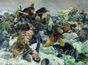
In the 13th century, the upper reaches were used to fight German knights. From the village of Parfino to the very mouth, the Lovat River is still navigable. But in the full-flow period. From 15 almost everything became Moscow. Why almost? During the time of feudal fragmentation, the upper reaches went to Lithuania (later Poland). However, at the end of the Time of Troubles, the entire basin found itself within the Russian state. After the end of the battles between Moscow and Novgorod the Great, active military operations were carried out many times. The largest ones were during the Second World War. Two fragments of the current are now part of two reserves: Rdeisky and Polistovsky.
Atlas, Cities and countries, seas and oceans. Around the World, Mysteries of the 20th century, The whole world is in your hands
A river flowing mainly in northwestern Russia. Its length is 535 km, of which 47 km (in the upper reaches) are in the territory of Belarus. Lovat flows into Lake Ilmen. This river was part of the route from the Varangians to the Greeks, on its banks there are many archaeological monuments, and the ancient city of Velikiye Luki, located on Lovat, the “mantle of Novgorod” and the “atrium of Moscow,” more than once honorably defended the center of Russia from the enemy.
BETWEEN LAKES AND KRUTOYARY
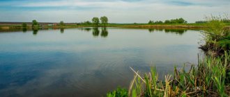
The upper reaches of the Lovat River are accompanied by a whole chain of lakes. It passes through some of them and flows into Lake Ilmen, around which (and the river delta) there are also many small reservoirs and swamps.
The most ancient geomorphological layers of the Prilovat Valley belong to the Devonian period. The outcrop of these rocks in the form of limestones, dolomites, clays of various types, marl, chalk with layers of sand can be observed with your own eyes on the steep slopes of the banks of Lovat, which in the Pskov and Novgorod regions are called ridges, or steep yars. In the upper and middle reaches, in some places the ridges reach a height of 20 m, and after the city of Kholm - 40-50 m, but not sharply vertically, but gradually, smoothly. Closer to the mouth the banks become gentle. In the riverbed, ancient rocks are covered with sediments of loose rocks and stones left over from four ice ages. The last of these is considered to be the Valdai glaciation, which ended about 25 thousand years ago. The Lovat riverbed, the surrounding lakes, hills, and swamps, were formed after the runoff of glacial waters, and in their current form - about 10 thousand years ago. The glacier left numerous boulders in the meadows and fields. Placers of them are quite often found at the very edge of the Lovat coast.
There are three hypotheses regarding the origin of the name of the river: Slavic, Finno-Ugric and Baltic. In all these language groups there are many words with the roots “lov”, “liva”, “lyyva”, etc. And all of them belong to vocabulary associated with the concept of “catch”, and even more often with swamps and rivers. Thus, on maps of Lithuania in the 16th century. The Lovaitis River is marked. Most likely, the Slavic name Lovat (ancient version - Lovot), established in the 9th-10th centuries, is the result of lexical interchange: Finno-Ugric, Slavic, Baltic tribes communicated constantly in ancient times, Finno-Ugric peoples also moved every now and then through the lands of the Slovenes and Balts.
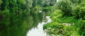
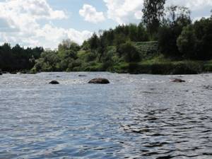
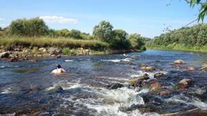
Lovat originates in Lake Lovatets near the border of the Pskov region of Russia and the Vitebsk region of Belarus (Lake Zavesno is sometimes still indicated as its source, as was believed at the beginning of the 20th century). Before the city of Velikiye Luki, Lovat has many rapids and rifts with a length of 150 and more than 1500 m, which is determined by the bottom topography. At the same time, it is shallow, on the rapids - only 0.3 m, on reaches with a sandy muddy bottom it does not exceed 1.25 m, the channel has a width of 10-25 m. Below Velikiye Luki the valley expands to 3-4 km, the channel - up to 120-140 m, the depth on the reaches reaches 6 m, on the rifts - 0.7 m. Floodplain loop-shaped meanders - bows - are formed, hence the original name of the city of Velikiye Luki - Luki. The city of Kholm stands at the confluence of the Lovat and its deepest and longest tributary, the Kunya River. The height of the Hill above sea level is 65 m. In some areas of the shore, dense pine forests and oak groves reach out to the water in wedges; on the shore there are huge boulders several meters high, and here are the steepest rapids on Lovat.
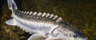
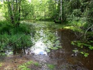
The river is rich in fish (catfish, pike perch, asp, pike, ide, silver bream, tench, river eel, and in some places trout and other species of fish). Blackberries, blueberries, lingonberries, raspberries, blueberries grow in the forests, and in late summer and autumn there are many mushrooms. From Kholm to the confluence of Lovat and Lake Ilmen, its channel is the most winding. In a straight line between Kholm and the village of Parfino - 100, and along the river - 160 km. The delta (formed by Lovat together with the Pola River; they are connected by a channel, but the Pola flows into the lake separately) occupies about 400 km2. In the delta area there are more than 60 small and fairly large lakes, many oxbow lakes, they are proof that when it flowed into the Ilmen, the river changed its course. There are extensive thickets of willow trees here.
Lovat usually freezes at the end of November, and opens at the end of March - beginning of April. In spring, the water level near the Hill rises by 4-6 m, and in especially snowy years - up to 10 m; water from the delta floods the surrounding meadows and swamps.
From the point of view of relief, the Lovat River and its plain (Prilovatskaya) relate to each other in an extremely harmonious manner. The river divides the plain, especially in its north, almost exactly in half, and it frames this water flow smoothly, merging closer to the mouth with the Priilmenskaya lowland. The boundaries of the Prilovatskaya Plain: in the east - the Valdai moraine ridge, in the west - the Bezhanitskaya and Sudomskaya uplands, and in the south - their spurs.
MARK ON HISTORY
Any river leaves such a trace in regions of the Earth inhabited since ancient times. Lovati's trail is not the loudest. But in terms of the richness of archaeological material, its shores are among the richest in Russia.
Archaeologists say that you can dig with the hope of finding finds here almost anywhere; ancient coins of various origins are often found at the bottom of Lovat. In the Velikiye Luki region alone there are more than 250 archaeological sites: 25 settlements, 37 villages, 160 so-called long barrows (collective burials of the Neolithic era), 20 individual barrows (hills), 6 zhalnichny burial grounds (burials marked with stones), several large boulders with petroglyphs that clearly had sacred meaning.
The first people began to settle on the banks of the Lovat in the Neolithic era; these were tribes of fishermen and hunters. Until the 5th century Here lived mainly Eastern Baltic tribes, as well as Finno-Ugrians: Chud, after all, Korela and others. Slavs: Ilmen Slovenes and Krivichi - appeared near Lovat in the 5th-7th centuries.
Lovat is mentioned as part of the route from the Varangians to the Greeks by the chronicler Nestor in the Tale of Bygone Years at the beginning of the 12th century. The city of Velikiye Luki was first mentioned in the Novgorod Chronicle in 1166 as Luki-na-Lovati. From the 12th century it belonged to the Novgorod Republic and more than once served as its defensive line, for which it earned the reputation of “the mantle of Novgorod” and the “atrium of Moscow.” The word “Great” was added to its name in 1406, and from 1478 the city, like the entire Novgorod land, came under the rule of the Moscow principality. The first mention of the Velikiye Luki fortress dates back to 1198. It burned and was rebuilt, but at different times it always stood in defense of the city and withstood sieges by the Poles, Lithuanians, and Swedes. During the Great Patriotic War, the Nazis settled in the fortress. There were six attempts to storm it, and on January 16, 1943 it was taken, which was the end of the offensive Velikoluksky operation (11/25/1942 - 01/17/1943), which war historians today call “little Stalingrad” (for a long time it was was undeservedly deprived of the attention of researchers).
The small, and also ancient, city of Kholm has an equally glorious five-hundred-year history, but during the Great Patriotic War all its ancient buildings were wiped off the face of the earth.
According to the Novgorod chronicles, the best builders of baroques on Lovat lived in Kholm - small flat-bottomed ships without a deck or rudder, used exclusively for transporting goods. And in the 19th century. on Lovati and Kunya there were about 20 centers of, let’s say, barque construction. The need for barges was constant: they did not return from St. Petersburg, they were sold there; obviously, this was more expedient than taking them back to Lovat.
This is how an 18th-century document describes the waterway along the Lovat: “...From Velikie Luki on the Lovat River watercraft sail to Novgorod and St. Petersburg, in which in the spring the cargo is 400 pounds or more, and in low water 200 pounds or less . On these, yuft, flax, and hemp are sent from local merchants, and various supplies and grain are sent from landowners. In the above-mentioned rapids, during the passage of ships with goods in the spring, and especially during low water, due to shallow water and many stones, there are considerable stops and many damages to ships and damage to goods occur. Empty ships are not returned. In the suburb of Kholm, ships are loaded with goods from Toropets merchants.” Nowadays, Lovat is navigable to the mouth for 70 km. Passenger boats run along it, from Parfino to Novgorod via Ilmen, along Polist - to Staraya Russa.
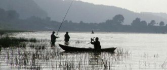
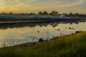
In summer, the shores of Lovat are full of colorful tents, and kayaks and rubber boats are not uncommon on the water. The river has its own loyal army of tourists who believe that in Central Russia there is no better or more picturesque place to relax on the water surface.
FUN FACTS
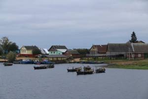
■ Within the city of Velikiye Luki on Lovat there is a large island called Dyatlinka, where sports grounds are now located. According to local hydrologists, this island is of artificial origin, built in the 13th century. In the XVI-XVII centuries. There was a Streltsy settlement there.
■ All the main Novgorod epics about Sadko, the merchant, the “rich guest” are connected with Lake Ilmen. The king of the sea, who lived at the bottom of the lake, really liked Sadko’s playing the harp. This is where the adventures of the main character of the epics began.
■ After the railway line was built to Velikiye Luki in 1901, cargo shipping along the Lovat gradually lost its economic importance. Moreover, it was associated with navigation difficulties. The main danger for the barges was, of course, the rapids; they were avoided carefully, cautiously and slowly, covering an average of 14 km of travel per day. The barges were loaded in three stages: to Kholm - about a third of the draft, in Kholm, depending on the water level - more, and completely - only in the village of Lobyti.
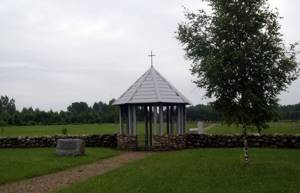
■ A native of the city of Kholm, Pavel Petrovich Kalitin (1846-1877) is a national hero of Bulgaria. A lieutenant colonel in the Russian Army, he commanded a detachment of the Bulgarian militia during the Russo-Turkish War of 1877-1878. under the banner donated to the squad by the city of Samara. During the battle, the banner fell to the ground, and the Turks were almost reaching it, but Kalitin jumped off his horse and picked up the banner, shouting: “Guys! Our banner is with us! Forward - follow him, follow me! The militia rushed forward, the Turks wavered and retreated, but Kalitin himself was killed in this battle. In the Bulgarian city of Stara Zagora there was a society of retired military men called “Lieutenant Colonel Kalitin”. The village of Kalitino was named after him, and Kalitin’s grave became a mass grave of Russian soldiers who died on Bulgarian soil. In 2007, the authorities of Stara Zagora presented Kholm with a monument to Kalitin and a copy of their city relic - the Samara Banner.
ATTRACTIONS
■ Archaeological complex “Gorodets on Lovat” 4 km from Velikiye Luki. ■ An Iron Age settlement 3.5 km from the village of Lyalevshchina and a Neolithic site near the village of Mezha in the Pskov region. ■ Reserves: “Rdeisky”, “Polistovsky”. ■ City of Velikiye Luki: Earthen fortress from the time of the Northern War of 1704-1708, Holy Ascension Cathedral of the former Ascension Convent (1768), recreated in the 1990s, Kazan Church (1821), building of the former Theological Seminary ( 1913), merchant mansions of the 19th century, Velikoluksky Museum of Local Lore, Literary and Art Museum of the History of the Great Patriotic War named after. I. A. Vasilyeva, Pskov Regional Postal Museum, near the city - the Memorial Museum-Reserve of the composer M. P. Mussorgsky, the museum-estate of S. V. Kovalevskaya.
Atlas. The whole world is in your hands No. 178
Like
SocButtons v1.5
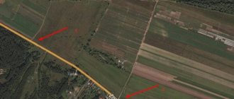
Source and mouth of the Lovat River
The source of the Lovat River is a narrow watercourse flowing from Lake Lovatets (its maximum diameter is 670 meters). It lies at a low altitude above sea level. Geographically, this is part of the Polesie swamps (namely, a peat swamp called Chistik). Administratively, this is the border of the Nevelsky district of the Pskov region of the Russian Federation and the Gorodok district of the Vitebsk region of Belarus. The landscape surrounding the just described river “start” is peat bogs and lush meadows. However, after 1.5 kilometers (in Lake Zavesno), the pond begins to be squeezed on all sides by dense forests.
The mouth of the Lovat River is the entrance to Lake Ilmen, which is a complex estuary. The main channel has a width of 420 meters, along with it the lake is replenished by the Staraya Lovat channel. Shortly before it splits into channels, the reservoir comes into contact with the Pola River. Geographically, the location belongs to the Starorussky district of the Novgorod region. Both banks are already low. They are dense floodplains along which the branches of tributaries run. The nearest settlement is the small village of Vzvad. In the east, the estuary, consisting of more than 25 watercourses and lakes, borders on the neighboring Sinetskoye Bay of Lake. Ilmen.
Tributaries
The table below shows all the left and right tributaries of the Lovat River (except for streams and nameless rivers), from mouth to source, as well as their large tributaries over 30 km in length.
| Distance from mouth (km) | Left tributary / Right tributary | Tributaries of tributaries | Length (km) | Water collection area (km²) |
| 2 | sleeve Novinskaya Lovat | 2,2 | ||
| 4 | sleeve Staraya Lovat | 10 | ||
| 15 | Polist | 176 | 3630 | |
| ↑ | Porusya (right) | 142 | 1030 | |
| ↑Lyutaya (left) | 40 | 179 | ||
| ↑ | Snezha (left) | 68 | 302 | |
| ↑ | Kholynya (left) | 72 | 681 | |
| ↑Kamenka (left) | 52 | 18 | ||
| 18 | Redya | 146 | 671 | |
| 61 | Robya | 71 | 696 | |
| ↑ | Starovskaya Robya (right) | 57 | 654 | |
| 73 | Zarobskaya Robya | 69 | 594 | |
| ↑ | Yazishchenskaya Robya (left) | 51 | 222 | |
| 106 | Rubezhenka | 30 | 0 | |
| 123 | Sambatovka | 25 | 139 | |
| 140 | Pankovka | 17 | ||
| 144 | Slingshot | 23 | 87 | |
| 163 | Khobolka | 19 | ||
| 165 | Gorodyanka | 15 | ||
| 183 | Tanning | 27 | 90 | |
| 187 | Shulga | 26 | 96 | |
| 192 | Cunha | 236 | 5143 | |
| ↑ | Big Tuder (right) | 94 | 879 | |
| ↑Krutovka (left) | 37 | 244 | ||
| ↑Oborlya (right) | 38 | 163 | ||
| ↑ | Small Tuder (right) | 85 | 572 | |
| ↑ | Aleshnya (right) | 34 | 124 | |
| ↑ | Seryozha (right) | 104 | 849 | |
| ↑ | Oka (right) | 66 | 325 | |
| ↑ | Big Burden (right) | 35 | 124 | |
| ↑ | Dobsha (right) | 33 | 279 | |
| ↑ | Usvyata (right) | 35 | 291 | |
| ↑ | Lusnya (right) | 34 | 163 | |
| 209 | Mazurovka (Burner) | 17 | ||
| 210 | Zherebchakha (Pakhomovka) | 18 | ||
| 229 | Vitsa | 22 | ||
| 242 | Rytovitsa | 11 | ||
| 244 | Big Smota (B.Smata) | 44 | 378 | |
| ↑ | Malaya Smota (right) | 53 | 208 | |
| 263 | Hlavica | 41 | 459 | |
| 269 | Loknya | 119 | 2190 | |
| ↑ | Chernushka (right) | 30 | 147 | |
| ↑ | Smerdel (right) | 78 | 647 | |
| ↑ | Puzna (Priskukha) (right) | 82 | 391 | |
| 309 | Rubezhnitsa | 18 | 98 | |
| 312 | Olshanka | 12 | ||
| 336 | Naswa | 46 | 1240 | |
| 338 | Krupitsa (Vskuica) | 33 | 352 | |
| 352 | Lazavica | 21 | 93 | |
| 371 | Sveretitsa | 26 | 108 | |
| 393 | Balazdyn (Bolazo) | 26 | 547 | |
| 409 | Emenka (Yamenka) | 64 | 722 | |
| 457 | Komlya | 26 | 281 |
Basin of the Lovat River
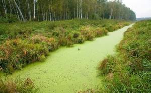
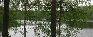
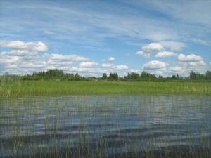
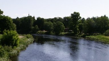
Already for the first kilometers the Lovat River falls into a very narrow valley cutting through the Gorodok Upland. The width of the stream itself is no more than 10-15 meters. But it passes through the spacious “mirrors” of the Pskov-Vitebsk Lake District, where the river floodplain meets coniferous-deciduous thickets (pine, spruce, alder, birch, ash, aspen and willow). The edges on both sides are extremely low. Overgrown with reeds. Beyond Lake Vorokhobsky the river “body” briefly expands to 225 meters! We emphasize that in Polesie the floodplain is very swampy in many places. The further (Pskov) course of the Lovat River is remembered by the Velikiye Luki section. The most winding, wide and fast. The diameter in this section ranges from 150 meters (Velikie Luki, near Dyatlinsky Island) to 40 meters (Kartsevo). Along its entire length there is proximity to large lakes. By the way, it is worth noting that the upper and middle basins of the Lovat River meander strongly for a reason. The channel passes between the hills of the Bezhanitskaya, Sudomskaya and Valdai uplands, which are of moraine (glacial) origin. Moreover, it is at the end of the middle section that the hydrological object crosses the spurs of Valdai, descending at the end along rapids and rifts. The banks are often steep and quite high. Only here are outcrops of different colored clays and sandstones visible. The lower basin of the Lovat River is marked by a passage through the wider Priilmenskaya lowland, from which the narrow Prilovatskaya plain is leveled (it divides the named lowland into exactly two halves). Here the oak joins the river floodplain rich in species composition. And a water lily appears in the water. The number of meanders does not decrease. Starting from Pogost, the forest disappears. Oxbow lakes appear (the river changed azimuth many times) and floodplains. The current speed is low on flat sectors of the route.
Sights of the Lovat River
Lakes Zavesno and Zadrach
In this Belarusian place, the Lovat River plunges into the first fairly large natural pools. Here they were inspired by the famous works of Marc Chagall and Kazimir Malevich, who could not imagine life outside the Vitebsk Lake District. Vasil Bykov immediately wrote his notes for future novels about the battles of the Second World War (by the way, he was also initially interested in painting - of course, such landscapes left no choice...).
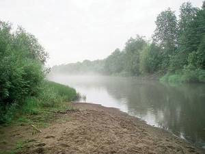
The curtain measures 1,900 by 1,100 meters. Depth no more than 2.4 meters. In the west and southwest the floodplain is swampy (peat deposits, lingonberries, shrubs and goosefoot vegetation predominate). On other parts of the riviera we see moraine ridges with birch groves and deciduous trees. Bream, pike, perch and crucian carp are found in abundance. The shallow water is sandy. Extensive. Large drainage area thanks to numerous streams.
The dimensions of Zadrach are 1,900 by 650 meters. The shape is an oval with a large number of bays. The depth of the tank is more than 6 meters! The settlement of Zadrachye grew on one of the edges. To the already mentioned fish, rudd, roach and molt are added here. The landscape is the same. But the shallow water is narrow. The floodplain is not wide. Wild raspberries, strawberries and hazelnuts grow around. All these water surfaces are popular due to the events of the 40s of the last century (in July 1941, the entire Gorodok region of the Vitebsk region was occupied by Hitler’s troops, until December 1943, punitive fascists killed thousands of villagers)…
Only near these places (judging by the excavations) did the Neolithic hunters manage to escape from the merciless warriors of the Fatyanovo culture (a branch of the Battle Ax culture)…
Lakes Butyka, Sosna, Czarniasta and Sesito
A picturesque holiday on the Lovat River is available to “watermen” here too – on the border itself. The first lake is 1,300 by 1,000 m, the second is 1,550 by 1,000 m, the third is 2,100 by 1,400 m, and the fourth is 3,400 (the length along the fairway is the longest in the entire system) by 1,300 meters. All of these flowing pools also do not exceed a depth of 6 meters. They lie in shallow hollows. There are a sufficient number of convenient sandy capes. Water lilies and pondweed grow in the bays. There is also firewood - there are thickets of aspen, black alder, birch and ash everywhere. Among the bushes here are wild raspberries. In the depths, ide is also caught.
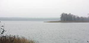
Vorokhob Lake
This is the first “civilized” site on the Lovat River. Here it passes through the largest water bowl on its way, and after a couple of kilometers it comes into contact with the first highway - Borisogleb - Porechye. The width of the lake alone is 2,700 meters. But the fairway stretches for as much as 2,800 meters (second in length only to Secito). Area – 2.3 sq. km. Unlike other extensions, Vorokhobskoe lies directly in the center of the Lovat channel. It has changed many names. Speaking about Lake Vorokhobskoe, we will also include catfish and pike perch in the ichthyofauna presented above. The entire perimeter was divided among emerald broad-leaved tracts. And also meadows and swamps. Behind the natural pool, the hydrological object expands once again (this is called Lake Koryto).
Lake Komshino (Komsha)
And at this point the Lovat River is also famous. Protection from garbage and water pollution by nets is very necessary (picnic lovers and irresponsible fishermen have heavily littered the local “wild” biocomplex). So, the mouth of Emenka eventually turned into a lake, which was named Komshino. The expansion has a lacustrine character already behind the dam (the Borka-Komsha-Nikulino “asphalt road” runs along it). Extended over 2,500 meters. Its largest diameter is 350 meters. On the coast, small rural municipalities live their quiet lives - Komsha and Bardino (from each to the water there is a dirt road). The resource is highly flowing. The water is perfectly clean. All kinds of fish. Pike bites best. An ideal nickel for a “wild” bivouac. There are both steep, sloping and low water edges. Stones, driftwood, driftwood and pondweed. From the ancient Pskov dialect (Pskovians are a cross between Slovenes and northern Krivichi), “komsha” means “bully” or “brawler.” It’s not hard to guess why the village was named that way, and the lake itself was named after it. It should be clarified that the name Rurik is typical only for these places (in Pskov it is “falcon”). It is quite possible that the Varangians, described as the founders of Rurik’s Rus', were not from Scandinavia at all, but from the Pskov region.
From the region of the strongest mixture of newcomers Scandinavians, northern Krivichi (Polotsk and residents of Pskov), Balts, as well as Slovenes. “Komshit” - to beat someone, “to crush someone’s sides.” Considering that “Varangian” is the oldest Slavic word denoting professional warriors, the concept of “fighter” explains everything. Moreover, the root “komsh” - “koms” is found further towards Latvia, on the territory of present-day Latvia itself and to the north (“Varangians”, according to the most ancient chronicles, first settled in the land of “vesi” and “Polotchan”, this is where they come from) called the chronicles of Slovenia). The Emenka River is an important stage of the journey from the Varangians to the Greeks. This has been proven by experts from both narrative and archaeological sources...
Lake Slavuy and Ryzhakovsky spring
In an idyllic fragment, the flow of the Lovat River is adjacent (400 m) to the natural reservoir indicated in the title. Its dimensions are 810 by 580 meters. Depths up to 3 meters. The “crushed stone” of Peski-Yakovlevo runs along the eastern shore. The surrounding landscape is a tall grass meadow, surrounded a little further by a rich natural arboretum (willow, aspen, ash, spruce, pine and birch). There will be no problems with brushwood. It remains to add that in this episode the Pskov-Vitebsk Lake District looks more colorful. The writer Viktor Vasiliev once wrote about the beauties of the current Velikiye Luki region: “The huge spruce tree is heavy in lifting branches with dark green needles”...
A water wanderer will encounter a consecrated spring a few kilometers below. In the village of Ryzhakovo. Little is known about him. Besides the fact that it flows right through the center of the village, being surrounded by a narrow strip of floodplain made of ash and aspen. By the way, there is a font.
Museum of Sofia Kovalevskaya in Polibino, Velikiye Luki, animal sanctuary
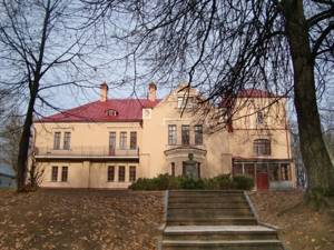
Further rafting along the Lovat River will lead the traveler to a beautifully restored estate located in the suburbs of the village of Polibino (the river basin is connected to the rural areas by a short stream, and on the other side Balazdyn flows into the main stream). The building has pinkish-cream shades. It was built in the eclectic style, popular in the last years of the century before last. The first Russian female mathematician, Sofya Kovalevskaya (née Korvin-Krukovskaya), once lived here. The Korwin-Krukovskys are a Polish noble family that dates back to the Lithuanian Glinsky dynasty, which, in turn, originated from the Pskov-Belarusian borderland. And that is, from the same ancient Polotsk Venets, to whom both Princess Olga and the first wife of Prince Vladimir belonged... In Polibino there is a gymnasium named after an outstanding compatriot. Her pupils always organize a folklore festival at the museum-estate on Kovalevskaya’s birthday. Few people know, but Sofya Vasilievna was also a playwright. Yes, I was also interested in music. Therefore, on this significant day, the halls of the estate become the stage for performances based on her wonderful plays.
A meat-processing plant known throughout the country, a whole set of local history gems of ancient origin (the Kremlin and burial mounds), picturesque restored churches (churches of the Holy Ascension Monastery), the Obelisk of Glory, the Matrosov Museum (with his figure), the Local History Museum and Vinogradov - these are the main brands of the one mentioned in the first line of the district center. Its population numbers over 100,000 people. The name of the object speaks for itself - Lovat bends here in the most incredible way. And too many times... Some mentions of the settlement date back to 1166. Although, judging by the finds, it stood there since the 7th century, serving as a primitive fortress of the Krivichi-Polotsk people. They subjugated the Baltic aborigines at that time. Adjacent to the villages were very long mounds, in which members of the clan, outstanding in military affairs, were collectively buried (along with all the required ammunition and weapons). Luke went through the so-called “path of the warrior” and only as a reward for this became Great in the 15th century. The fact is that at first they had to fight for the independence of the Novgorod Land, first from the German knights and Moscow, and in subsequent centuries - against Livonia, Lithuania and Poland (already in the 15th, 16th and 17th centuries). But the troubles did not end there. They continued during the Second World War (the city was liberated by tankers, and therefore the T-34 was installed at the prevailing level). Now the city is made up of bright, neat neighborhoods. It is noteworthy that Catherine the Great, in memory of the valor of the townspeople, changed the city coat of arms - the bows became not river bows, but those from which they shoot (in the amount of three pieces) ...

Velikoluksky Zoological Reserve was “born” in 2005. It starts 15 km north of the just described regional center and reaches the Lopatniki tract. That is, it is adjacent to the settlements of Maryino (in the south) and Kostrovo (in the north). Beavers and other near-water (including flying) game are rescued here. You can get up with tents. Hunting, cutting down forests, building dams and all other structures - no. Here they begin to divert canals from the main channel to the agricultural lands of the nearest villages.
Firsanov Bor tract
Beyond Velikiye Luki the shores cease to be low-lying. What do future sites on the Lovat River have in store for us? Firsanov Bor stretches along the riverbed for exactly a kilometer. The rich, dense tree stand comes close to the water. We are talking about aspen, ash, black alder, oak, willow and hazel. And, of course, about pine (it’s not for nothing that the word “pine forest” is present in the toponym). The entire building of the same name was located here before the events of the last great war. In front of the object, the water flow seems to be wound into a ball - Lovat manages to make 8 loops in a space of 1,500 meters. Inside the onion is an oxbow. Not far away (downstream) on the eastern side is Kurova Gora - the first river ravine (height only up to 4 meters). And on the cliff is the namesake village. Here the middle fragment of the path begins to slowly come to an end - the river slowly crosses the spur of the Valdai Ridge...
Lovatskie Porogi and the WWII Museum in Borki
The height of the banks begins to steadily increase towards the north, reaching a height of 50 meters closer to the Lovat rapids. It is here that the riverbed ends up in a wide basin (the diameter is now 40 - 120 meters). It was in the historical tract Podberezye in the mid-10th century that Princess Olga built the Trinity-Khlavitsa churchyard. Later, a rich monastery grew there, which was robbed more than once by the Lithuanian knights and their Krivichi allies, who hated (along with the Drevlyans) the Rurik dynasty. Olga herself was from a Polotsk family close to them, but not a noble one. And at the end of the 16th century, the Muscovites were already fighting here with the Polish army of Stefan Batory. Podberezye, Malye and Bolshiye Borki (“Borkovskaya volost”) - all these are landmarks that provide us with an indication of natural beauty and one artificially created historical object. In the nearest villages, researchers found 6 groups of settlements and burial mounds dating back to our era.
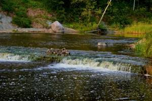
So, the thresholds. Rafting down the Lovat River finally reaches a rapids and rolling section. It exists only here - at the border of the middle and lower reaches. It is even included in the register of protected areas - like the Velikoluksky Zoological Reserve (see above about it). In place of many rocky rifts and “steps,” the stream suddenly narrows to 20 meters (and later expands everywhere again). And all this from Podberezye to the very mouth of Zagarka (sections below Kholm). That is, about 100 kilometers of “attraction”. It is here that the reaches are the widest, and the banks sometimes reach a height of 50 meters, exposing clay rocks of all shades of the rainbow... All these 100 km are a must-see.
The literary and artistic exhibition in Borki is a building made up of a pair of two-story houses. Its premises contain material reminders of front-line writers and front-line artists. The institution was opened by writer-publicist Ivan Vasiliev. This happened in 1988. The fund contains thousands of items.
Reserved lake Polisto, the city of Kholm and Rdeisky reserve
The Lovat River also provides us with a rich list of natural attractions here. To the west there is a neighborhood with the buffer zone of the lake-reserve Polisto. All adjacent swamps are protected objects (this is part of the largest peat bog in Europe). Together with the Rdeiskie swamps, they are the main regulators of the water level in Lake Ilmen, as well as the main filters of all local rivers and streams. The swamps have preserved a relict biocenosis. Lake Polisto is 8 kilometers long and 5.3 kilometers wide. On the outskirts of the GZ there is also Lake Tsevlo. The term “polist” in the Slovenian language meant “dangerous quagmire.” And indeed it is.
The town of Holm is “stuck” between two of the largest areas of raised moor in Europe. In addition, Lovat continues to descend through its most beautiful rapids here. Moreover, this city has great historical value. Therefore, it is difficult to overestimate it. Its name is “speaking” - the cultural core of the agglomeration is indeed concentrated on the hills. Virgin forests, the Heat Swamp, a road bridge, ancient estates, the mouths of tiny rivers, the Tikhvin Temple - these are the main assets of the town. There are also 2 local history centers. One of them is dedicated to the history of the development of printing in Russia. The hill is very green - there is an Arboretum, a City Park, and a public garden on Vladimirsky Boulevard. Note: there are two comfortable sandy beaches and a good hotel “Lovat”. The main pool meets the Cunha River, on which (away from the residential areas) you will find a small waterfall. They christened it romantically: Blue Lagoon...
The protected area “Rdeisky” comes into contact with the river on a fragment of the swamp of the same name (the transition from the Kholmsky to the Poddorsky district of the Novgorod region). The value of this type of swamp was described in the first paragraph of this section. The State Zone is also distinguished by the presence of the border between the taiga and the zone of broad-leaved forests - this is where it is the clearest. It should be noted that in an impassable area on the shores of Lake Rdeiskoe lie the remains of a monastery of the same name, which, nevertheless, is again a church parish. Cranberries, cloudberries, blueberries, lingonberries, and marsh wild rosemary grow on marsh pigweeds.
Regional center Parfino and the Lovat estuary
At this point, the protection of the Lovat River is also more relevant than ever. Parfino is the “capital” of Lower Lovat. There are plenty of sandbanks on quiet backwaters and picturesque lakes. Islands. True, they are not too wide. This point appeared on the map in 1495. Like the village of Parfeevo, born on the site of an ancient Slovenian settlement. It was renamed Parfino only in 1539. This entire area has always been part of the Shelonskaya Pyatina of the Novgorod Republic. And from the Romanov period - in the Starorussky district of the Novgorod province. In 1910, on the other side of the river, the merchant of the first guild, Dmitry Lebedev, built a manufactory for the production of plywood, which grew into a reputable plant during Soviet times. The influx of workers ended with the fact that in 1938 the large village grew into a workers' settlement. After all, the railway track was also installed here. In August 1941, Parfino was occupied by the Nazis. In February 1942 – liberated by the Red Army. After another 26 years, the village turns into a regional center. And a little later - also to a resort (several recreation centers and one pioneer camp were opened in the area). What will we see in the historical core? Monuments to Lenin and Soviet Tankers. Memorial to the Executed Red Army Soldiers (near the station). Church of Sarov. Parfino lies on two banks at once, connected by railway and road bridges.
The joint delta of Pola and Lovat is a unique natural object at the southern end of Ilmen. It was awarded the title of a nature reserve. In addition, the Parfinsky district is the largest concentration of ordinary, hunting and fishing camp sites. The shores here are just convenient. It is typical that the water level is not constant. The labyrinth of channels (decorated with floodplains) hides endangered flora and fauna. The part open to fishing is widely used for leisure by fishermen. Or fall waterfowl hunters. In addition to them, workers from two fishing farms operate motor boats. Their metal shallows (net traps) catch pike, pike perch, roach, silver bream and particles. Most of the fishermen live in the village of Vzvad, surrounded by river water on three sides. In the estuary, one bank is even wider than the main channel (Lovat itself). This means Old Lovat. Lost among the branches are lakes Sitnoye, Chagodovskoye, Zhirokhlinskoye, Galkinskoye. There are also 4 smaller ones. At the very beginning of the fork, Pola merges with Lovat (this point is surrounded on both sides by 2 raised swamps - Dryaby and Black Forest). As a result, we can say that both rivers, all swamps and all channels of the estuary have exits into each other. Fishing camps stretched from the village of Khmelevo to the already mentioned village of Vzvad...
Lovat
Lovat is a river flowing in the upper reaches through the territory of Belarus, in the middle and lower reaches through the territory of Russia. Lovat belongs to the Baltic Sea basin, the Lake Ilmen basin and the Volkhov and Neva river basins.
From the source to the village of Mezha (Vitebsk region), the Lovat River flows to the southeast, then sharply changes direction and flows to the north, deviating strongly to the left and to the right. The Lovat River begins from Lake Lovatets in the Vitebsk region of Belarus. It flows into the southern part of Lake Ilmen, 7 km north of the village of Vzvad in the Starorussky district of the Novgorod region of Russia, where, together with the Pola River, it forms a delta with an area of about 400 km².
The origin of the river's name "Lovat" is controversial. The name “Lovat” can be either Slavic, Finno-Ugric and, with a lesser degree of probability, Baltic (Lithuanian-Latvian).
Settlements . _ The Lovat River flows in the Vitebsk region of the Republic of Belarus and in the Pskov and Novgorod regions of Russia. In the Pskov region: in the Usvyatsky district, in the Velikoluksky district, in the Loknyansky district. In the Novgorod region: in the Kholmsky district, in the Poddorsky district, in the Starorussky district, in the Parfinsky district.
On its way, the Lovat flows through such large settlements as the city of Velikiye Luki, the city of Kholm and the large village of Parfino.
The city of Velikiye Luki - its first mention in chronicles dates back to 1166. It has held the title of city since 1777. It is an urban district and a city of military glory. The city's population is 98,552 as of 2011. Velikiye Luki is a large multidisciplinary commercial, industrial, cultural and educational center in the southern part of the Pskov region.
The city of Kholm - its first mention in the chronicles dates back to 1144. It has been called a city since August 3, 1777. It is the administrative center of the Kholm municipal district of the Novgorod region. The city's population is 3,829 as of 2010. One of the attractions is the Blue Lagoon waterfall. This is a natural threshold of the Mesozoic geological plate on the Big Tuder River. The waterfall on the river is located 2 kilometers southwest of the city center of Kholm. This place is amazing; the water has healing properties due to the presence of blue clay in the soil.
The urban-type settlement of Parfino - its first mention in chronicles dates back to 1495. It has been a settlement since 2008. It is the administrative center of the Parfinsky municipal district of the Novgorod region. The city's population is 7,268 as of 2012. There are no historical sites in Parfino. In the village there is the Church of St. Seraphim of Sarov, built at the end of the 20th century.
The entire list of settlements located on the banks of the Lovat River can be found here >>…
Routes (access roads) . The main major roads to the river are listed below: In the Pskov region: - near the village of Uzkoye (Usvyatsky district), the Lovat River is crossed by the P-133 “Nevel - Smolensk” highway. - near the village of Stukany (Velikoluksky district) and further in the city of Velikiye Luki, the Lovat River is crossed by the P-51 highway “Loknya - Velikiye Luki - gr. with Belarus." — in the vicinity of the city of Velikiye Luki, the Lovat River is crossed by the M-9 “Baltic” highway (Moscow - Volokolamsk - border with Latvia).
In the Novgorod region: - near the city of Kholm (Kholmsky district) there are three roads - one road P-51 through the village of Poddorye connects the city of Kholm with the city of Staraya Russa, another road P-51 passes through the village of Loknya and Velikiye Luki, the third road leads to Marevo and Demyansk. — near the village of Korovitchino (Starorussky district), the Lovat River is crossed by the P-48 highway “Soltsy - Staraya Russa - Demyansk - Yazhelbitsy - Valdai”. — near the village of Parfino (Parfinsky district) the river is crossed by a branch of the Pskov-Valdai railway.
In the lower reaches of the Lovat River, it is navigable for 70 km.
Main tributaries . The largest tributaries of the Lovat River are the following: - Polist River - length 176 km; drainage area 3630 km²; located 15 km from the mouth of the Lovat River; left tributary. It flows through the territory of the Bezhanitsky district of the Pskov region and through the territory of the Poddorsky and Starorussky districts of the Novgorod region.
– Redya River – length 146 km; drainage area 671 km²; located 18 km from the mouth of the Lovat River; left tributary. It flows through the territory of Poddorsky and Starorussky districts of the Novgorod region.
— Loknya River – length 119 km; drainage area 2190 km²; located 269 km from the mouth of the Lovat River; left tributary. It flows through the territory of Loknyansky and Bezhanitsky districts of the Pskov region.
— Kunya River – length 236 km; drainage area 5143 km²; located 192 km from the mouth of the Lovat River; right tributary. It flows through the territory of the Velikoluksky, Kunyinsky, Kholmsky districts of the Pskov region and through the territory of the Toropetsk district of the Tver region.
Information about other tributaries of the Lovat River can be found here >>…
In addition to rivers, many lakes flow into Lovat: Blagi, Bludenskoye, Galkinskoye, Glubokoye, Tens, Oaks, Zhirokhlitskoye, Zanyusskoye, Zaorlitskoye, Indyuk, Kadolovskoye, Kalenoye, Kamenets, Kisloye, Kisloye, Koloushinskoye, Kupuyskoye, Lenostovo, Lyubzhir, Nespo, Odgast , Orelye, Osplya, Ostrovno, Porechye, Psovo, Sekuy, Sennitsa, Sereberskoye, Serutskoye (Siroto), Sitnoye, Snezhye, Sokoto, Sorito, Cloud, Ulishchevo, Khrebtovskoye, Chagodovskoye, Chistoe, Chistoe.
Also, the Lovat River flows through flowing lakes: Lake Vorohoba, Lake Zavesno, Lake Zadrach, Lake Mezha, Lake Sesito, Lake Sosno (Bolnichnoe), Lake Chernyasto.
Relief and soils . Within Belarus, in the upper reaches, the Lovat River flows through the Gorodok Upland. The area of the hill is about 3000 km². Heights range from 135 m to 263 m. The surface of the hill is a system of terminal moraine ridges, which are separated by hollows and basins. Areas of kame relief are also common. Soils are sod-podzolic or sod-podzolic, swampy or peat-boggy or floodplain. Raised and transitional swamps. Meadows are confined to depressions.
In the Pskov region, in the middle reaches, the Lovat River flows along the Velikoluksky ridges. The rise of the ridges is about 140-160 meters. They are located between the Valdai and Bezhanitskaya hills south of the city of Velikiye Luki. Further, the river flows through the Lovatskaya lowland, which is part of the vast Priilmenskaya lowland. It is a flat, sometimes slightly undulating and swampy plain with heights from 50 - 60 meters to 100 - 120 meters. The lowland is bounded from the south by the Velikoluksky ridges, from the west by the Bezhanitskaya, Sudomskaya and Luzhskaya, and from the east by the Valdai Uplands. The soils are moderately infertile. In general, light soils are typical for the territory: sod-carbonate and sod-gley, light-loamy and medium-loamy, as well as swampy soils. The largest tracts of raised sphagnum bogs are concentrated in the Lovat Lowland.
In the Novgorod region, in the lower reaches, the Lovat River flows through the Ilmen lowland. The Ilmen lowland is represented by a tectonic depression, which in post-glacial times was filled with water from the periglacial basin and filled with moraine, sands and banded clays. The Ilmenskaya lowland is quite flat. Altitudes vary from 18 to 50 m above sea level. Its central part near Lake Ilmen is more depressed. In the Priilmenskaya lowland, soddy-alluvial podzolic-marsh and bog soils predominate, the formation of which is caused by waterlogging.
Vegetation . The vegetation is represented by birch, poplar, willow, alder, maple, linden, aspen, spruce and pine trees. In some places, forest areas have been converted into agricultural land (arable lands, fallow lands, meadows). Heather, cassandra and poisonous wild rosemary grow from the shrubs. In the swamps there are a lot of cranberries, cloudberries, blueberries, and blueberries; in dry places there are raspberries, strawberries, lingonberries, and blackberries. Trees grow rarely in swamps, they are stunted and are represented by pine and birch.
Hydrological regime . The length of the Lovat River is 530 km. The drainage basin area is 21,900 km². The height of the source is 170 m. The average water flow at the mouth is 169 m³/s. The river is fed predominantly by snow. On Lovat, in the spring, from the second half of March to the beginning of May, about 55% of the annual flow passes. During the summer-autumn period, from June to October, about 23% of the annual flow passes. In winter, from November to March, about 22% of the annual flow passes.
The Lovat River is a lowland river with a low flow rate. The channel is winding, the flow speed and depth are uneven. The pools in some places reach 5-6 meters in depth, but sandy and rocky shoals that form rapids are also often found. The river's floodplain is meadow. The width of the river in the upper reaches reaches 10-15 m. After the confluence of the Nasva River, the Lovat riverbed begins to pass through forested areas. The banks become high and in some places steep. There are many rapids and riffles in the middle reaches of the river. The main rapids are concentrated at the confluence of the Loknya River and below the city of Kholm (Novgorod region). In this place, the width of the river reaches 50-60 meters, and after the confluence of the Kunya River - already more than 100 m. In the lower reaches, in the Priilmenskaya lowland, the banks of the Lovat River are flat. 22 km from the mouth it is connected by a channel to the Pola River. In spring, floodplain meadows located in the delta are flooded to a depth of 2-3 m.
Ichthyofauna . The river is very rich in the presence of a variety of fish. Among the fish species found in the river are: silver bream, perch, pike, roach, verkhovka, pike perch, gudgeon, catfish, burbot, tench, asp, dace, bleak, bream, eel, chub, ruff, ide.
Historical reference . In the 8th-13th centuries, the “Volga Trade Route” and the famous route “From the Varangians to the Greeks” (from the Baltic Sea to the Black Sea) passed along the Lovat River. It connected the Scandinavian countries with Byzantium. Lovat played an important role in communication between the cities of Kiev and Veliky Novgorod.
Attractions, tourism and recreation . On the right bank of the river, 3.5 km from the village of Lyalevshchina (Vitebsk region), there is an archaeological site - an Iron Age settlement, near the village of Mezha (Vitebsk region) - a Neolithic site. The Lovat River is interesting for kayaking and fishing. A variety of healthy berries grow in coastal forests. At the mouth of the river there are recreation centers for tourists and travelers. Reference Information .
Length: 530 km. Basin area: 21,900 km². Swimming pool: Baltic Sea, Lake Ilmen. River basin: Volkhov, Neva. Source: Lake Lovatec. Location: Vitebsk region, Belarus. Coordinates: 55°49′33.01″ N. latitude, 30°15′10.98″ e. Ustye village: southern part of Lake Ilmen. Location: 7 km north of the village of Vzvad, Starorussky district, Novgorod region, Russia. Coordinates: 58°11′41.11″ N. latitude, 31°30′13.31″ e. d.
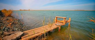
Tourism and recreation on the Lovat River
The Lovat River is located within that part of the “benign” temperate climate, which is softened by proximity to the seas of the Atlantic Ocean. In January it is no colder than minus 5, and in July it is no hotter than plus 22 degrees. The only problem is that there are a lot of cloudy days and a little more rain than we would like. Humidity accumulates abundantly in this land - that’s why there are so many lakes, swamps, fields and streams. This is the same reason why the forest is so diverse! Hiking relaxation is the main activity for tourists, and jeep safari and rafting are for extreme sports enthusiasts. In autumn, “mushroom” and “cranberry” tours are popular (there are enough cranberry reserves in the described area). And, of course, hunting. Crushed stones, dirt roads, and walking trails are a joy for cyclists. What serious transport arteries lead here? Firstly, the railway tracks of the Nevelsk and Starorusskoe directions intersect with the Lovat shores more than once. And, secondly, such highways as E-95 (St. Petersburg - Odessa), Gorodok - Velikiye Luki, Velikiye Luki - Podberezye, Loknya-Kholm, Kholm - Staraya Russa. There are secondary asphalt roads.
Horseback riding and beach holidays on the Lovat River are ideal on the Velikiye Luki – Yuryevo section.
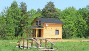
This same zone is the only region with tourist centers and children’s holiday camps:
- "Forest Tale";
- "August";
- "House of the Hunter and Fisherman";
- "Capercaillie";
- "Brown bear";
- "Rusich";
- "Zhabino".
The fact is that here is the most convenient entry into the water (an excellent swimming pool). There is sand. Swamps at a decent distance from the water's edge. In general, campers will really like it here too.
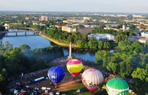
As for extreme, pilgrimage and event tourism, as well as fishing, the Lovat River provides many opportunities near large settlements and riverbed lakes. Tourism festivals are held in Belarusian Ezerishche. In Velikiye Luki there is an annual ballooning festival (we take to the air with everything we can). In Kholm there is the same regular gathering of patriotic song performers. And in Parfino there is a fascinating event called “Lighting up the Stars” (a gala concert of vocal and choreographic youth groups). Please note that there is a lot of fish everywhere here (it’s not for nothing that most of the recreation centers are built for fishermen)!!!
Rafting on the Lovat River is a popular activity among extreme sports enthusiasts such as kayakers, rafters, kayakers and even lovers of homemade rafts. They usually start where the distance between the banks is already at least 100 meters. That is, from the Pskov Lake District (usually from the village of Borisogleb, which can be easily reached from Porechye, otherwise it is connected by road to the international highway Velikie Luki - Gorodok). The diameter narrows in some places, but does not become less than 15 meters. There are no rubble anywhere. There are a lot of forests of different types. And on the water there are reeds and water lilies (which indicates the ecological well-being of the biotope). The current speed is average. But on the bends it is high. On the right and left there are fireplaces of experienced people. And also birch groves. There are also giant ash trees. A series of rapids are indicated in one of the top paragraphs. I must say that these obstacles are passed without difficulty - with a smile on their face. Commercial water trips also take place. But already beyond the threshold - in the Novgorod region. Most often from Chekunovo (already outside the town of Kholm) to the village of Seleevo (on this stretch a kayaking adventure is suitable even for children). A pleasant feature of the named fragment is the complete absence of bridges. And from Blaznikha you also get a “primer”. Along the banks (they are extremely winding) the cliffs begin to gradually decline. They descend at the end to prosaic 3-meter edges. The current speed is average. There are not so many muddy banks. Besides, no shallows. Among the forests, coniferous tracts, birch and alder forests begin to predominate. River oxbows appear to the side, the banks of which are sometimes more convenient than river banks in terms of parking. And further. For those who want to catch the last rapids, we recommend rafting directly from the town of Kholm. You will be carried away at great speed. At least some experience is desirable, but in general the water excursion will be safe and bright...
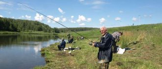
Fishing the river - fishing for every taste!
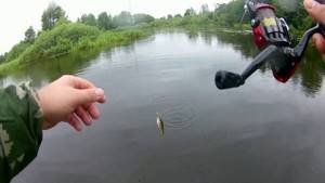
Fishing on the Lovat River is very varied; its waters are home to a large number of different species of fish. Fans of bottom fishing, fans of float fishing, spinning and fly fishermen, and of course connoisseurs of winter fishing will find a place here.
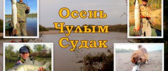
Lovat is a river where fishing is very diverse: catfish, pike, ide, grayling, asp, roach, bleak, pike perch, bream, perch and many other types of fish - everyone can try their luck and hunt for the desired trophy.
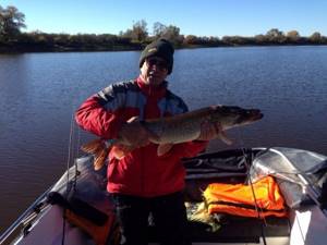
It is clear that the Lovat is a river, fishing in the waters of which can bring a lot of pleasure from both the fishing process and the result. The reason for this is the beautiful nature of these places and the large number and variety of fish that live in it. It is not uncommon in these places to catch trophy specimens: one kilogram perch, 15 kg pike, bream around 4 kg, large pike perch over 2 kg.
Fishing base "RUSICH" - winter fishing
We invite everyone to visit our fishing base in winter. Choosing from fishing bases where winter fishing will be good, our base has many advantages.
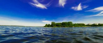
Winter fishing in the vicinity of the fishing base "RUSICH" includes fishing on the Lovat River and Lake Ilmen. The water expanses of these places are very vast and very rich in fish.
At our fishing base you will find everything you need to organize excellent winter fishing and protect yourself from unnecessary difficulties. Excellent conditions of stay and assistance from the base staff are guaranteed to provide you with a good rest.
Our fishing guides will show you the most promising places for winter fishing and share their experience regarding local fishing features. In addition, a snowmobile and all the necessary equipment are at your service.
In winter, we actively catch perch. It should be noted here that the perch on Lake Ilmen is very large. This is influenced by both the abundance of food and the large expanses of water in the lake; the fish eats well and quickly gains weight. If we compare fish of the same age caught in Lake Ilmen with specimens from other reservoirs, then the perch from Ilmen will be one and a half, or even 2 times larger.
The best time to catch a striped predator is during ice cover. There are a great many perch in Ilmen, so winter fishing for perch in the Novgorod region is interesting and very productive.
Catching perch involves a lot of movement on the ice and you may have to drill holes many times, because schools of perch move quite actively in search of food. But having found a good place, the catch can be very significant, 30-50 kg of perch!
As practice shows, the best results, as a rule, are for those who use the services provided by fishing bases; winter fishing at the RUSICH base is a vacation without unnecessary hassle.
Fishing and hunting on the Lovat River
Fishermen like the Lovat River. Fishing here promises an encounter with various delicacies:
- pike;
- perch;
- crucian carp;
- minnow;
- language;
- catfish;
- zander;
- rudd;
- line;
- burbot;
- silver bream;
- roach;
- asp;
- bream.
On the Lovat River, catchers can fish almost everywhere. After all, there are plenty of oxbow lakes and lakes, riffles, deep reaches, fast-flowing channels, quiet backwaters with snags and reeds, as well as floodplains. That is, the water landscapes here are suitable for any fish. The same can be said about Lovat sleeves. There is no point in recommending any one place. Locals and visitors respect casting from the shore, standing on rapids, walking on inflatable boats, “watching” under bridges and even on bridges. As for the type of gear or bait, they are all good here - today this is a proven fact. Attention. Catching ichthyofauna is not allowed in sections of the Polistovsky and Rdeysky reserves. Of course, no nets or poisoning machines.
We remember about the spawning season and about the water protection zones of the 2nd protected area (to do this, just read the signs on the full houses). Among the inhabitants of the Red Book in the waters of the Lovat basin, you will only find the sculpin or the Ukrainian lamprey. There are enough stones in the presented region. You can catch a lot of crayfish here.
This is the joy the Lovat River provides to its guests. Fishing, however, can only be part of a hunting trip, which we will talk about here. There are dozens of hunting grounds along the riverbed (the area, by and large, is not very populated). In the territory of Polesie, in the Pskov region and in the southern Novgorod region, the following game animals are available: wolf (without restrictions), elk (from October 1 to December 31), wild boar (from June 1 to December 31), furs (exclusively from September to December 31 - forest polecat, American mink, otter, marten and fox), hare. Next are small rodents, a badger and a raccoon dog. Brown bear is limited here. Flying and swimming game - wood grouse, black grouse, pheasant, quail, partridge, curlew, nuthatch, turtle dove, snipe, ducks, coot and goose. “Red Books” - owls, all birds of prey, swans, cranes, storks and all kinds of herons.
Fishing
On the Lovat River they fish in all ways all year round. They hunt both peaceful and predatory representatives of the ichthyofauna. You can fish from early spring to late autumn, and in winter - as soon as stable ice cover is established. Both residents of the Novgorod region and fishing enthusiasts from other regions come here.
Fishing on the river Fishing with a spinning rod is the most popular and versatile method of fishing. In addition, representatives of the following fishing trends can be found on the reservoir:
- trolling;
- feeder;
- fly rod;
- plug;
- match;
- fly fishing
The predator is caught with both spinning baits and natural baits. In particular, you can fish for live bait caught right on the pond, large crawler, frog, leech, and crayfish meat.
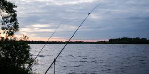
Morning Lovat attracts anglers with its beauty and the prospect of catching large fish
The main methods for catching peaceful fish are a feeder, a donka and a fly-float rod. For bait, we can recommend dung worm, bloodworm, maggot, caddis larva, grasshopper. In warm water, it is advisable to switch to baits of plant origin - dough, steamed wheat, canned corn, boiled potatoes.
Important! In the Lovat River you can always count on a bite from large fish, so the gear must have a sufficient margin of safety.
In winter, all methods of fishing from the bottom work. In oxbow lakes, calm water and shallow water, it is advisable to use a jig with bloodworms and a no-moth. The predator is caught with spoons and balancers, as well as with the help of girders. It is better to go out into the current with bottom equipment - a helicopter, ends and others.
Protection of the Lovat River
As you already understand, protection of the Lovat River is definitely needed along its entire length. The conversation turned to the issue of “post-picnic” cleanup and abandoned poaching nets. And yet, serious pollution (threatening to change the environmental status of the site) is present only on a 12-kilometer section of the Velikolukskaya agglomeration (here IZ is already defined - “moderately polluted”). But everything above is considered a completely impeccable recreational area. At the moment, the active actions of scientists, officials and citizen volunteers are concentrated around the problem of wastewater from industrial, agricultural and municipal enterprises. The content of pesticides, copper and manganese compounds, and biologically hazardous organisms is exceeded. Slight contamination is also present on many fragments lying below Velikiye Luki.
This description of the Lovat River is intended to outline all the recreational pros and cons of the mentioned “water road”. It also gives an idea of the historical significance of its banks. An interesting feature of the upper reaches of this watercourse is the presence of a cascade of channel widenings, many of which received “titles” of lakes on the map. Alas, in some places the river edge is very swampy. In cities the water is slightly polluted...
0