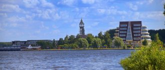
Geography of the Stavropol Territory
The area of Stavropol is 66.16 km², it includes 26 administrative districts with a population of 2.8 million people, of which 58.36% are urban (data as of 01/01/2017).
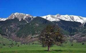
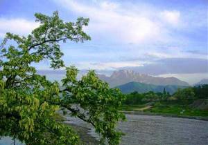
The climate of the region is temperate continental. The terrain is difficult. The central part is occupied by the Stavropol Upland, which in the south connects with the foothills of the Greater Caucasus, in the east it smoothly flows into the Terek-Kuma Lowland and into the Azov-Kuban Lowland in the west, and in the north it connects with the Kuma-Manych depression.
In the foothills, one can distinguish Pyatigorye, a volcanic region with numerous peaks. The maximum height is observed in the Kislovodsk region and reaches 1603 meters above sea level. The smallest peak is located in the lower reaches of the Kuma River. Its height is only 6 meters.
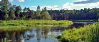
The rivers, lakes and mountains of the Stavropol Territory are original and picturesque. There are 130 mineral water springs in the Stavropol region. The water resources of the region are not only rivers and lakes created by nature, but also man-made reservoirs, ponds and canals, which are used to moisten arid steppe lands.
Water resources, presence of rivers, lakes
The Stavropol Territory extends from the northern foothills of the Caucasus Range in the territory of the Caucasian Mineral Waters in the south to the Manych Valley in the north and is one of the most difficult territories of the Russian Federation in terms of water management. The Stavropol Territory is the only one in the Russian Federation that falls within the boundaries of three basin districts - Kuban, Don and West Caspian. There are more than two hundred rivers and streams in the Stavropol region. The Stavropol Upland is a watershed of rivers carrying their waters to the Azov and Caspian Seas. There are four main rivers in the region - Kuban, Kuma, Kalaus, Bolshoi Yegorlyk. In addition, there are 38 lakes, mostly salty and bitter-salty, with a water surface area of 150 square kilometers. Of the lakes of natural origin, the largest is Manych-Gudilo, located at the junction of Stavropol, Rostov region and Kalmykia. In the foothills, in the region of the Caucasian Mineral Waters, Tambukanskoye Bolshoye, Tambukanskoye Maloe, Lysogorskoye Northern, Lysogorskoye Yuzhnoe are widely known. They are known, first of all, for their therapeutic mud, used by the health resorts of Georgievsk, Pyatigorsk, Zheleznovodsk, Essentuki and Kislovodsk. In the valley of the Kuma and its tributaries, the most famous lakes are Medyanika and Buivola.
Due to the limited availability of its own water resources and the unevenness of their distribution, water supply to the population and economy of the region is based on inter-basin flow transfers of the Kuban and Terek rivers, which are provided by the largest water management complex in the Russian Federation. Through the Tersko-Kuma and Kumo-Manych canals, Terek water is supplied to the basin of the Kuma and Vostochny Manych rivers, and Kuban water, after re-regulation in the Kuban reservoir, is supplied to water consumers in the river basin. Kuma and Kalaus along the Great Stavropol Canal. In addition, the river flow The Kuban River, through the Nevinnomyssky and Pravo-Egorlyksky canals, after re-regulation in the Sengileevsky reservoir, is transferred to the basins of the Yegorlyk, Kalaus and Western Manych rivers. Every year, up to 4 cubic kilometers of water are transferred through main canals, complex canals and distributors, with a length of more than 3.5 thousand kilometers, which provides up to 80% of the region’s water consumption. The surface flow of rivers and inter-basin transfer canals is regulated in 58 reservoirs and many ponds. The largest reservoirs are Otkaznenskoye and Chograyskoye.
The water management system of the Stavropol Territory includes hydropower facilities - cascades of hydroelectric power stations. In addition, the Stavropol and Nevinnomyssk state district power plants, which are the largest water consumers in the south of Russia, are located on the territory of the region. Due to the functioning of the water management complex, 78% of drinking and domestic water supply is provided, watering of 80% of the territory of the region, generation of 18.3 billion kWh of electricity, irrigation of 374 thousand hectares of agricultural land, development of the fish farming industry and water supply to adjacent regions (Rostov region of the Republic Dagestan and Kalmykia). Stavropol region has unique reserves of underground fresh water. For the purposes of domestic water supply, 15 deposits have been explored, of which 12 deposits are in operation with a total production volume of about 100 thousand cubic meters per day. Actual water withdrawal is only about 6% of the explored and approved reserves. In general, 95% of the region’s population uses centralized water supply services in the Stavropol Territory, which is higher than the all-Russian level (75%) and corresponds to the level of developed countries (90-95%).
Unique hydromineral wealth and a wonderful bouquet of healing mineral waters are concentrated in the small territory of the Caucasian Mineral Waters (546.5 thousand hectares).
On the territory of the Caucasian Mineral Waters there are 24 deposits and areas of mineral water of 12 different types and 40 varieties, with total approved reserves of 16.7 thousand m3/day. Among them are the world-famous Kislovodsk Narzans, carbonated waters such as “Essentuki-4”, “Essentuki-17”, “Essentuki-20”, “Essentuki healing”, Pyatigorsk hot and cold carbonated waters such as “Mashuk-1” and “Mashuk- 19", Zheleznovodsk thermal baths "Slavyanovskaya", "Smirnovskaya", "Novoterskaya healing", "Slavyanskaya", "Beshtau", carbonic-hydrogen sulfide waters, bitter-salty, hydrogen sulfide, soda (analogue of Borjomi), siliceous, iodine-bromine, boric and radon waters.
Rivers of Stavropol
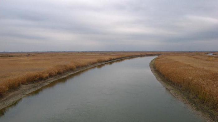
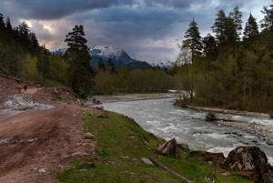
The rivers of the Stavropol Territory belong to the basins of the Caspian and Azov seas. Due to the arid climate in most of the region's lands, the density of the river network is insignificant and unevenly distributed. The rivers are most densely located in the foothills, and to the east and north their number decreases significantly. What rivers are there in the Stavropol Territory?
There are just over 200 rivers and rivulets in the Stavropol Territory. Most of them are small rivers. The length of such rivers is from 101 to 200 km with a drainage area from 1000 to 2000 km². The rivers flowing in the eastern part of the region contain a large amount of mineral elements, which is associated with the salinity of the local soils.
The list of rivers of the Stavropol Territory can be divided into two parts: rivers belonging to the Azov-Black Sea basin, and those belonging to the Caspian Sea basin.
Western Manych
The left tributary of the Don is the Western Manych. Translated from Turkic, “manych” means “bitter”. Its source is located at the site of the former branching of the river into Western and Eastern Manych, the Kalaus River.
The length of Western Manych is 219 km. The flow of this river passes through the valley of the Manych hollow. It feeds mainly from melting snow cover. The main tributaries are the Kalaus and Yegorlyk. Western Manych is most often used for fishing.
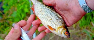
What kind of fish is found in the Stavropol Territory?
Zander
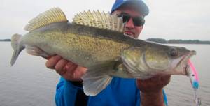
It differs here in that it grows rather slowly. Here, an individual weighing 4 kilograms is already considered large, although some fishermen caught pike perch weighing up to 7 kilograms.
It is caught here more with artificial baits, which are light in color. Deep-sea wobblers are considered no less catchy, since pike perch leads a bottom-dwelling lifestyle. Sinking wobblers perform well when catching pike perch.
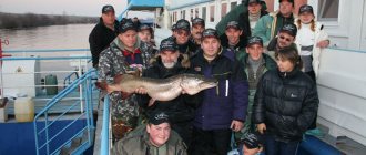
Som
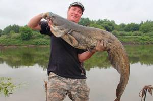
This large freshwater predator is found in almost all reservoirs of Russia and the Stavropol Territory is no exception. In addition, it is possible to catch trophy catfish here. Catfish should be looked for in deep-sea areas, where they prefer to stay almost all the time, leaving them only to feed.
As a rule, this happens at night, since the catfish is a nocturnal hunter. Large catfish can be caught on a frog, fried sparrow or crayfish, and smaller individuals can be caught on a bunch of worms.
Egorlyk
The Yegorlyk River in the Stavropol Territory is a left tributary of the Western Manych. Its source is on Mount Strizhament.
Yegorlyk flows into the Proletarskoye Reservoir. Its length is 458 km. It flows in the Stavropol Territory, Rostov Region and the Republic of Kalmykia. The river is fed in the upper reaches by snow and underground, in the lower reaches by snow and rain. It has two large tributaries: Bolshaya Kugulta and Kalala.
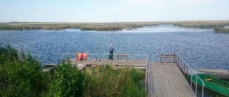
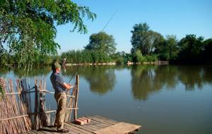
The best paid reservoirs in the Stavropol Territory
Popovskie Ponds
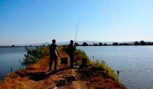
Popovskie ponds number more than 50 reservoirs located on the territory of the Stavropol Territory and occupy an area of more than 500 hectares. On these reservoirs, paid fishing is organized. Throughout the year they are regularly replenished with live fish such as crucian carp, silver carp, perch, rudd, pike perch, carp and grass carp.
For one hour of fishing on these ponds you will have to pay 500 rubles. Here, but for additional money, you can purchase groundbait and any bait. After fishing, the service staff, if desired, can process the catch, but you will have to pay 100 rubles per 1 kg of weight.
Popovskie ponds are located at the intersection of the Stavropol-Sengileevskoe-Tonnelny roads, which is located 23 km from Stavropol.
Other bodies of water
In addition to Popovsky Ponds, there are other paid places. For example:
- Two ponds in the Novotroitsky district. Here you can really catch a lot of different fish in a day of fishing.
- Pond near the village of Novoulyanovka. It is located in close proximity to the place where water is discharged from the reservoir. There is a sufficient amount of crucian carp here, but you can also catch catfish if you try hard enough.
- Lake near the village of Krasnoye. There is also a fishery here that provides paid services for fishermen. The pond contains a lot of large and varied fish, and the staff is very hospitable.
Kuban
The Kuban River is the largest river in the Stavropol Territory. Its source is the western slope of Mount Elbrus, where the Uchkulan and Ullukam rivers merge. The length of the Kuban River is about 870 km. The route of its flow passes through Karachay-Cherkessia in the Stavropol Territory, then to the border of the Krasnodar Territory with Adygea, it flows into the Sea of Azov. The river waters are used for drinking and irrigation.
The largest tributary of the Kuban is the Bolshoi Zelenchuk. The highest rise in water level can be observed in the second half of summer. The Kuban River bed is filled with rain, melt water, including from mountain glaciers, and underground flows. In the Stavropol region, the river is mainly fed by rainwater. The main rivers of the Caspian Sea basin are Terek, Kuma, Gorkaya Balka, and Vostochny Manych.
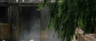
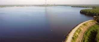
Fishing on the Sengileevskoye Reservoir
Previously, it was not for nothing that the lake was called Fish. It is home to about 20 species of fish - silver carp, pike perch, bream, bluefish, carp, roach, crucian carp, ram, carp, sleeper. Local residents talk about giant catfish the size of a person, but exact evidence of this fact has not yet been found.
Fishing on the Sengileevskoye Reservoir has long been prohibited, both from boats and from the shore. This decision was made to maintain the cleanliness of the reservoir. Its implementation is carefully monitored here - violators are regularly caught and boats are confiscated.
© gjp2007
Terek
The source of this river in the Stavropol Territory lies in the Trusovsky Gorge, located on the Main Caucasus Range. The length of the Terek channel is 623 km. The river flows from Georgia to North Ossetia, then through the territory of Kabardino-Balkaria and the Stavropol Territory, through Chechnya and Dagestan to the Agrakhan Bay of the Caspian Sea. Its main tributary is the Malka.
The river is fed mainly by the melting of mountain glaciers and snow, so the flood occurs at the height of summer. The Terek is used to irrigate adjacent fields and gardens.