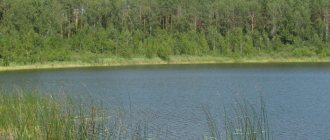
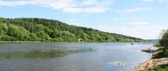
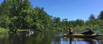
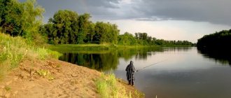
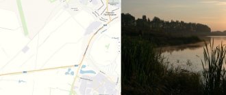
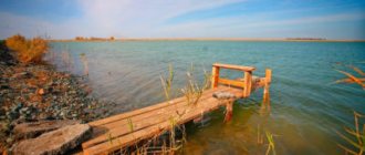
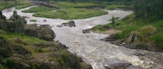
The rivers of the Bryansk region entangle the territory with a dense water network. Their total length is 9 thousand kilometers. There are a total of 129 rivers and streams in the region. A large number is the result of the favorable influence of climate. A characteristic feature is the uneven location, due to the combination of flat and hilly surfaces. The main number of rivers are located in the east and in the central part of the region. The rivers Snov, Iput and Besed flow in the northwest and southwest.
River feeding
All rivers are mainly fed by melting snow. During spring floods, rivers flood widely, the average annual volume of water increases 10-20 times, and water consumption accounts for up to 60% of the total annual flow. Ground and rain nutrition makes up 20% of the total volume. In dry times, rivers are fed by groundwater, which dramatically affects their full flow. In hot summer, watercourses become shallow, their flow does not exceed 10% of the total annual flow. Rivers break up from ice in early April, and freeze in December.
Large rivers of the Bryansk region
The list of rivers in the Bryansk region is quite impressive. But for the most part, these are small rivers that are tributaries of larger watercourses. Let's name significant ones, in addition to Desna, Iput, Besedi, which we will dwell on in a little more detail. In addition to them, the following rivers flow through the territory of the Bryansk region:
- Chatter. A tributary of the Desna, which is about 200 kilometers long.
- Judgement. A tributary of the Desna, 195 kilometers long.
- Nerussa. A tributary of the Desna, length 182 kilometers.
- Navlya. A tributary of the Desna, 126 kilometers long.
- Vetma. The Desna tributary is 112 kilometers long.
- Ivotka. The Vit tributary is a branch of the Desna. Length 94 kilometers.
- Gabia. The Desna tributary is 74 kilometers.
- Voronitsa. The Iput tributary is 73 kilometers long.
The rivers and lakes of the Bryansk region are fishing grounds and the decoration of the land. The Desna and its tributaries are surrounded by the greenery of the surrounding forests. In spring it is shrouded in the color of bird cherry. But in beauty it is in no way inferior to its tributaries - Navlya, Sudost, Boltva.
Flora of the Bryansk region
The flora of the Bryansk region is rich and diverse. The central and eastern parts of the region are largely located in the forest zone, where mixed-type forests predominate. But the forest is the main wealth of the region. They cover a quarter of the region's territory. Their location is uneven: most of the large forests are located on the left bank of the Desna. Here forests cover up to half the territory.
Taiga coniferous forests in the region transform into broad-leaved forests. There are only a few percent fewer coniferous forests than deciduous forests. More than 70 species of shrubs and trees are found here. Pine, spruce, aspen, birch, oak, ash and maple trees grow here in greatest numbers.
Apple trees grow on the edges and near rivers, and pear trees grow in the ravines. Medicinal and industrial plants grow in the forests.
The region's forest resources are used in agriculture and industry. Bryansk pine was recognized as one of the best coniferous species in the world.
Gum
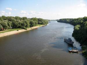
It is the largest in the Bryansk region. The Desna River originates in the hills of the Smolensk-Moscow ridge and is located in swampy places called Golubev Moss, not far from the village of Nalety, which is located ten kilometers from Yelnya, Smolensk region. It carries its waters to the Dnieper. Its mouth is located 6 kilometers from Kyiv. This is the largest tributary of the Dnieper. The current flows in the direction from northeast to southwest.
The length of the Desna is 1187 kilometers. The width in the channel is 50-180 meters, in the floodplain - 4-6 kilometers. The maximum depth is 12 meters. It receives its main tributaries mostly from the left bank. These are the rivers Snezhit, Nerussa, Bolva, Navlya and others. From the right bank, Snov, Sudost, and Gabya flow into it.
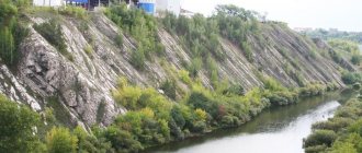
In the upper reaches of the river the banks are low-lying and swampy. Down from Bryansk the right bank rises, there are many oxbow lakes and channels. The river is frozen from early December to early April.
Zhukovka, weather forecast and fish bite
| Weather forecast and fish bite | Calendar, from 02/16/2021 to 02/19/2021 | |||||||||||
| VT | SR | Thu | PT | |||||||||
| Times of Day | Evening | Night | Morning | Day | Evening | Night | Morning | Day | Evening | Night | Morning | Day |
| Cloudiness, precipitation | Partly cloudy | Partly cloudy | Mainly cloudy | light snow | light snow | light snow | Partly cloudy | Partly cloudy | Mainly cloudy | Partly cloudy | Clear | Partly cloudy |
| Temperature °C | -14 | -15 | -14 | -12 | -7 | -13 | -19 | -18 | -12 | -19 | -22 | -21 |
| Pressure, mm. | 770 | 768 | 765 | 762 | 762 | 762 | 762 | 764 | 767 | 771 | 773 | 774 |
| Direction, | Wind southwest | Wind southwest | Wind southwest | Wind southwest | West wind | North wind | North wind | North wind | North wind | North wind | North wind | Wind northwest |
| wind speed | 3 m/s | 5 m/s | 6 m/s | 4 m/s | 4 m/s | 2 m/s | 2 m/s | 4 m/s | 5 m/s | 3 m/s | 2 m/s | 2 m/s |
| According to the forecast, they will bite on: bloodworms crucian carp | 50% | 0% | 55% | 55% | 45% | 0% | 45% | 45% | 30% | 0% | 45% | 60% |
| According to the forecast, they will bite on: bloodworms Carp | 25% | 0% | 20% | 20% | 20% | 0% | 10% | 10% | 5% | 0% | 10% | 25% |
| According to the forecast, the fish will bite on: live bait (jigs), winter spinners, balancers Pike | 50% | 10% | 75% | 75% | 65% | 10% | 45% | 45% | 50% | 0% | 45% | 60% |
| According to the forecast, they will bite on: bloodworms, winter spoons, balance beams Perch | 60% | 0% | 65% | 65% | 55% | 0% | 55% | 55% | 40% | 0% | 55% | 70% |
| According to the forecast, they will bite on: bloodworms, maggots, bark beetles, burdocks Chub | 50% | 30% | 60% | 45% | 40% | 0% | 50% | 35% | 20% | 10% | 50% | 55% |
| Bait: maggot, bloodworm Bream | 50% | 65% | 50% | 40% | 40% | 35% | 40% | 30% | 20% | 45% | 40% | 50% |
| Bait: maggot, bloodworm Roach | 50% | 0% | 75% | 65% | 55% | 0% | 55% | 45% | 40% | 0% | 55% | 60% |
| Bait: maggot, bloodworm Bleak | 50% | 0% | 50% | 50% | 40% | 0% | 50% | 50% | 30% | 0% | 50% | 60% |
The bite forecast will help you better choose a fishing day in January, February, March, April, May, June, July, August, September. October, November, December in the Zhukovsky district. You may also be interested in the bite forecast for all fish in the Bryansk region, or fishing in Bryansk.
Cities and towns on the Desna
The places where the waters of the Desna flow have a rich history. It is on its banks that the ancient Russian cities of Chernigov, Bryansk, Trubchevsk and Novgorod-Siversky are located. In ancient times, trade routes ran along the Desna to the Dnieper cities, to the Don across the Seim River, to the Ora and further along the Bolva to the Volga. Merchants in forest areas exchanged the skins of wild animals, honey, and furs for goods and transported it all to the lower reaches of the river, to the Dnieper. Today the watercourse in the lower channel is partially navigable.
Before the revolution, ships sailed along the Desna, loaded with white and semi-white glass, crystal products, enamel dishes, cast iron products, which were produced in the Bryansk district of the Oryol province. In recent years, due to changing climatic conditions and human activities, in particular deforestation in the river floodplain, the water level in the Desna has dropped significantly. Navigation became almost impossible. But at present, measures have been developed to save the largest river in the Bryansk region.
And the way
It ranks second in the region in terms of length, which is 475 kilometers, as well as in terms of basin area - more than 10 thousand square kilometers. Iput is a left tributary of the Sozh River, which is the second largest and most water-rich left tributary of the Dnieper, the most beautiful river in Belarus and the Bryansk region.
The description of the river can include that it originates in marshy areas of the Smolensk region, flows through the Bryansk region and further across Belarus, where near the city of Gomel it flows into the Sozh.
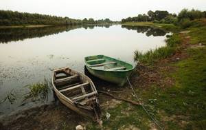
A characteristic feature is the fact that it does not have significant tributaries on the right side. On the left side, Nadva, Voronusa, Unecha and others carry their waters into it. The average width of the channel is 40-80 meters, depth 1-1.5 meters. This is a very slow river that flows through flat terrain with a slight slope.
Fauna of the Bryansk region
The fauna of the Bryansk region is very diverse, since two forest zones connect here: subtaiga and broad-leaved. This creates excellent conditions for the existence of a large number of animal species.
The region is home to brown bears, wolves, raccoon dogs, common foxes, and lynxes. You can also find many representatives of the mustelid family: badgers, river otters, pine martens, stone martens, forest and steppe ferrets, and stoats. The most common artiodactyls are elk, red deer, sika deer, and European roe deer. Also found are bison, wild boars, hedgehogs, moles, shrews, squirrels, beavers, hares, jerboas, hamsters and even various species of bats.
Etymology of river names
The origin of the names of rivers in the Bryansk region still causes some disagreement among linguists. Some see Iranian roots in the formation of river names, others have found Baltic ones. If we take the latter into account, then the origin of the name of the Besed River can be explained as besti - to carry. This suggests that ancient people used the river for transportation. The name of the river Iput is derived from the Baltic py;(-u)ti - to soak.
Floodplain lakes
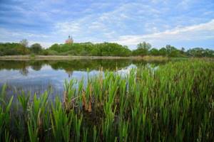
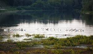
On the territory of the Bryansk region there are 49 large lakes, which by origin can be floodplain, basin and dammed. Floodplain lakes include oxbow lakes that remain on old river beds. They, as a rule, have an oblong shape, elongated in the direction of the old river bed.
There are many such lakes in the floodplains of the Desna River. They surprise with their discreet beauty and attract fishing enthusiasts. Their diet is mixed, consisting of groundwater and sediments. During floods they connect with rivers. After the water recedes, the waters are high, but by mid-summer their level decreases. The largest of them are Kozhany, Bechino, Orekhovoye, Markovo, Boroven, Khvoshchnoye, Khotnya and others.
The legend of how Round Lake appeared
Bryansk is surrounded by many reservoirs and rivers. In total, there are 49 large and small lakes in the region. Many of them are of karst nature. These include Krugloe Lake (Bryansk). At the same time, from ancient times, from mouth to mouth, the inhabitants of the region passed on the legend of the old man, whose name was associated with his origin. According to it, there was once a hut on the site of the lake. There, far from people, lived a wise old man with his grandson. Everyone who despaired of finding a way out of a difficult life situation came to him for advice and spiritual help. The good old man did not refuse consolation to anyone, but one day the pilgrims were amazed to see that the hut had disappeared, and in its place a completely round lake had formed.
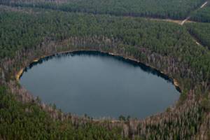
Kotlovinnye lakes
They are formed as a result of karst, relict faults or depressions in the earth's crust, which are filled with water after rains and melting snow. The most beautiful is Lake Svyatoye, which has a water surface area of 16 hectares. It is located near the Rzhanitsa railway station.
Another equally interesting lake is located in the Zhukovsky district and is called Bezdonnoe. It’s called that for a reason; its depth in some places reaches 20 meters. Area – 20 hectares. The water in it is very clean and transparent. It is surrounded on three sides by old mixed forest, most of which are tall pines.
In the Bryansk region there are also many artificial lakes that appeared as a result of dams on rivers. They are big. So Beloberezhskoye has an area of 300 hectares, and Batyshsky pond has an area of 260 hectares. All lakes have a lot of fish and excellent bite, which attracts a large number of fishermen and lovers of beautiful places.
Free fishing in the Bryansk region
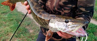
In the Bryansk region there are a large number of different reservoirs where you can have excellent fishing, both in summer and winter. This activity is loved by many local residents; besides, the lakes, rivers and ponds in this region are clean. Fishing in the Bryansk region is distinguished by its diversity, including due to the specific geographical location of the region, which predetermined the presence of many different bodies of water. The region is located in the watershed of two large rivers - the Volga and the Dnieper, which already means great opportunities for your favorite hobby. And these possibilities are fully confirmed by the actual situation, since fishing in these places is a pleasure.
There are 125 rivers in the region, and their total length is over 9,000 kilometers. The network of these rivers is branched and unevenly distributed throughout the region. Most of the rivers pass through the central and eastern parts of the region, and almost all of these reservoirs belong to the Dnieper River basin. Rivers belonging to the Oka basin flow in these same areas.
Here are the TOP 10 best places where you can fish for free in the Bryansk region:
1. Desna River
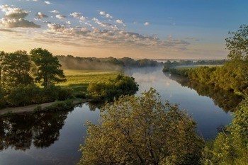
Description, what kind of fish is found, how to get there:
Desna is considered one of the largest in the region. Taking into account the strong current, fishing techniques in this river have their own characteristics. Thus, local fishermen mainly use gear with weights. The topography of the bottom of the Desna is extremely heterogeneous, and deep holes give way to sandbanks. Common fish include pike, ide, pike perch and some others. There is also bream in the river, but the strong current creates some difficulties when catching it. As a rule, fishermen place their boats near the holes or fish directly from the shore. Spinning rods are used to catch pike, chub, and perch. At the same time, the pike is found mainly in places with a weak current, and the chub chooses places on the rifts. Fish enter the Desna River mainly during floods from the Dnieper.
GPS coordinates: 53.39143, 33.92937
2. River Iput
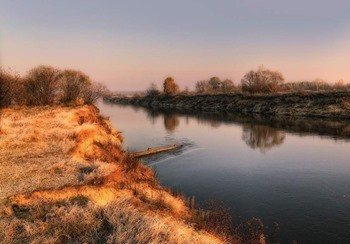
Description, what kind of fish is found, how to get there:
Iput is a medium-length river flowing through the region. The most attractive areas for anglers are the areas in its lower reaches, near the village of Starye Bobovichi. The average depth of the reservoir in the riverbed is 3 meters, and in places of pits it can reach 7 meters.
Successful anglers can catch medium-sized catfish. Local fishing connoisseurs often call Iput the ulcer river, and this fish is caught here in various ways - from a feeder to an ordinary crust of bread in the form of bait and a long rod, with which it is much easier to retrieve. The reel installed, as a rule, is inertia-free, since with its help it is much more convenient to cast equipment. In this case, the equipment needs to be released quite far - over 50 meters.
GPS coordinates: 52.89464, 32.0365
Lake Shumovets
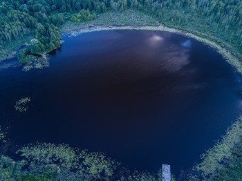
Description, what kind of fish is found, how to get there:
The lake is located 35 km southeast of Bryansk, and only 2 km from the Kyiv highway. Fishing on this lake is one of the most enjoyable activities, thanks to the remarkable intensity of the bite and the high density of fauna. These qualities have made the destination popular among lovers of fishing tourism.
When fishing, you should use the inflatable boat you brought with you; fortunately, getting to the lake by car is not difficult. You should use regular oars, because motor boats make a lot of noise when moving, which negatively affects the intensity of the bite. It is better not to take metal punts when rowed, as they are also quite noisy.
Fishing from the shore is difficult due to the steep, uneven slopes, densely overgrown with bushes and young animals. However, with a lot of desire and remarkable patience, you will find a flat area for fishing.
GPS coordinates: 53.05777, 34.55611
Lake Belogolovl
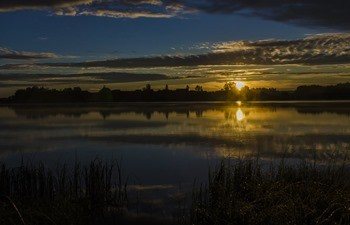
Description, what kind of fish is found, how to get there:
The village of Belogolovl is located 60 km northwest of Bryansk. Nearby is the lake of the same name. The most suitable season for fishing on this lake is from early May to mid-June. Local crucian carp bite especially intensively at this time of year. However, fish are caught here all year round.
The lake is also home to ruffes, tench and carp. There is much less pike in the reservoir, however, it has an impressive size. The best places on Lake Belogolovl are those areas where deep streams flow into it. Locals prefer a medium to long length float rod. The most popular among the Aborigines is catching roach.
Winter fishing on Lake Belogolovl involves catching large perches, which is absolutely unattainable in the summer. Sometimes you come across individuals weighing half a kilo, which is a good result, given the peculiarities of the weight gain of these fish.
GPS coordinates: 53.39083, 33.60869
Lake Bezdonnoe
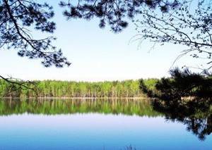
Description, what kind of fish is found, how to get there:
Lake Bezdonnoye is located at the Staroye Lavshino station, 18 km east of Zhukovka. Its depth actually reaches quite good values - about 20 meters in the deepest place. It is an oval in shape with a flat coastline.
The water in the lake is clean and clear, although there is a possibility of waterlogging in the reservoir. An angler is more likely to encounter perch, bream, roach and pike here. Sterlet, barbel and pike perch are much less common.
In most cases, fishing is simply an opportunity to be alone with nature. For those who count on a rich catch, as already mentioned, there are recreation centers and paid clubs. And yet, in this region there are enough reservoirs where you can sit on the shore and catch pike or carp for free.
Whatever you choose - paid fishing at a developed base, or quiet fishing on the shore of a lake, do not forget about respect for nature. It’s easy to find a beautiful and fishy place, but not everyone can leave behind such a clean landscape.
GPS coordinates: 53.53985, 33.96275
Lake Krugloe
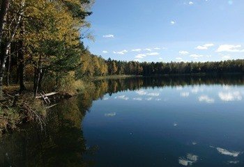
Description, what kind of fish is found, how to get there:
The Round Lake in the Bryansk region is not particularly popular among fishermen; there is not enough fish in it. But it is very beautiful, and there are always vacationers here. Lake Krugloye is of karst origin, has a round shape, its size is 5.3 hectares, if in diameter it is about 300 meters. The depth gradually increases towards the center of the lake, where it reaches a maximum of 16 meters.
GPS coordinates: 53.43695, 34.29083
Lake Zalomenye
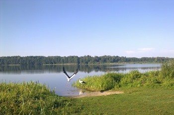
Description, what kind of fish is found, how to get there:
Zalomenye Lake is quite a beautiful body of water in the Klintsovsky district, where you can meet both fishermen and vacationers. Fishing here is interesting, there are a lot of roach, bream, perch and pike.
GPS coordinates: 52.89777, 32.055
Lake Kozhanovskoe
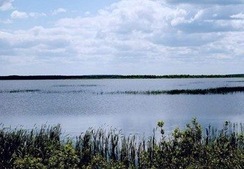
Description, what kind of fish is found, how to get there:
Kozhanovskoye Lake is the largest natural lake in the Bryansk region. Crucian carp, carp, roach, perch and pike live here. Fishing is prohibited here, but fishermen visit this reservoir. It is 3 km long and 2 km wide.
GPS coordinates: 52.78833, 31.69805
Lake Bechino
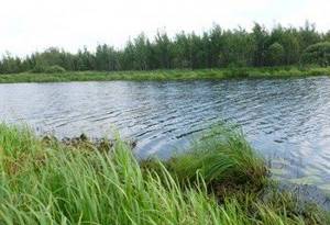
Description, what kind of fish is found, how to get there:
Lake Bechino is famous among all fishing enthusiasts and people who want to enjoy the beautiful nature. Most of the fish caught are medium and small in size, but you may be lucky in the form of a large pike or perch. An excellent place for active recreation and a fairly promising lake for fishing for predatory fish.
GPS coordinates: 53.4275, 33.83027
Lake Svyatoe
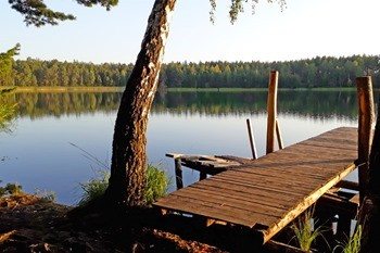
Description, what kind of fish is found, how to get there:
The Holy Lake is a forest reservoir in the Bryansk region, belonging to the unique karst lakes. This is a specially protected natural area, a hydrological monument of regional significance. The lake is very picturesque; its shores abound with a large number of berries and mushrooms.
The lake is home to bream, perch, roach and other fish.
GPS coordinates: 52.48083, 33.33138
Do you know any other good places for fishing in the Bryansk region - write in the comments

