Information
Author: Wiki Catcher
Date: Jul 26, 2017
Category: Ural Federal District
Rating: no rating
Characteristics
Federal District:
Ural Federal District
Region:
Kurgan region, Sverdlovsk region, Tyumen region
Type of reservoir:
rivers
Fish:
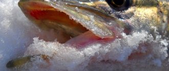
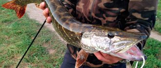
dace, ruff, crucian carp, bream, tench, burbot, perch, roach, pike perch, pike, ide
Types of fishing:
float fishing, bottom fishing, spinning, fly fishing, live bait fishing, winter types of fishing, other types of fishing
Length:
606 km
Width:
20-200 m
Maximum depth:
5 m
Pool:
58900 km²
GIMS:
Ministry of Emergency Situations for the Sverdlovsk Region, Ministry of Emergency Situations for the Tyumen Region, Ministry of Emergency Situations for the Kurgan Region
Status:
free
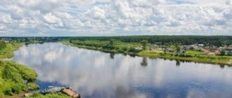
Iset is a river in the Urals and Western Siberia, a left tributary of the Tobol River. It flows through the territory of the Sverdlovsk, Tyumen and Kurgan regions. The name of the river is translated from the Mansi language as “a lot of fish.”
Geographical information
The river originates in the Middle Urals from Lake Isetskoe, 25 km northwest of Yekaterinburg, at an altitude of 252.2 m. The flow from the lake is regulated by a dam. Sometimes the source of the river is considered to be either the Shitovsky Istok (length 14 km) or the river flowing into Shitovsky Lake. Bobrovka (length 4.5 km). The Iset flows into the Tobol on the left near the village of Pamyatnoe. The fall of the river is 160 m. The Iset receives 945 tributaries, of which 83 tributaries are more than 10 km long. The main tributaries are the Sinara, Techa, Miass (right).
The river's water resources are used for drinking and industrial water supply.
The basin is divided into upper (above the city of Kamensk-Uralsky), mountain-foothill and lower, flat parts. The upper part of the basin is an elevated peneplain with flat-topped dome-shaped hills covered with spruce and pine-birch forests, rock outcrops and wide basins with swamps and lakes. The lower part lies within the Turin Plain (the forest-steppe pre-Ural part of the West Siberian Lowland) with an undulating topography.
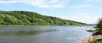
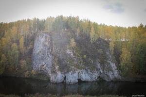
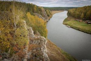
Between the cities of Aramil and Kamensk-Uralsky, the river flows in a narrow (100-500 m) slot-shaped valley with sloping, sometimes steep rocky slopes up to 20-30 m high. The floodplain is fragmentary and absent for a significant extent. The channel is incised, with bends or straight, 20-50 m wide, sand and pebbles. Long stretches with calm currents and depths of 3-4 m alternate with numerous rocky rapids. At the village The overflowing river cuts through outcrops of porphyrites and diabases, forming a mountain stream over a distance of 2 km (the “Revun” threshold) with a slope of 10‰ and a flow speed of 3-4 m/s. Near the city of Kamensk-Uralsky, the river cuts through a layer of limestone; karst grottoes and caves are developed in the valley.
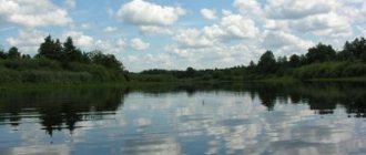
Below Kamensk-Uralsky the valley gradually widens from 1-2 to 8 km, becomes terraced with a wide (up to 2.5 km) ragged forest-meadow floodplain 3-4 m high. The channel is meandering, with sandy sides. Channel width 60-120 m; the depth of the flow on the rifts is 0.4-1 m, on the stretches - up to 5 m. The flow speed decreases to 0.2-0.5 m/s. On significant sections of the channel, floodplain multi-branch systems are developed; secondary channels are long, winding and low-water. There are many oxbow lakes on the floodplain.
The average long-term water flow is 65.4 m³/s (flow volume is 2.064 km³/year). The river is fed predominantly by snow; the share of underground and rainwater supply is relatively small. The intra-annual flow distribution is similar to the Kazakhstan type. The flood is short (1-1.5 months), the maximum flood occurs at the end of April - mid-May. The maximum water flow is 2470 m³/s. The low water period is long and low-water, but relatively high water levels are maintained by numerous dams. Freeze-up lasts from late October to late April.
The river valley is developed and densely populated. Kataysk, Dalmatovo and Shadrinsk, Kurgan region, are located on the river; Isetskoye, Yar and Sloboda-Beshkil, Tyumen region; Gat, Palkino, Yekaterinburg, Aramil, Kamensk-Uralsky, Maminskoye, Dvurechensk, Sverdlovsk region.
According to the State Water Register of Russia, the river belongs to the Irtysh Basin District, the water management section of the river is Iset from the confluence of the Techa River to the mouth, without the Miass River, the river sub-basin of the river is Tobol. The river basin is the Irtysh.
Rafting routes on the Iset River
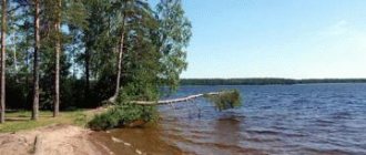
Along the upper reaches of the river: from Isetsky Lake to Verkh-Isetsky Pond
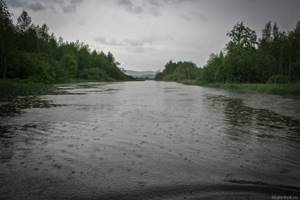
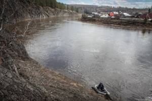
In the upper reaches you can arrange a one-day rafting trip from the dam on Lake Isetskoye . It is convenient to assemble the watercraft and prepare for rafting on the right bank below the dam. This is a favorite place for fishermen. In winter, you can travel along the Iset on ice (but from the dam to Lake Melkoye it does not always freeze).
The river flows through swampy banks and is quite deep. There are a couple of ugly iron pedestrian bridges. Then the river flows through the village of Gat station . Here the river is crossed by railway and road bridges. Archaeologists have found a significant archaeological site here - Kalmatsky Ford .
Below, 7 km from the source, the river flows through Lake Melkoye . It lives up to its name. In some places the boat touches the muddy bottom. Egg capsules and water lilies bloom on the water surface in summer. There are many archaeological sites in this part of the river. On the right bank there is a Spruce Cape with rocks - an ancient sacrificial place. There was a settlement on the left bank of Small Lake.
Downstream on the right bank is the archaeological site Makusha , and just downstream on the left bank is the Palkinsky stone tents (or Stone Island) . This place became popular after the EKAD passed nearby. Its study has been going on for many decades, presenting new surprises.
It is worth noting that in the Neolithic - Bronze Age (V - II millennium BC) the upper reaches of the Iset were a system of high-water lakes (starting from the modern Lake Shitovskoye). Now in place of the lakes there are numerous floodplain swamps. Only Lake Melkoye remains to this day, and even then it will eventually turn into a swamp. The ancient lakes were rich in fish and birds, and in the forests surrounding them there were many animals. This contributed to the emergence of numerous settlements and sites.
Soon the river leads to the village of Palkino , on the site of which multi-layered archaeological monuments were also found. The decoration is an ancient stone railway bridge across the river, built at the beginning of the 20th century. The Reshetka River flows nearby on the right . In the past, one of the projects proposed to connect the basins of the Chusovaya and Iset rivers for the construction of the Transural Waterway. And in Soviet times (and to this day), this river helps supply the city of Yekaterinburg with drinking water - a canal was dug to Reshetka from the Volchikhinsky reservoir.
In Palkino you can finish your rafting or swim further - to the Bolshoy Konny Peninsula or to Vizovsky Beach in Yekaterinburg.
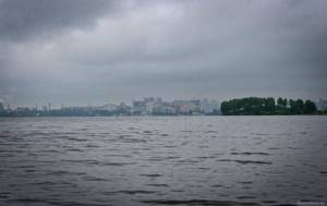
Below Palkino the vast Verkh-Isetsky pond . On the left bank, a small artificial cape stands out for its regular shape - the former Grafskaya pier . Nearby in the forest there are quarries of the ancient marble Obroshinsky mine . Further on the left bank is Cape Gamayun . And on the right, behind the swampy shore, lies Lake Zdochnya , which has actually turned into a sump for a filtration station.
There are several picturesque islands on Verkh-Isetsky Pond. The urban development of Yekaterinburg begins from the Great Horse Peninsula. This area of the city is perhaps the most colorful. And on the shore, the former power station named after Kuibyshev stands out for its unusual architecture. To the right is the Cuba beach club with a swimming pool.
Rafting route Chernousovo – Revun rapids
This route is best rafted in spring in deep water. In summer, water may be scarce. In several places you have to navigate around obstacles. Nevertheless, the route is interesting and picturesque. The disadvantages are dirty water and debris found at the bottom, including that which can damage watercraft. There are rifts with stones lying in the riverbed and rapids.
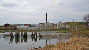
We started one of the rafting trips along the Iset in the village of Chernousovo . Of course, you can start higher, but there is little interesting there. In Chernousovo you can see the buildings of an ancient factory standing on the shore, an old stone church, and a dam drain. On the way to Chernousovo you can look at the Gilevsky waterfall on the Brusyanka River.
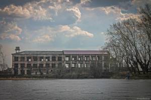
Below the river will lead to the village of Golovyrina, after which the village of Kamyshevo . The river here is dammed and the dam has to be removed. Near the dam there is an abandoned boot and felting factory. In the village itself, on the left bank, you can see the St. George Church, as well as numerous ancient houses. Downstream on the left bank there is a children’s camp “Druzhba”, and even further – “Zvezdochka”.
In the village of Shilova, the beautiful stone pillars of the old bridge are of interest. At the beginning of the village on the left bank there is the former Shilovsky rest house. The Shilovo-Isetsky mine operated near the village, where the first ore gold was discovered (earlier than in Berezovsky).
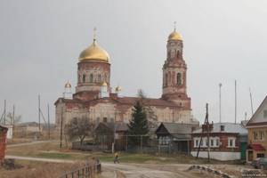
A few kilometers later on the right bank there is the village of Maminskoye . The main architectural dominant, clearly visible from the river, is the Archangel Michael Church, built in 1835. There are a lot of old houses in the village. And near the dam of the pond you can find a small waterfall.
Behind the road bridge on the right bank of the Iset there is a dilapidated mill , which was used as a power station during Soviet times.
Even lower on the left bank are the remains of the abandoned former children's camp “Druzhba”. Most of the buildings have already been dismantled. Below on the same bank is another abandoned camp “Sputnik” (not at all preserved), and further on is the active camp “Isetskie Zori”.
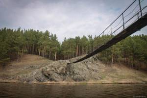
Below on the left bank stretches the village of Isetskoye . On the high bank in the center of the village stands the abandoned St. Nicholas Church of the early 20th century. At the end of the village there is a suspension bridge over the river. From here the rocks begin to appear. There is a small rapid on the river. On the right bank, not far from the bridge, is another former children’s camp “Zarya”. Below, on the left bank, there are operating children's camps "Salyut", "Kolosok" and the recreation center "Vostok" almost one after another.
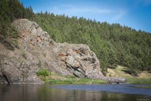
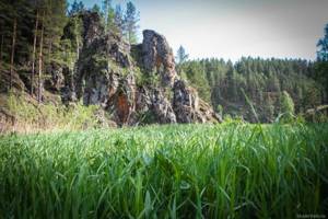
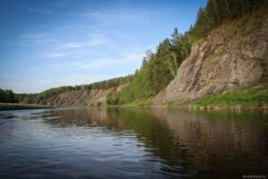
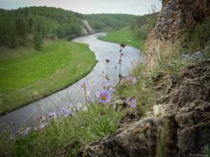
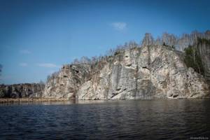
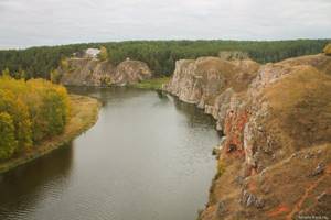
The village of Perebor begins on the right bank . There is a suspension bridge across the river here. On the left bank in this place are the rocks of Shameyskaya Mountain . The place is picturesque! From here the banks of the Iset become noticeably more beautiful; downstream the rocks are almost one after another.
Soon a road bridge appears. To the left of it is the village of Beklenishcheva, and to the right is the village of Gorny, on the shore behind which the ruins of a former cardboard factory are visible.
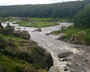
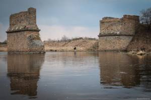
A rift begins, gradually turning into the stormy rapids Revun . It is impossible to pass Revun on unreliable watercraft, without the necessary experience and equipment (life jackets, helmets) - it is very dangerous, especially at the peak of the spring flood. The running of the rapid along the shore is quite long and difficult. It is better to do this along the left bank.
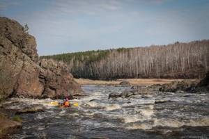
The Revun rapids itself is very beautiful. The river breaks through solid igneous rocks. There are a lot of stone blocks in the riverbed, the water is seething and bubbling. Sheer cliffs rise along both banks. You can also find several millstones.
Rafting route Revun rapids - the city of Kamensk-Uralsky
This is the most popular and most beautiful rafting route on the Iset River. It can easily be completed in one day, and with a leisurely exploration of the Revun rapids, Smolinskaya cave and other attractions, it can be stretched over two days.
Beyond the threshold the river becomes calmer. The channel widens and several islands have formed here. the Smolinsky Log opens to the river . The stream flowing along it, just before it flows into the Iset, forms a small waterfall. If you moor and climb up the ravine, you can get to the popular Smolinskaya cave . Along the way you will encounter rocks with a through arch and small grottoes.
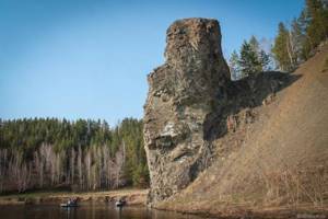
Below, at the turn on the left bank, there is a very beautiful rock of an original shape. It is called the Stone Pillar (or Smolinsky Stone) . During mountain building, a magmatic body arose here in a crack in the earth's crust. The softer rocks surrounding it collapsed and over time a pillar like this was formed.
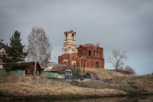
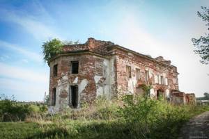
Opposite is the village of Smolinskoye , where it is worth seeing the abandoned Elias Church with preserved old frescoes (it is now being restored).
Around the bend there is a rock stretching along the right bank, and a little further on there is a rock on the left bank. Because of its unusual shape, we nicknamed this rock the Elephant.
Behind the village of Klyuchi there is another very similar place with a rock on the right bank, and then on the left (Minina Gora). Behind it is the beautiful mouth of the Kamyshenka River . On the left bank of the Kamyshenka, near the mouth, rises the picturesque rock Kukushkin Stone (or Kopeshka) . Higher up along Kamyshenka you can see a beaver dam.
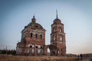
Below, over the Iset, power line wires hang. Here on the left bank is the Gushchinskie stones rock. Behind them, on both banks, stands the village of Shcherbakovo . Its two parts are connected by a pedestrian suspension bridge. In the right bank part you can see the ruins of the dilapidated Nicholas Church built in 1845.
On the left bank rises a beautiful and rather long wall-like rock, the Fortress .
Behind the village on the right bank the rocks Zayachya Gora and Ryabovo .
Downstream there are two groups of rocks on the left bank. Behind them the river is crossed by a road bridge . A memorial plaque is installed on one of its supports, reminiscent of the tragedy that happened here in 2010. A young couple rafting along the Iset became interested in the bungee jumping taking place on the bridge and decided to try it. Due to incorrect adjustment of the fastening they broke...
village of Kodinka appears ahead . Of interest in it is the Kodinsky warm spring . The temperature of radon-enriched water is constant all year round: +18°C.
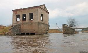
The iset in Kodinka is spring-loaded. There is a dam near the pumping station, and below it there is a rather dangerous threshold. It is better to fence the watercraft. The last time we rafted here, the pumping station was guarded by a feisty, aggressive man who made it very difficult to clear the obstacle. Below the dam on the left bank, some ruins of the Zhiryakovskaya mill . You can also see underground structures (though they don’t represent anything special).
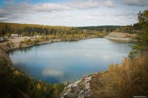
Below on the right bank you will see a picturesque rock. And on the left bank you can see the buildings of an industrial stone quarrying enterprise. Just 40 m from the river, behind the road running along the bank, there is a quarry . In 2012, a man-made accident occurred here. Due to the washing out of the karst cavity during the spring flood, water from the Iset River rushed through the resulting underground cavity into the quarry. The workers had to urgently evacuate the equipment. The quarry quickly went under water and has not been exploited since then.
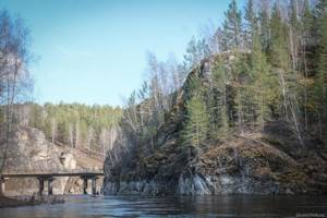
In front of the road bridge that leads to the enterprise, on the right bank there is a rock, which climbers who love to train here have nicknamed Petit Dru . By the way, this place with the fisherman sitting here was photographed by S.M. in 1912. Prokudin-Gorsky.
It is better to moor on the right bank immediately behind the rock and follow the man-made threshold formed under the bridge along the shore. In high water, the current carries directly to the bridge supports, and in the river and on the shore there is a lot of reinforcement and other dangerous rubbish. During one of the rafting trips along the Iset, in this place we tore the boat very badly and almost drowned, after which we had to forget about river expeditions for some time.
Behind the bridge along the left bank there are picturesque rocks. By the way, they offer a beautiful view of the flooded quarry and the Iset River. From this place to Kamensk-Uralsky you can walk along the paths of the left bank on your own - this is a wonderful weekend walking route . It’s best to walk along it during golden autumn – the views are unforgettable!
Judge for yourself. Here is a video from such an autumn walk of ural scientists.
Further on the right bank stands the Mammoth rock (or Elephant's feet). River water washed away the base of the rock, forming bizarre shapes, thanks to which the stone sculpture began to resemble this extinct animal. There is a small grotto above the water's edge.
A little lower on the same bank at the beginning of the clearing there is a ravine. The water flowing through it in the spring disappears into the karst ponor before reaching the river.
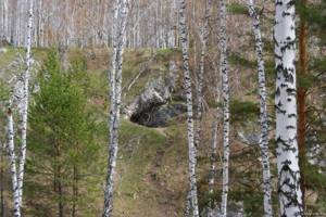
And on the left bank rises a rather long rock, the Seven Brothers . It consists of seven rocky ledges up to 20 m high. A very beautiful view opens up from above. If you look closely at the rocks, you can see numerous fossils. And a cave formed in the lower rock.
Further on the same bank there will be the Rastrus rock, up to 25 m high. An archaeological site has been discovered next to this rock. And on the right bank there is a grotto in the rock. A recreation center was built on the shore opposite Rastrus. In the golden autumn, a larch grove looks beautiful just above the cliff.
Below on the right bank is the village of Brod , and on the left are the rocks of the Weathering Niche . Here it is no longer limestones that come to the surface, but sandstones. The rocks are dotted with numerous weathering niches, which is why they got their name. The Maryin Klyuch spring flows nearby . I do not recommend collecting water in it. It flows from the collapsed entrance to a coal mine adit, the water contains harmful impurities.
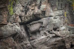
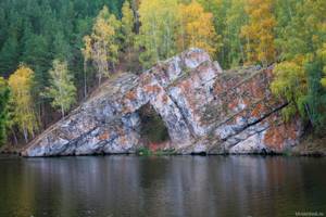
Below Brod there is no longer any current on the river. You can feel the backwater of the reservoir. Along the right bank there is a series of small rocks. Soon, perhaps the most impressive rock of the Iset River appears - Stone Gate . A huge arch formed in the center of the rock. The rectangular hole is about 10 m high. The arch was formed in ancient times due to the gradual destruction of rocks. In addition, there is a small cave, and on the rock itself there are beautiful fossils.
Behind the Stone Gate rises the Owl rock . On the mountain opposite it is the Sosnovy Bor guest complex. Here, too, there is a rock on which rotunda gazebos are visible.
Further on the left bank the Chirov Log . According to one version, the name is associated with the events of the Peasant War - with Pugachev’s comrade-in-arms, Ataman Chira, who captured the Kamensky plant.
Behind the log rises the picturesque Three Caves rock . It got its name from a small cave with several entrances.
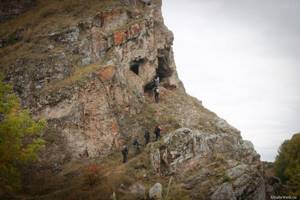
The city of Kamensk-Uralsky begins here. Meanwhile, the rocks stretch one after another. Among them are the Tombstone, Martyusheva Ridge . There are several caves in the rocks, one of which is called the Mysterious Cave. There are also picturesque through holes. In one place over the river there will be a suspension bridge to the village of Martyush.
On the left is the mouth of the Kamenka River . It also has picturesque rocks, but Kamenka deserves a separate article. At the mouth of Kamenka there was a mine in the past. And on the right bank of the Iset stands the rock Lobasty (Tokarevsky) stone . Nearby are the houses of the village of Tokareva.
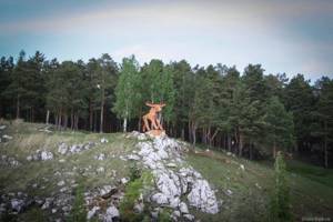
On the left bank there is a former boat station. sculpture “Moose” on the rock nearby . The rafting can be completed near the Baynovsky Bridge.
Below, the river becomes flat. Skal is no longer found. In the Kurgan region on the Iset there are interesting cities from a tourism point of view: Kataysk, Dalmatovo, Shadrinsk. Here the notorious Techa River, polluted by radiation, flows into the Iset. The Iset ends its run in the Tyumen region, merging with the Tobol.
When traveling around the Urals, take care of nature! Thank you for attention!
Pavel Raspopov
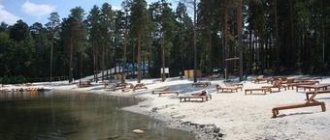
Fishing on Kalinovka
The club has existed since 2005 and operates all year round. This is a complete vacation not only for avid fishermen, but also for the whole family. Here you can walk through the forest, rent a house or gazebo, rent fishing equipment, which is carried out with vouchers.
The cost of the trip starts from 300 rubles; you will need to pay for the catch based on its weight. The following species are caught :
- Carps of various types
- Trout
- Bream
- Whitefish
- crucian carp
- Pike
- Okun and others
The base is located on the territory of the Kalinovsky Forest Park, exit from Voikova Street.
Large lakes and reservoirs transferred to tenants for use
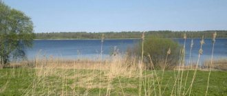
Pike Lake
It is attractive to city residents because it is located right at the exit from the city, and the places here are beautiful. You need to go in the direction of Berezovsky. The lake is located in the forest, the territory is well equipped.
Some people can fish, while others will enjoy walking around the territory, especially since there is a whole small zoo here. Children will love it here. The carp are going well, sometimes so well that catching them becomes uninteresting.
The price of the tour is 300 rubles.
Dvurechenskoye Reservoir
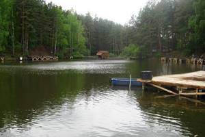
Located 50 kilometers from the city, the reservoir attracts fishermen who value savage recreation.
The territory is arranged without any frills, but everywhere is clean. Good fish include bream, carp, tench, and perch.
The farm has a whole water amusement park:
- Boats
- Catamarans
- "Bagel"
- Boat
- Jet ski
You can come overnight. Nearby is the village of Dvurechensk.
(KRH) “Lake Izhbulat”
A lake of extraordinary beauty! The distance from the city is 50 kilometers towards Polevsky. On the shore they try to restore order and remove everything that vacationers “forget.” There is a forest around the lake.
With fish, not everything is so smooth; they tried to breed both perch and bream in it, but if anything bites, it’s only crucian carp the size of a finger.
Conclusion - you can relax on the lake and go for a few days, but it’s not worth going for fishing. Perhaps something will change.
Lake Bagaryak
It is this lake that some fishermen call pike lake. It is located 60 kilometers from the city towards Chelyabinsk. The places here are clean, but not equipped. There are boats for rent.
The ticket costs 250 rubles.
The bottom of the lake is overgrown, making spinning fishing not entirely convenient, but many manage to catch fairly large pikes and perches. The important thing here is to be patient and lucky.
Lake Bolshoye Kostousovskoye
The lake is now given over to the Dynamo base, which is 60 kilometers from Yekaterinburg. After the village of Losiny, right before the bridge there will be an exit to the right to the base. The downside is that the road is quite bad.
You can spend the night at the base itself. Everything is equipped to a C grade. But is this the main thing for a fisherman? The lake is really big and deep. To catch perch and pike, you need to look for places, and for this you will need a boat. Boat rental is provided.
The trip will cost 350 rubles.
Big Sungul
If you get further away from the city, for example, to Bolshaya Sungul, then you will have to drive about 100 kilometers along the highway. Nearby is the village of Rybnikovskoye, near Kamensk-Uralsky.
The lake is large, rich in perch and carp. Currently intended for growing commercial fish. The situation with vouchers is still unclear.
There is no fenced area for fishing as such, and sometimes they ask you to pay without presenting any documents. Sometimes they spend their time calmly; there are always a lot of fishermen.
Lake Tygish
A little further from the Big Sungul is the no less famous Lake Tygish. It was recently handed over to a tenant for the purpose of maintaining the territory and organizing fishing trips for amateurs. This lake has long been famous for its large predators, especially pike.
Let's start with the price:
- Voucher – 300 rubles
- Boat – 100 rubles/hour
- Entry to the territory by car – 300 rubles.
It’s really difficult to fish on Tygish without a boat: the shore is shallow. The lake itself is large, there are no picturesque beauties nearby, the base is equipped as standard.
There are fishermen's houses, quickly built frame buildings in case one of the fishermen wants to spend the night. For those who do not like a boat, fishing from the shore will also be fun, but the catch will most likely be small.