In 2020-2021, the Federal Law on Recreational Fishing came into force, but its provisions also do not contain specific prohibitions and rules for fishing. This law contains general provisions regarding recreational fishing.
Specific fishing rules are approved for each fishing basin.
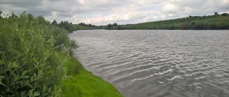
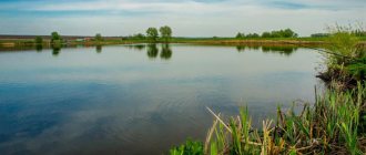
On the territory of the Belgorod region, the Fishing Rules for the Volga-Caspian fishery basin are in force, approved by Order of the Ministry of Agriculture of Russia dated November 18, 2014 N 453 (as amended in force in 2021). These rules apply throughout the region. The administrative center is Belgorod. Large cities and towns in the region: Stary Oskol, Gubkin, Shebekino, Alekseevka, Valuyki, Stroitel, Novy Oskol, Razumnoye, Chernyanka, Borisovka, Volokonovka, Rovenki, Rakitnoye, Severny, Prokhorovka, Proletarsky, Maysky, Dubovoe, Krasnaya Yaruga, Tomarovka, Ivnya, Biryuch, Oktyabrsky, Streletskoye, Urazovo, Veydelevka, Grayvoron, Troitsky.
The Volga-Caspian fishery basin is divided into the Northern and Southern fishery areas, delimited by a conventional line running along the dam of the Volzhskaya Hydroelectric Power Station (the city of Volgograd).
The northern fishery region of the Volga-Caspian fishery basin includes the Volga River from the upper reaches to the dam of the Volzhskaya Hydroelectric Power Station (the city of Volgograd) with the basins of the rivers flowing into it, as well as all water bodies of fishery importance located in the territories of the Republics of Bashkortostan, the Republics of Mari El, Mordovia, Tatarstan, Udmurt Republic, Chuvash Republic - Chuvashia, Perm Territory, Belgorod, Bryansk, Vladimir, Volgograd (above the Volzhskaya Hydroelectric Power Station dam), Vologda (Rybinsk Reservoir and other water bodies of fishery importance in the Cherepovets region), Ivanovo, Kaluga, Kirov (beyond with the exception of water bodies of fishery importance in the Northern Dvina River basin), Kostroma, Kursk, Moscow, Nizhny Novgorod, Orenburg, Oryol, Penza, Ryazan, Samara, Saratov (with the exception of water bodies of fishery importance in the Don River basin), Smolensk, Tambov, Tver, Tula ( Oka River basin), Ulyanovsk, Yaroslavl regions and the city of Moscow.
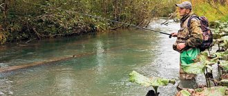
Citizens have the right to carry out recreational and sport fishing in water bodies of public fishery importance freely and free of charge in accordance with the rules of fishing.
Forbidden tools and methods of fishing in the Belgorod region
On the territory of the Belgorod region it is prohibited:
- a) application: networks of all types;
- traps of all types and designs (merezh, venter, versh, “muzzle”, “pins”), with the exception of crayfish traps;
- passive production (catch) tools (“zakidushki”, “postavushki”, “pokes” and others) on rivers that are habitats for salmon species of fish;
- firearms and pneumatic weapons, crossbows and bows;
- fishing rods (including bottom fishing rods) and spinning gear of all systems and types with a total number of hooks (single, double or triple) of more than 10 pieces per citizen;
- trawling and dredging mining (catch) gear;
- net straining and seizing fishing gear (catch) and devices (drags, seines, drags, bastings, lifts, circles, “TVs”, “screens”, “grabs”, “drills”, “shards”, “capes”, “kerchiefs” ", "sakov", "kotsov", "krylatok", "German", "vozmilok", "rezhakov", "okhan" and others), with the exception of lifts ("spiders") and scoops - no more than one piece per citizen , size (length, width, height) of no more than 100 cm, and mesh size (pitch) of no more than 10 mm (including those used with bait) for the production (catch) of live bait (bait), except for especially valuable and valuable species of fish;
- piercing fishing (fishing) tools (spears and others), with the exception of amateur and sport fishing carried out using special pistols and guns for underwater hunting;
- catfish;
- traps;
- hook fishing gear;
- by the method of purpleing, jamming, rutting (including with the help of rattling and bogging);
Important. In amateur and sport fishing, the use of nets for fishing (catching) from fishing line (monofilament) is prohibited.
During amateur and sport fishing, the installation (construction) of huts and other stationary structures on ice is prohibited, with the exception of portable windproof devices.
Prohibited periods and places for fishing in the Belgorod region
Areas (places) prohibited for the extraction (catch) of aquatic biological resources have not been established in the Belgorod region.
Prohibited fishing periods
Fishing rules in the Belgorod region prohibit the following fish:
- from April 1 to June 10 - with all fishing gear (except for one float or bottom fishing rod from the shore with a total number of hooks of no more than 2 pieces on fishing gear for one citizen outside spawning grounds);
- from October 1 to April 30 - in wintering pits;
- at night - from watercraft.
Spawning sites in the Belgorod region
The following spawning sites are located in the Belgorod region.
| Name of spawning place | Location |
| — | Belenkaya River: everywhere from source to mouth; |
| — | Seversky Donets River: from the bridge in the village of Rzhavets to the village of Gnezdilovka (12 km); |
| — | Seversky Donets River: from the old wooden bridge (Belgorod beach) along the right bank to the thermal power plant; |
| — | Seversky Donets River: from the old wooden bridge (Belgorod beach) to the mouth of the Vezelka River (2.5 hectares); |
| — | Seversky Donets River: from the Volchansky railway bridge to the bypass road bridge in the area of the Plodoovoshchnaya state farm (8.5 km) and upstream from the bridge 1 km (2.5 hectares), backwater (1.2 hectares); |
| — | Seversky Donets River: from the administrative border of the village of Pushkarnoye 500 m downstream; |
| — | Seversky Donets River: the lower pool of the Belgorod reservoir from the dam to the end of the bay on the right side of the river (1 km); |
| — | Seversky Donets River: from the confluence with the Nezhegol River to the sugar factory dam (5 km); |
| — | Seversky Donets River: from the border with Ukraine to the old riverbed in the White Mountain area, backwater (1.5 hectares); |
| — | Seversky Donets River: from the village of Krivtsovo to the village of Gnezdilovka; |
| — | Seversky Donets River: from Staroselsky wooden bridge to the end of the village of Staroselye (2 km); |
| — | Toplinka River: from source to mouth; |
| — | Valuy River: mouth (1.5 ha); |
| — | Valuy River: from the village of Rozhdestvenskoye to the highway bridge near the bypass road (1.5 hectares); |
| — | Vezelka River: from the Kosharsky bridge across the river (the city of Belgorod) to the Selburvod motor depot; |
| — | Razumnaya River: from the mouth to discharge from city wastewater treatment plants; |
| — | Donetsk Seymitsa river: from the bridge of the Seymitsa village to the border with the Kursk region (5 km); |
| — | Donetskaya Seimitsa river: from the village of Kondrovka to the village of Vasilyevka (12 km); |
| — | Nezhegol River: from the Rzhevka state farm to the railway bridge of the small-scale plant (6 km); |
| — | Nezhegol River: from the village of Mikhailovka to the village of Voznesenovka (3 km); |
| — | Nezhegol River: from the Zayachiy Bridge downstream to the village of Titovka; |
| — | Nezhegol River: backwater near the village of Titovka (0.8 ha); |
| — | Nezhegol River: from the mechanical plant to the old wooden bridge and 200 m downstream with an area of 0.4 hectares; |
| — | Koren River: from the village of Zamosye to the village of Mazikino (0.25 ha); |
| — | Koren River: from the pond near the village of Krugliy Brodok upstream to the village of Kolomytsevo (0.2 ha); |
| — | Koren River: from the fish farm near the village of Ionovka upstream to the village of Peschanoye (0.25 ha); |
| — | Koren River: from the village of Novotroevka downstream on the left side to the village of Baitsurovo (0.3 ha); |
| Korocha River: from the upper reaches of the Korochansky reservoir upstream of the river (1 km); | |
| Korocha River: area of the village of Repnoye (3 ha); | |
| — | Korocha River: from the Korochansky reservoir downstream of the river to the village of Tyurino; |
| — | Oskol River: from the village of Urazovo to the border with Ukraine (10 km); |
| — | Oskol River: from the mouth of the Orlik River downstream to the village of Ezdochnoe (15 km); |
| — | Oskol River: from the village of Okuni to the village of Raevka (1 km); |
| — | Oskol River: from the village of Golubino downstream of the river (3 km); |
| — | Oskol River: from the bridge of the state-owned poultry plant in the city of Novy Oskol to the bridge in the village of Ninovka (3.5 km); |
| — | Oskol River: the old bed of the Oskol River in the beach area of the city of Stary Oskol; |
| — | Oskol River: from the village of Staraya Simonovka to the new large bridge in the village of Druzhba; |
| — | Oskol River: from the Ivanovka village bridge downstream to the OEMK recreation area (2 km); |
| — | Oskol River: Zamornoe Bay (locomotive depot area) (3 ha); |
| — | Oskol River: Raevka village, area of the hydroelectric dam (0.5 km above and below the dam); |
| — | Oskol River: river floodplain in the Chernolesye area (2.5 hectares); |
| — | Oskol River: area of the village of Goreloye (Makaryevka) (3 ha); |
| — | Oskol River: sand quarry near the village of Morkovino (1 ha); |
| — | Urazovo River: from the railway bridge to the Solochansky road bridge (3.5 km); |
| — | Uraeva River: from the village of Veidelevka to the beginning of the Mayorovskoye reservoir; |
| — | Uraeva River: river mouth, area of the village of Dubrovka (1.5 hectares); |
| — | Uraeva River: area of the village of Romashovka, village of Kolykhalino (2.5 hectares); |
| — | Orlik river: from the village of Orlik downstream of the river to the mouth (1.5 ha); |
| — | Kholok River: from source to mouth everywhere (15 km); |
| — | Kurasovka river: from the village of Kalinovka to the village of Kurasovka (5 km); |
| — | Kurasovka River: from the upper reaches of the pond near the village of Kalinovka upstream 0.5 km, everywhere in the floodplain (0.25 ha); |
| — | Kozinka river: from the mouth to the village of Znamenka (2 ha); |
| — | Kozinka River: upper reaches of the reservoir near the village of Kazinka (5 ha); |
| — | Kozinka River: upper reaches of the reservoir near the village of Borki (5 ha); |
| — | Olshanka River: from the border of the Olshanka village to the mouth (10 km); |
| — | Tikhaya Sosna River: Krasnogvardeisky village, upstream from the lock (3 km); |
| — | Tikhaya Sosna River: the village of Blidneye Chesnochnoye, the town of “Liman”; |
| — | Tikhaya Sosna River: Alekseevka town, upstream from the dam (2 km); |
| — | Tikhy Userdets River: from source to mouth everywhere; |
| — | Gryaznaya River: from the confluence with the Psel River to the pond dam near the village of Kostroma on both sides of the river (0.05 ha); |
| — | Gryaznaya River: from the upper reaches of the pond near the village of Gryaznoe upstream 2 km, with an area of 0.15 hectares; |
| — | Vorskla River: oxbow lake and floodplain lakes of the city of Grayvoron (1 ha); |
| — | Vorskla River: floodplain in the area of the village of Dalnyaya Ivanovka (1 ha); |
| — | Vorskla River: floodplain in the area of the village of Dobroye (1 ha); |
| — | Vorskla River: from the village of Povalyaevka to the border of the village of Golovchino (1 ha); |
| — | Vorskla River: from the village of Borisovka to the village of Dubino (3 km); |
| — | Vorskla river: from the village of Lugovka to the village of Antonovka (4 km); |
| — | Vorskla River: from the confluence with the Grayvoronka River upstream (3 km); |
| — | Vorskla River: Borisovka village in the area of Chekhov Street (1 hectares); |
| — | Starosokolskoye Reservoir: from the mouth of the Gerasimovo River, Zhukovo village, to the Gazstroy recreation center (5 hectares); |
| — | Morkovinskoye Reservoir: area of the Belaya Gora town, backwater (0.5 ha); |
| — | Morkovinskoye Reservoir: a drained pit near a hydroelectric power station (1 ha); |
| — | Morkovinskoye Reservoir: mill backwater near the hydroelectric power station (1 ha); |
| — | Morkovinskoye Reservoir: oxbow lake near the former Red Mill (1.5 ha); |
| — | Soldatskoye Reservoir: from the water intake of the Vorsklitsa River, left side (5 ha); |
| — | Soldatskoye Reservoir: the right side of the Vorsklitsa River to the backwater and the backwater itself (5 hectares); |
| — | Melikhovo Pond: right flat side from the upper reaches to the spillway dam, the upper reaches itself (10 hectares); |
| — | Mayorovskoye Reservoir: area of the village of Uraevo, flat side from the upper reaches to the dam (50 ha); |
| — | Belgorod Reservoir: area of the mouth of the channel connecting the reservoir with the Far Sandy Pit in the area of the village of Olshanets, bay (1 km); |
| — | Belgorod Reservoir: Karnaukhovsky Bay from the high-voltage line to the administrative border of the village of Maslova Pristan (5 km); |
| — | Belgorod Reservoir: bay near the village of Rzhavets (3 km); |
| — | Belgorod Reservoir: bay opposite the mouth of the Razumnaya River (60 x 100 m); |
| — | Belgorod Reservoir: from the village of Solomino to the village of Toplinka (3 km); |
| — | Belgorod Reservoir: from Pulyaevsky Bay to the high-voltage line (1 km); |
| — | Belgorod Reservoir: from the village of Pristen to the village of Ivanovka (3 km); |
| — | Korochanskoye Reservoir: everywhere; |
| — | Stary Oskol Reservoir: from the recreation center “Beryozka” to the recreation center “Slavyanka” (12 hectares); |
| — | pond on the Gryaznaya River: area of the village of Gryaznoe from the headwaters of the pond downstream 100 m on both sides of the pond (0.4 ha); |
| — | pond on the Solotinka River: from the dam of the pond near the village of Sokholotino to the source of the pond near the village of Kochetovka on both sides (0.8 ha); |
| — | all other riverbed ponds in the region; |
List of wintering pits in the Belgorod region
The following wintering pits are located in the Belgorod region.
| Name of wintering pit | Location |
| Aidarskaya | Aidar River (Rovensky district): upstream 300 m from the Ozerny farm (dimensions: 300 x 20 x 2.5 m); |
| Belgorodskaya | Seversky Donets river (Belgorod district): Belgorod reservoir: 500 m from the village of Dalnie Peski to the left bank (Zmeinaya Polyana) (dimensions: 800 x 80 x 3.5 m); |
| Dobroivanovskaya | Seversky Donets river (Belgorod district): Belgorod reservoir: 500 meters from the center of the dam towards the village of Dobraya Ivanovka (dimensions: 2500 x 100 x 4.5 m); |
| Buyanovskaya | Seversky Donets river (Belgorod district): Belgorod reservoir: Buyan backwater, Obkomovskie Dachas district 600 m from the dam along the right bank (dimensions: 400 x 250 x 10 m); |
| Pulyaevskaya | Toplinka river (Belgorod district): river mouth, 400 m from the school in the village of Toplinka (dimensions: 2000 x 100 x 4 m); |
| Valuyskaya | Valuy River (Valuysky District): 500 m from the village of Rozhdestveno downstream (dimensions: 70 x 25 x 8 m); |
| Wezelskaya | Vezelka River (city of Belgorod): downstream 300 m from the sports complex named after Svetlana Khorkina Bel-GU (300 x 100 x 8 m); |
| Gaivoronskaya | Vorskla River (Gaivoronsky District): mouth of the Grayvoronka River, 400 m downstream from the village of Zamostye (dimensions: 120 x 50 x 4 m); |
| Village | Vorskla river (Grayvoronsky district): downstream 300 m from the village of Antonovka (dimensions: 50 x 30 x 11 m); |
| Dubinskaya | Vorskla river (Borisov district): 800 meters downstream from cordon N 3 of the forestry enterprise “Forest on Vorskla” (dimensions: 60 x 60 x 8 m); |
| Ignatyevskaya | Vorskla river (Borisov district): 300 m downstream from the Nikolsky farm (dimensions: 50 x 30 x 4 m); |
| Sheykinskaya | Vorskla river (Borisov district): 1.5 km downstream from the village of Novoborisovka (dimensions: 100 x 20 x 4 m); |
| Krapivinskaya | Koren river (Shebekinsky district): 800 m from the village of Krapivnoye, near the chalk mountain (dimensions: 100 x 10 x 3 m); |
| Korochanskaya | Korocha river (Korochansky district): Korochansky reservoir: at the center of the dam (dimensions: 100 x 80 x 9 m); |
| Morkvinskaya | Oskol river (Chernyansky district): Morkvinskoe reservoir: 30 m from the dam (dimensions: 120 x 80 x 4 m); |
| Shebekinskaya | Nezhegol River (Shebekino city): center of the city beach (dimensions: 100 x 30 x 3 m); |
| Lugovskaya | Nezhegol River (Shebekinsky district): 500 m downstream from the village of Lugovoe (dimensions: 80 x 30 x 3.5 m); |
| Green Glade | Seversky Donets River: 1.5 km upstream from the Belgorod railway station, in the “Green Polyana” area (dimensions: 200 x 80 x 3 m); |
| Rescue | Seversky Donets River (Belgorod city): the center of the city beach near the city railway station (dimensions: 200 x 80 x 3.5 m); |
| Shtanovskaya | Seversky Donets river (Shebekinsky district): area of the mouth of the Nezhegol river, 800 m from the village of Titovka (dimensions: 100 x 10 x 4); |
| Chernovskaya | Seversky Donets river (Prokhorovsky district): 800 m downstream from the village of Chernovka (dimensions: 150 x 10 x 3 m); |
| Rzhavetskaya | Seversky Donets river (Prokhorovsky district): 300 m downstream from the village of Rzhavets (dimensions: 100 x 35 x 7 m); |
| Kozlovskaya | Oskol river (Valuisky district): 500 m downstream from the village of Kozly (dimensions: 100 x 35 x 7 m); |
| Agoshevskaya | Oskol River (Valuysky District): 1 km downstream from the village of Agoshevka (dimensions: 80 x 35 x 5 m); |
| Scorched | Oskol river (Valuisky district): 1.5 km downstream from the village of Logachevka (dimensions: 80 x 35 x 6 m); |
| Bad | Oskol river (Valuysky district): 1.3 km downstream from the village of Nizhnyaya Melnitsa" (dimensions: 80 x 35 x 6 m) |
| Cold | Oskol river (Valuisky district): 500 m downstream from the village of Novoivanovka (dimensions: 70 x 30 x 6 m); |
| Black Forest | Oskol River (Novooskolsky district): 1.5 km downstream from the village of Miroshniki (dimensions: 100 x 30 x 9 m); |
| Novooskolskaya | Oskol River (city of Novy Oskol): 800 m downstream from the road bridge (dimensions: 70 x 30 x 6 m); |
| Yamskaya | Oskol River (Starooskolsky district): 5 km downstream from the Yamskaya farmstead (dimensions: 80 x 40 x 5 m); |
| Mill | Oskol River (city of Stary Oskol): 800 m downstream from the old mill (dimensions: 150 x 40 x 3.5 m); |
| Sgolbishchenskaya | Oskol river (Chernyansky district): mouth of the Olshanka river, 1 km from the village of Stolbishche (dimensions: 80 x 40 x 3 m); |
| Monashenskaya | Oskol River (Volokonovsky district): 2 km downstream from the village of Pyatnitskoye (dimensions: 80 x 30 x 5 m); |
| Shelaevskaya | Oskol River (Valuisky District): 1.5 km downstream from the village of Shelayevo (dimensions: 100 x 40 x 5 m); |
| Cool | Oskol River (Valuysky District): mouth of the Valuy River (dimensions: 80 x 35 x 4 m); |
| Bogatovskaya | Pena river (Ivnyansky district): 300 m downstream from the village of Bogatoye (dimensions: 70 x 30 x 3 m); |
| Dragunskaya | Pena river (Ivnyansky district): 800 m downstream from the village of Dragunka (dimensions: 50 x 20 x 4 m); |
| Soldatskaya | Vorsklitsa river (Rakityansky district): Soldatskoe reservoir: dam area (dimensions: 100 x 100 x 5 m); |
| Starooskolskaya | Oskol River (Starooskolsky district): 200 m from the outlet of the Starooskolsky reservoir dam (dimensions: 100 x 80 x 11 m); |
| Lebedinskaya | Oskol River (Starooskolsky district): Stary Oskol reservoir: 300 m from the tourist center of JSC Lebedinsky GOK (dimensions: 120 x 80 x 8 m); |
| Aspen | Tikhaya Sosna river (Alekseevsky district): 1.5 km downstream from the village of Ilyinka (dimensions: 150 x 30 x 8 m); |
| Beloglinovskaya | Tikhaya Sosna river (Alekseevsky district): 2 km downstream from the village of Beloglinka (dimensions: 100 x 25 x 6 m); |
| Kalyuzhnaya | Tikhaya Sosna River (Alekseevsky district): 1.5 km downstream from the city of Alekseevka (dimensions: 100 x 25 x 3 m); |
| Water pump | Tikhaya Sosna river (Alekseevsky district): 1 km upstream from the city of Alekseevka, in the area of the water pump (dimensions: 100 x 30 x 6 m); |
| Trade Union | Tikhaya Sosna river (Alekseevsky district): Alekseevka city, opposite SPTU-24 (dimensions: 100 x 30 x 6 m); |
| Sugulovo | Tikhaya Sosna river (Alekseevsky district): 2 km downstream from the village of Koltunovo (dimensions: 120 x 30 x 5 m); |
| Flashing | Tikhaya Sosna river (Alekseevsky district): 1.5 km downstream from the village of Blizhne Chesnoshnoye (dimensions: 170 x 30 x 6 m); |
| Ostrovnaya | Urazovo River (Valuysky District): 3 km downstream from the village of Urazovo (dimensions: 80 x 35 x 3.5 m); |
| Gremuchenskaya | Donetskaya Seimitsa River (Prokhorovsky district): 1.5 km downstream from the village of Gremuchiy (dimensions: 100 x 8 x 4 m); |
| Vasilyevskaya | Donetskaya Seimitsa river (Prokhorovsky district): 800 m downstream from the village of Vasilyevka (dimensions: 40 x 5 x 2.5 m); |
| Borovskaya | Koren river (Korochansky district): 200 m downstream from the village of Borovskoye (dimensions: 80 x 30 x 2.5 m); |
| Brodki | Koren River (Korochansky district): in the area of the pond dam near the village of Krugliy Brodok (dimensions: 100 x 100 x 4 m); |
| Korotkovskaya | Korochka River (Korochansky district): 500 m downstream from the village of Korotkoye (dimensions: 100 x 10 x 3 m); |
| Stepnaya | Ivnya River (Ivnyansky District): 500 m downstream from the village of Steppe (dimensions: 60 x 5 x 3.5 m); |
Intermediate points for navigation between Belgorod and the village of Nizhnie Peny
All details of the road route from Belgorod (Belgorod urban district, Belgorod region, Russia) on the road to the village of Nizhnie Peny (Rakityansky district, Belgorod region, Russia), indicating all intermediate points, settlements, distances and travel times between them.
Plan your route point by point in advance using our free online navigator.
| Intermediate point of the route Belgorod - the village of Nizhnie Peny | Time and distance to next point | Time from the start of the route | Distance from the start of the route |
| The starting point of your journey is Belgorod, Belgorod urban district, Belgorod region, Russia | Start! | ||
| Belgorod urban district Belgorod, Belgorod region, Russia | Less than 1 minute (0 km.) | Less than 1 minute | 0 km |
| Dubovoe village, Belgorod district, Belgorod region, Russia | 2 minutes (0.5 km.) | 2 minutes | 0.5 km |
| Belgorod urban district Belgorod, Belgorod region, Russia | 8 minutes (4.2 km.) | 11 minutes | 4.7 km |
| Dubovoe village, Belgorod district, Belgorod region, Russia | Less than 1 minute (0.2 km.) | 11 minutes | 4.8 km |
| Belgorod urban district Belgorod, Belgorod region, Russia | 3 minutes (2.5 km.) | 15 minutes | 7.3 km |
| Dubovoe village, Belgorod district, Belgorod region, Russia | Less than 1 minute (0.1 km.) | 15 minutes | 7.4 km |
| Belgorod urban district Belgorod, Belgorod region, Russia | 6 minutes (4.7 km.) | 22 minutes | 12 km |
| Domnino village Yakovlevsky district, Belgorod region, Russia | 27 minutes (20.8 km.) | 49 minutes | 32.9 km |
| Moshchenoe village, Yakovlevsky district, Belgorod region, Russia | 1 minutes (0.4 km.) | 50 minutes | 33.2 km |
| Yamnoye village, Yakovlevsky district, Belgorod region, Russia | 17 minutes (10.2 km.) | 1 hours, 8 minutes | 43.4 km |
| Zavidovka village, Yakovlevsky district, Belgorod region, Russia | 19 minutes (15.6 km.) | 1 hours, 27 minutes | 59 km |
| Bolshaya Khrushchevka village Rakityansky district, Belgorod region, Russia | 18 minutes (6.8 km.) | 1 hours, 45 minutes | 65.8 km |
| Melovoe village, Rakityansky district, Belgorod region, Russia | 1 minutes (1.1 km.) | 1 hours, 46 minutes | 67 km |
| Razdol village Rakityansky district, Belgorod region, Russia | 3 minutes (2.6 km.) | 1 hours, 50 minutes | 69.6 km |
| Vengerovka village, Rakityansky district, Belgorod region, Russia | 2 minutes (2.3 km.) | 1 hours, 53 minutes | 71.9 km |
| Vyshnie Peny village, Rakityansky district, Belgorod region, Russia | 13 minutes (4.5 km.) | 2 hours, 7 minutes | 76.4 km |
| Nizhnie Peny village, Rakityansky district, Belgorod region, Russia | 24 minutes (7.3 km.) | 2 hours, 31 minutes | 83.8 km |
| The end point of your journey is the village of Nizhnie Peny, Rakityansky district, Belgorod region, Russia | We've arrived! |
And here’s what you need to know: The setup for catching grayling on the Yenisei, diagrams of the most catchy gear for magnificent grayling
Species of fish prohibited from catching in the Belgorod region
Species of fish prohibited from catching:
- sturgeon fish species, salmon and whitefish species, carp.
Minimum size of fish caught in the Belgorod region
When carrying out fishing, it is prohibited to produce (catch), accept, process, transship, transport, store and unload aquatic biological resources that have a fresh length (in cm) less than that indicated in the table.
Minimum allowed size of fish caught
| Name of aquatic biological resources | Fishing size, cm |
| Asp | 30 |
| Zander | 30 |
| Bream | 20 |
| Pike | 32 |
| Freshwater catfish | 60 |
| Carp | 40 |
| Chub | 20 |
| Cancers | 10 |
The commercial size of aquatic biological resources is determined in fresh form:
- in fish - by measuring the length from the top of the snout (with the mouth closed) to the base of the middle rays of the caudal fin;
- in crustaceans, by measuring the body from a line connecting the middle of the eyes to the end of the tail plates.
Important. Extracted (caught) aquatic biological resources having a length less than that indicated in the table above are subject to immediate release into the natural habitat with the least damage.
Fish biting forecast on the Belgorod Reservoir
| Weather forecast and fish bite | Calendar, from 02/16/2021 to 02/19/2021 | |||||||||||
| VT | SR | Thu | PT | |||||||||
| Times of Day | Evening | Night | Morning | Day | Evening | Night | Morning | Day | Evening | Night | Morning | Day |
| Cloudiness, precipitation | Partly cloudy | Partly cloudy | Clear | Partly cloudy | Partly cloudy | Mainly cloudy | Mainly cloudy | Mainly cloudy | light snow | Partly cloudy | Partly cloudy | Clear |
| Temperature °C | -12 | -15 | -16 | -16 | -9 | -11 | -11 | -11 | -8 | -12 | -17 | -18 |
| Pressure, mm. | 769 | 771 | 769 | 767 | 765 | 764 | 763 | 762 | 763 | 767 | 770 | 772 |
| Direction, | North wind | North wind | West wind | Wind southwest | Wind southwest | Wind southwest | Wind southwest | Wind southwest | North wind | Wind northeast | North wind | North wind |
| wind speed | 2 m/s | 2 m/s | 1 m/s | 2 m/s | 3 m/s | 3 m/s | 2 m/s | 1 m/s | 2 m/s | 4 m/s | 5 m/s | 3 m/s |
| According to the forecast, they will bite on: bloodworms crucian carp | 35% | 0% | 60% | 60% | 50% | 0% | 55% | 55% | 30% | 0% | 45% | 45% |
| According to the forecast, they will bite on: bloodworms Carp | 10% | 0% | 25% | 25% | 25% | 0% | 20% | 20% | 5% | 0% | 10% | 10% |
| According to the forecast, the fish will bite on: live bait (jigs), winter spinners, balancers Pike | 35% | 0% | 60% | 60% | 50% | 25% | 75% | 75% | 50% | 0% | 45% | 45% |
| According to the forecast, they will bite on: bloodworms, winter spoons, balance beams Perch | 45% | 0% | 70% | 70% | 60% | 0% | 65% | 65% | 40% | 0% | 55% | 55% |
| According to the forecast, the fish will bite on: live bait, winter spinners, balancer Zander | 45% | 45% | 70% | 50% | 60% | 55% | 65% | 45% | 40% | 45% | 55% | 35% |
| According to the forecast, they will bite on: bloodworms, maggots, bark beetles, burdocks Ruff | 35% | 30% | 60% | 55% | 50% | 35% | 50% | 45% | 25% | 30% | 45% | 40% |
| Bait: maggot, bloodworm Bream | 30% | 45% | 60% | 50% | 50% | 55% | 50% | 40% | 20% | 45% | 40% | 30% |
| Bait: maggot, bloodworm Roach | 35% | 0% | 70% | 60% | 50% | 0% | 75% | 65% | 40% | 0% | 55% | 45% |
| Bait: maggot, bloodworm Bleak | 40% | 0% | 60% | 60% | 50% | 0% | 50% | 50% | 30% | 0% | 50% | 50% |