Svir River - photos
The Svir River in the guidebook “Leningrad - Astrakhan - Rostov-on-Don” (1968)
Map of the Svir River from the guidebook “River Cruises (2002)”
Map of the Svir River from the guidebook “Leningrad - Astrakhan - Rostov-on-Don (1968)”
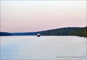
The Svir is a river in the north-west of the Leningrad region, connecting two great lakes - Onega, from which it flows, and Ladoga, into which the river flows. Previously, Svir was one of the links of the Mariinsky system built in 1810, and currently it is an important part of the Volga-Baltic route. The river is the route of cruises of many tourist ships heading to St. Petersburg and Kizhi.
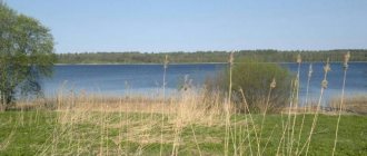
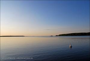
The river and its surroundings are famous for their beauty and rich natural world. The water in Svir is so clean and transparent that the sky and forest in the rays of the sun are reflected in it, like in a mirror, and the clouds seem to be swimming in the river.
Poets glorify the river, calling it fabulous and shining, beautiful and wonderfully glowing. The poet Sergei Pronin writes about the diversity of the Svir:
Sparks sparkle in the waves, But the Svir can be different: From hanging clouds - gray, From crimson dawns - red, It can be dark blue, It can be dark pink, It flows through Russia, Alder and birch, It flows, rustles with breakers, Sometimes quiet, sometimes stormy , Steel, blue, But I love any!
Also, many poems have been written about Svir, dedicated to the heroes who died in these places during the Great Patriotic War, and to the builders of the hydroelectric power station.
Source of the Svir
The river originates in Lake Onega and flows from east to southwest. Its source is located near the village of Voznesenye, which appeared in the first half of the 19th century. Here, goods arriving via Lake Onega or along the Onega bypass canal were reloaded from lake ships to river ships.
Ascension is located at the crossroads of the White Sea-Baltic and Volga-Baltic routes. There is a meteorological station in the village, which, depending on weather conditions, prohibits or allows ships to enter Lake Onega.
The river bed can be divided into three sections:
- Upper Svir 95 km long
- Middle Svir with a length of 45 km
- Nizhnyaya Svir is 80 km long.
Svir
Svir is a river flowing through the northeastern territory of the Leningrad region near the border of Karelia. Belongs to the Lake Ladoga basin. It is part of the Volga-Baltic Canal.
The Svir River flows from east to southwest. It originates from Lake Onega near the village of Voznesenye, Podporozhsky district, Leningrad region. After 33 km it flows into the Ivinsky Razliv. Further, after the city of Svirstroy, it flows through the Lodeynopolsky district and near the village of Sviritsa, Volkhovsky district, the Svir River flows into Lake Ladoga.
Two hydrological nodes were erected on the river - Verkhnesvirsky and Nizhnesvirsky. These hydroelectric complexes divide the river into three different sections: Lower Svir 80 km long, Middle Svir 45 km long and Upper Svir 95 km long.
Settlements. Podporozhye district: Voznesenye, Krasny Bor, Yannavalok, Nimpelda, Vyazostrov, Gakruchey, Ostrechino, Rovskoye, Plotichno, Pidma, Myatusovo, Hevronino, Podporozhye, Uslanka, Verkhniye Mandrogi.
Lodeynopolsky district: Svirstroy, Kharevshchina, Lodeynoye Pole, Ruchi, Gorka, Gnilnoye, Nizhnyaya Shotuksa, Konevo.
Volkhov district: Bird Island, Sviritsa.
Routes (access roads). At the source of the river near the village of Podporozhye there is the P19 Petrozavodsk-Vytegra highway. Near the village of Plotchino, on the left is the road H147 (P37) “Arkhangelsk Tract” leading to the city of Lodeynoye Pole. Near the village of Pidma, on the right lies the road H187. From the village of Myatusovo, on the right side, road H187 winds along the river bed leading to the city of Podporozhye, then from the city there is road H185 to the village of Uslanka. There, near the city of Podporozhye, the Svir River is crossed by a railway leading south to St. Petersburg and north to Murmansk. Near the town of Lodeynoye Pole in the river area there is an interweaving of roads - P36, P37, E105, M18. At the mouth of the river, the N39 road approaches the river bed, along which you can get to the city of Novaya Ladoga and further to the city of St. Petersburg.
Main tributaries. The left tributaries of the river: Yanruchey, Kuzra, Svyatukha, Toiba, Meldusa, Kiselevka, Svyatukha, Pogra, Yandeba, Mungala, Pekhtega, Yanega, Pudanka, Kanomka, Shakshozerka, Shamoksha, Zaostrovka, Shotkusa, Oyat, Kislaya Oyat, Pasha.
The right tributaries of the river: Shavreka, Muromlya, Ivina, Pidemka, Pidma, Uslanka, Mandroga, Negezhma, Segezha, Tenzeya, Rudeya, Vazhinka, Ostrechinka, Irvinka, Syarba, Korelka, Lisya.
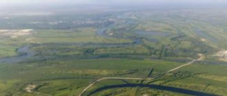
About 30 rivers flow into the bed of the Svir River, the largest and most important of them are Oyat, Pasha, Vazhinka, Ivina, Yandeba. The Pasha and Oyat rivers are navigable in the lower part. The Novoladozhsky Canal adjoins the river mouth on the left side.
There are islands in the riverbed. There are about thirty of them on the river in total. The islands are mostly small and low.
Relief and soils. The river flows in lowlands that in the past were occupied by glacial reservoirs. The lower reaches of the Svir are located within the Ladoga Lowland. The river basin is asymmetrical, its left tributaries predominate over the right ones. The soil of the territory is predominantly marshy and clayey, in some places sandy and partly rocky.
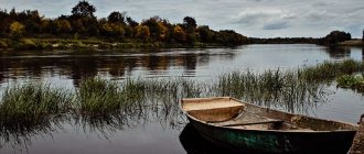
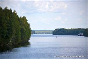
Vegetation. The banks of the Svir River are almost everywhere a forested area with shrubs and sometimes meadow vegetation.
Hydrological regime. The length of the river is 224 km. The height at the source of the river is 35 m. The height at the mouth is 4.84 m. The water flow is 785 m³/s. The width of the Svir River throughout its entire length varies from 100 meters to 10-12 kilometers (Ivinsky Razliv). The current speed in the river varies from 0.5 km/h to 10.6 km/h. About 80% of the river's drainage area falls on Lake Onega. The water regime of Svir is uniform throughout the year. But, in comparison, for example, with the Neva, spring floods in the lower reaches are more pronounced, including due to ice jams. The soil in the river mainly consists of clay and stones, and in some places silt and sand. There are many places on the river with a predominance of rocky areas.
There used to be rapids in the middle reaches of the river, but after a cascade of power plants was built on the river, the water level rose, thereby flooding the rapids and creating a deep-water path along the entire length of the riverbed. On the river there are Verkhnesvirsky (120 km from the mouth) and Nizhnesvirsky (80 km from the mouth) hydroelectric complexes. The reservoir of the Verkhnesvirskaya hydroelectric power station formed the “Ivinsky Razliv” with an area of 183 km².
Depending on weather conditions, the river is covered with ice for a period of 3-6 months. The stages of freezing and breaking up of ice in certain sections of the river, due to the peculiarities of its water regime, occur in a very diverse manner. The river begins to freeze around November-December, the ice disappears completely in April-May. Sometimes, in warm years and in places with high current speed, continuous ice cover may not form. In the upper part of the river, warm water entering the Svir riverbed from Lake Onega contributes to the melting of the established ice cover. In the lower reaches of the Svir, ice jams form, which are accompanied by a rise in water level from 0.8 meters to 3.3 meters. There is often a polynya at the mouth of the river. Spring ice drift on the upper reaches of the Svir occurs twice. First, the river is freed from its own ice, then ice from Lake Onega flows along it. As a rule, lake ice moves down the river 2-4 weeks after river ice. It also happens that a second ice drift is not observed.
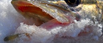
Ichthyofauna. The river is home to asp, salmon, bream, grayling, pike, pike perch, minnow, ide, roach, burbot, catfish, etc.
Whitefish fishing is prohibited in the Svir River throughout the year. Fishing for other species of fish in the river is permitted only near populated areas.
Fishing for salmon species is permitted: 1) from the mouth to the 500-meter restricted zone of the Nizhne-Svirskaya hydroelectric power station (donka and float without restrictions on fishing periods, spinning fishing is allowed except for the periods from October 1 to November 30 and from May 15 to June 15) ; 2) along the entire length of the river, excluding the 500-meter prohibited zones of bridges and dams (ice fishing for burbot is allowed with two single-neck meshes up to 2 m long with a hoop diameter of 0.5 m); 3) above the dam of the Nizhne-Svirskaya hydroelectric power station by 500 m and further along the entire length of the river (fishing is allowed with a float rod with no more than 10 hooks and you can fish with a donkey without any restrictions on the timing of fishing, fishing with a spinning rod is allowed from May 20); 4) from the mouth to the village of Alekhovshchina (fishing is allowed with a float rod without restrictions on the place of fishing and the timing of fishing; fishing rods of no more than 5 units per fisherman are allowed from the beginning of the ice melting until July 1).
Tourism and rest. Among the attractions, the Nizhnesvirsky Nature Reserve is located on the river, which is located in the lower reaches of the Svir River. There is also the Storozhensky lighthouse on the river. In the autumn-summer period, the river is actively used for passenger transportation and transportation of goods by water transport. Timber is floated on the Oyat and Pasha tributaries. The river is convenient for fishing and river travel.
Reference Information.
Length: 224 km. Basin area: 84,400 km². Swimming pool: Baltic Sea, Lake Ladoga. River basin: Neva. Source: Lake Onega Location: Voznesenye village, Podporozhsky district, Leningrad region. Coordinates: 61°0′47.22″ N. latitude, 35°29′17.9 in. village Ustye: Lake Ladoga. Location: Sviritsa village, Lodeynopolsky district, Leningrad region. Coordinates: 60°30′9.94″ N. latitude, 32°48′12.55″ e. d.
Verkhne-Svirskoye Reservoir - Ivinsky Razliv
The Verkhne-Svirsky hydroelectric complex was launched in 1952, it includes an earthen and spillway dam, a hydroelectric power station building and a single-stage single-thread lock, the useful dimensions of which are 17.8 by 270 meters.
After the construction of dams in the upper reaches of the river from the village of Voznesenye almost to the village of Plotichno, the Verkhne-Svirskoye Reservoir, or Ivinsky Razliv, was formed. The length of the reservoir is 43 km, and the width of individual sections reaches 24 km.
During the construction of the dam, all settlements, from Ascension to Podporozhye, were moved away from the shore, as they fell into the flood zone. Dozens of villages and all the temples located along the banks disappeared. One of the flooded settlements was Ostrechina, in the center of which was the village of Vorobyovo. Now this village is gone, and in the middle of the flooded area stands an island - the remains of a church. Now a modern cross has been installed on the island, around which the surviving tombstones of the church cemetery are collected.
Nine rivers flow into the Verkhne-Svirskoye Reservoir, including Ostrechinka and Ivina, Rzhanoi and Selga. The banks are covered with dense coniferous and deciduous forests, and sometimes there are meadows.
Ducks nest on large and small islands, and there is a lot of fish in numerous creeks. The forests are rich in berries and mushrooms, they are home to black grouse and wood grouse, hazel grouse and squirrels, hares and bears.
Through the gateway of the Verkhne-Svirsky hydroelectric complex, the ship descends 14.5 meters and enters the middle Svir, where the city of Podporozhye and the Vepsian Forest nature reserve are located.
The Vepsian Forest is a national park with many rivers, lakes and springs, the water in which seems to be crystal. There are untouched areas of forest with a variety of flora and fauna. This is the region where the Vepsians live - a people with a distinctive culture, their own language and traditions.
Economic use
The Nizhne- and Verkhnesvirsky hydroelectric complexes are located here. The reservoir of the latter is expressed by the Ivinsky Razliv/Verkhnesvirsky Reservoir, its area is about 185 km². The Lower Svir is considered to be the area in the Ladoga Lowland area and further downstream. The flowing Pasha and Oyat form a delta with numerous tributaries and branches connected to Guba Zagubskaya. The Nizhnesvirsky nature reserve is located there. In total there are about 30 islands. The banks of the river are covered with dense coniferous and deciduous forests, sometimes interspersed with meadows.
Verkhniye Mandrogi
Downstream is the amazing and unusual village of Verkhniye Mandrogi, which houses an open-air museum of modern wooden architecture created by woodcarver Yuri Ilyich Gusev.
Mandrogi translated from the Vepsian language means Thresholds. Previously, the local rocky shores did not allow boats to pass through, and then cargo was unloaded onto the shore and carried along with the boat in their arms or dragged.
Currently, a tourist center has been created in Verkhniye Mandrogi, where guests can visit a pottery and printing workshop, a forge, a painting workshop and the Vodka Museum. Master classes, horse riding, trips to the shooting range and shooting from hunting rifles under the guidance of an experienced instructor are organized.
For owners of yachts and boats there is guest parking at the piers. Those who wish will be able to take a steam bath in a Russian bath and taste traditional Russian cuisine.
Geographical information
The river is an important link in the Volga-Baltic waterway and the Mariinsky system that preceded it. It is 224 km long, originates in Lake Onega and flows into Lake Ladoga. The width of the river along its entire length varies from 100 m in narrow places of the channel to 10-12 km in the Ivinsky Razliv. The current speed varies from 0.5 to 10.6 km/h.
Before the appearance of Svir, the flow from Lake Onega to Ladoga occurred further south - through the Oshta, Tuksha and Oyat rivers. The modern river arose about 9.5 thousand years ago as a result of transgression of the southern part of Lake Onega, caused by the isostatic uplift of the northern part of the lake basin. As the river bed was cut, the level of Lake Onega dropped from 75 meters above sea level to the current 33.
The river flows in lowlands that in the past were occupied by glacial reservoirs. The Svir coast is mostly a forested hilly area. There were rapids in the middle reaches of the Svir, but after the construction of a cascade of power plants on the river, dams raised the water level, flooding the rapids and creating a deep-water path along the entire length of the river. On the river there are Nizhnesvirsky (80 km from the mouth) and Verkhnesvirsky (120 km from the mouth) hydroelectric complexes. The reservoir of the Verkhnesvirskaya hydroelectric power station formed the Ivinsky Razliv or Verkhnesvirskoye Reservoir with an area of 183 km².
The Lower Svir flows within the Ladoga Lowland and downstream from the confluence of the Oyat and Pasha rivers into it, it forms a delta with many branches and channels, one of which connects with the Zagubskaya Guba. The Nizhnesvirsky Nature Reserve is located here. In total there are about thirty islands on the river.
The main source of nutrition for the Svir is Lake Onega, which provides 75% of the annual water flow. The Svir has 30 tributaries, there are small and several large ones - for example, Oyat, Pasha, Yandeba, Vazhinka, Ivina. The river has an asymmetry of the basin, and the left tributaries dominate over the right ones.
On the banks of the Svir are the cities of Podporozhye and Lodeynoye Pole. The river is used for water supply, hydropower, fisheries and shipping.
Nizhne-Svirskoye Reservoir
In 1927, under the leadership of academician Heinrich Graftio, the construction of the Nizhne-Svirsky hydroelectric complex began. More than 15 thousand people took part in its construction, and most of the work was carried out manually.
In the summer of 1933, ships sailed through the built lock, and in 1935 the hydroelectric power station was fully operational. The lock of the Nizhne-Svirsky hydroelectric complex will raise and lower motor ships by 12 meters, its length is 200 meters, width - 20 meters.
During the Great Patriotic War, German troops captured the waterworks, and on the eve of the Soviet offensive, the occupiers blew up the gates of the lock. The waterworks was restored at the end of the war, also under the leadership of Academician Graftio.
Svirstroy
During the construction of the hydroelectric complex, the village of Svirstroy was built; about 30 thousand people lived there, the builders of the hydroelectric power station, including many prisoners. Now Svirstroy is an urban village with a population of about 1000 people.
A monument to Academician Graftio was erected in front of the hydroelectric power station; his name was given to the Nizhne-Svirsky hydroelectric complex. Also in the village you can see a monument to Kirov, who visited the hydroelectric complex under construction in 1927. Next to the pier there is a small market where souvenirs are sold.
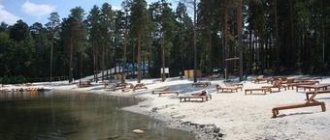
In summer, you can swim in a small bay located a 5-minute walk from the pier. There is a sandy beach here, and the water is much warmer than in the river itself.
Tourists can also visit two shrines of the Russian North - the Trinity Alexander-Svirsky Monastery and the Vvedeno Oyatsky Convent.
Trinity Alexander-Svirsky Monastery
The Trinity Alexander-Svirsky Monastery is located in a picturesque location on the high shore of Lake Roshchinskoye, 30 km northwest of the village of Svirstroy, in the village of Staraya Sloboda. The monastery was founded in 1484 and consists of two closely located monasteries - Trinity and Preobrazhensky.
- In the center of the Trinity Monastery rise the stone Trinity Cathedral, built in 1695, the Intercession Church of the first half of the 17th century with a 2-story refectory and a 3-tiered belfry.
- In the Transfiguration Monastery there is a stone Transfiguration Cathedral, created in 1644, and cells built in the second half of the 17th century.
In the monastery you can venerate the incorruptible relics of St. Alexander of Svirsky, which, according to legend, have healing powers, as well as drink water from the holy spring and take sand from the place where the Holy Trinity appeared to the saint.
Introduced Oyat Convent
Introduced The Oyatsky convent was first mentioned in the chronicle of 1448; it is the oldest monastery in the Lodeynopolsky district of the Leningrad region, located near the mouth of the Svir tributary of the Oyat River, the length of which is greater than the Svir itself.
The three-tier bell tower of the monastery, created in the late classicist style, was erected much later - in 1857–1859. During the restoration, its spire was replaced with an ancient Russian tent.
In the village of Mandera, located on the other bank of the Oyat River, the wonderworker Saint Alexander of Svir was born.
The monastery was revived in 1992. A chapel was built next to it, inside which flows a holy spring, famous for its miracles. Its healing water tastes like Narzan mineral water. A warm winter bath was built on the pond of the monastery, where you can wash yourself with holy water from the source at any time of the year.
The monastery contains the relics of Saints Reverend Sergius and Varvara, parents of Saint Alexander of Svirsky.
Lodeynoye Pole
The birth of this city is associated with the name of Peter the Great, who created the Russian fleet. At the beginning of the 18th century, Russia was in dire need of sea vessels to wage the Northern War. Here, on Svir, there were all the conditions for creating a shipyard - a deep river, an abundance of slender mast-bearing pines and carpenters famous for their skill.
Construction of the Olonets shipyard began in 1702 by decree of Peter the Great under the leadership of Prince Alexander Menshikov. On August 22, 1703, the first ship of the Baltic Fleet, the 28-gun frigate Shtandart, was launched.
The ships at the Olonets shipyard were built until 1829 and all of them distinguished themselves in the battles in which the Russian Empire participated during the Northern War. Many ships carried out round-the-world sea expeditions.
On the three-masted sailing sloop "Diana" Vasily Golovnin made his famous voyage from Kronstadt to Kamchatka, and the sloop "Mirny" under the command of Mikhail Lazarev took part in the first Antarctic expedition.
Not far from Lodeynoye Pole, a drawbridge was built, along which a railway line, two lanes for cars and a pedestrian path were laid.
Svir River
Svir River
- a large freshwater river flowing in the north-west of the European part of Russia through the territory of the Leningrad region, and connecting Lakes Onega and Ladoga, being the most important link of the Volga-Baltic waterway. The source of the Svir is in the Svirskaya Bay of Lake Onega, and the mouth is in Lake Ladoga.
Svir River.
2010 Photo: Mikhail Arkhipov The length of the Svir River is 224 km, the basin area is 84,400 square meters. km. The width of the Svir River has a wide range of sizes: at the source in Lake Onega - 1.5 km, at the confluence with Lake Ladoga - 900 meters, the widest point of the Svir is the Ivinsky Razliv - up to 10 km, but on average the width of the Svir is from 200 up to 400 meters.
The depth of the Svir River along the shipping route ranges from 4.5 meters to 20.3 meters in the section from Lake Onega in Voznesenye to the Verkhne-Svirskaya hydroelectric power station in Podporozhye. In the area between the Verkhne-Svirskaya and Nizhne-Svirskaya hydroelectric power stations, the depth of the Svir along the shipping channel ranges from 4.7 to 16 meters. And the river has its shallowest depths in the area from Lodeynoye Pole to Lake Ladoga - from 4.2 to 7 meters.
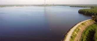
Ivinsky Razliv on the Svir.
2010. Photo: Mikhail Arkhipov Until the 1930s, the Svir was a fast and shallow river with rapids, water running over the crystalline projections of the foundation of the Russian Platform, complicating navigation. In the first years of Soviet power, it was decided to build the Svirsky cascade of hydroelectric power stations here, which, in addition to the much-needed electricity according to the GOELRO plan, made it possible to flood the rapids with reservoirs and create a deep-water path along the entire length of the river.
As a result, two hydroelectric power stations were built on the Svir River: the Verkhne-Svirsky hydroelectric complex and the Nizhne-Svirsky hydroelectric complex. The dam of the Verkhne-Svirskaya hydroelectric power station formed the so-called Ivinsky Razliv - the widest place of the Svir, and also raised the water level, making the section to Lake Onega the deepest.
The Svir has more than a dozen tributaries - such rivers as Vazhinka, Zaostrovka, Ivina, Kanomka, Kiselevka, Kuzra, Mandroga, Mungala, Muromlya, Negezhma flow into it. Ostrechinka, Oyat, Pasha, Pidma, Pogra, Svyatukha, Segezha, Toiba, Uslanka, Shamoksha, Shotkusa, Yandeba, Yanega.
On the Svir River there are cities and towns such as Voznesenye, Lodeynoye Pole, Podporozhye and Svirstroy. There is no water transport connection between the cities, and cruise passenger ships make stops in Lodeynoye Pole and Svirstroy, but not to explore these cities, but to transfer tourists to the famous Holy Trinity Alexander Svirsky Monastery (1484), located between them. The monastery contains the incorruptible relics of St. Alexander of Svirsky.
Another stop for cruise ships on Svir is the Verkhniye Mandrogi parking lot - this is a tourist center specially built in the second half of the 1990s to receive passenger ships with foreign tourists - as an alternative to foreign tourists visiting Valaam. Over time, the center turned from a purely cruise station into a large regional one and began to function year-round, and in addition to cruise foreign tourists, ships with Russian tourists always come here.
Svir in the Upper Mandrog region.
2015 Photo: Mikhail Arkhipov The Svir River is located within the territorial boundaries of the Volgo-Balt Administration and its division, the Svirsky District of Hydraulic Structures and Shipping. Navigation and transit shipping on the Svir begins on April 30 with the opening of the navigation facilities of the Verkhne-Svirsky and Nizhne-Svirsky hydroelectric complexes, and ends on November 15. In different years, due to a long or early winter, the dates shift by 7-10 days.
Waterworks on the Svir River:
— Verkhne-Svirskaya HPP (Podporozhye) — Nizhne-Svirskaya HPP (Svirstroy)
Settlements on the Svir River:
— Vazhiny — Verkhniye Mandrogi — Ascension — Podporozhye — Svirstroy — Lodeynoye Pole
Bridges on the Svir River:
— Road drawbridge of the Verkhne-Svirsky lock — Lodeynopolsky automobile-railway bridge — Podporozhsky railway bridge
Related news:
10/18/2018 — Construction of a new berth for cruise ships has been completed in Svirstroy 08/04/2018 — The opening of a new berth in Svirstroy has been postponed to August 2021 01/12/2018 — In May 2018, a new berth for cruise ships will be opened in Svirstroy 03/08/2017 — The Ministry of Transport will transfer to Leningradskaya region five berths on the Neva and Svir 01/01/2014 - The second line of the lock of the Nizhne-Svirskaya HPP should be completed by the spring of 2021
Sviritsa
In the river delta, six kilometers from its mouth, is the village of Sviritsa, the history of which began in the 13th–14th centuries, when a trading post of Veliky Novgorod was created here. In the 18th century, on the instructions of Peter the Great, Alexander Menshikov came here to build a military harbor. But the place was considered unsuitable for these purposes.
The village of Sviritsa is located on seven islands and numerous dams protect it from the storms of Lake Ladoga and spring river floods.
There are weather stations here, according to which information ships are allowed or prohibited from entering the Ladoga Sea.
Hydrology
Since almost 80% of the Svir’s watershed falls on Lake Onega and the flow from part of the river basin itself is regulated by hydraulic structures, its water regime is uniform throughout the year. But, in comparison, for example, with the Neva, spring floods in the lower reaches are more pronounced, including due to ice jams.
Tributaries
River bed diagram
| Lake Onega | ||||
| Legend | ||||
| P19 ferry crossing | Ascension | |||
| 200 km | Kuzra | |||
| 200 km | Saint | |||
| Ivankoostrov | ||||
| Muromlya | ||||
| Ivina | ||||
| Porutoma | ||||
| Ostrechinka | ||||
| 162 km | Toiba | |||
| 157 km Pidma | Meldusa 157 km | |||
| 154 km | Shakshozerka | |||
| 128 km | Saint | |||
| Podporozhye | ||||
| Verkhne-Svirskaya HPP | ||||
| 119 km | Pogra | |||
| Vazhinka | 112 km, Vazhiny | |||
| Uslanka | 105 km | |||
| 90 km | Mandroga | |||
| Sarah | 90 km | |||
| 88 km | Yandeba | |||
| Nizhne-Svirskaya HPP | Svirstroy | |||
| M18 | Lodeynoye Pole | |||
| 83 km | Mungala | |||
| 72 km | Yanega | |||
| 43 km | Shamoksha | |||
| Segezha | 41 km | |||
| 22 km | Shotkus | |||
| 15 km | Oyat | |||
| 7.9 km | Pasha | |||
| Sviritsa | ||||
| 1.5 km | Sour Oyat | |||
| Ladoga lake | ||||
The Svir has an asymmetry of the basin, and the left tributaries dominate over the right ones. The most significant of them are the Pasha and Oyat rivers.
Left tributaries
| Right tributaries
|
Nizhne-Svirsky Nature Reserve
The Nizhne-Svirsky State Nature Reserve, located in a picturesque place on the right bank of the Svir, was formed in 1980, its area is 42,390 hectares, and the landscape is represented by pine, spruce and birch forests, as well as vast swamp areas, numerous lakes and rivers.
The flora and fauna of the reserve are rich and diverse. Here you can find elk and bear, wild boar and wolf, beaver and badger, mink and fox, pine marten and many other animals. The reserve is home to 262 species of birds, and 33 species of fish are found in the reservoirs.
The territory of the reserve is classified as wetlands of international importance. The spring and autumn migration routes of birds pass here and their traditional stopover along the flight path is located.
Storozhensky lighthouse
Storozhensky lighthouse is one of the tallest in Europe, its height is 72 meters. Previously, when there was no lighthouse, there lived a watchman on the cape who helped Novgorod merchants find their way to the mouth of the Svir. Currently, the lighthouse helps to bypass the Storozhensky Reef, which stretches from Cape Storozhensky to Torpakov Island in the north.
There is a legend according to which in the 16th century, robbers lived on Cape Storozhensky, robbing ships that sailed along Lake Ladoga to the mouth of the Svir. But one day they found themselves in a strong storm, during which they made a vow that if they were saved, they would build a monastery. As promised, they built the St. Nicholas Monastery, which existed here for almost two centuries.
The red light of the Storozhensky lighthouse indicates to ships that they cannot go directly west, but must turn north and go around the white buoy marking the Torpakovsky reefs, which are also called the Sovereign Shoal.
According to legend, when there were still many shallows in this area, Tsar Peter the Great himself sat down on one of them. This shoal was named Gosudareva. Currently, the fairway is deepened and ships do not have to worry about running aground.
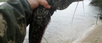
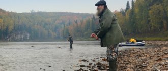
Fishing on the Svir
The banks of the river in many places are indented with large and small, shallow and deep creeks, rich in fish, and Svir is simply a paradise for fishermen: salmon and bream, grayling and pike, ide and pike perch, roach and catfish, burbot and many other species of fish are found here.
At the same time, with the construction of dams, the biological conditions for their life changed, especially in the area between the Podporozhskaya and Svirstroy dams. This part of the river resembles a huge aquarium, in which there is not much room for fish. In addition, the frequently and sharply changing water level associated with the operation of the sluices is also unfavorable for their life.
Despite all these negative consequences of dam construction, an experienced fisherman here will never be left without fish.
River Svir: description, features
The river flows from Onega and, with a length of 220 km, flows into Ladoga. It has 30 tributaries, there are small and several large ones - for example, Oyat, Pasha, Yandeba. The width of the reservoir varies: near the city of Podporozhye it does not exceed 100 m, and in Ivinsky Razliv it reaches 12 km.
The shores amaze with their picturesque, diverse nature: stretches give way to rocky landscapes, the reservoir is surrounded by hills overgrown with dense forests. A favorite place for fishermen throughout the region is the Svir River; fishing here is available all year round.
Two hydroelectric complexes were built on the river - Nizhne-Svirsky and Verkhne-Svirsky, dividing it into three sections, each of which has its own unique features. The upper one is 45 km long, the middle one is 80 km, and the lower one is 95 km long. The Verkhne-Svirskoye reservoir, which appeared thanks to the dam, resembles the shape of a mushroom with a long stem extending to Lake Onega. There are many creeks of varying depths along the banks.
The pond and nearby creeks are home to pike, bream, roach, pike perch, burbot, ide, smelt, and perch. Behind the Verkhne-Svirsky reservoir, Svir has a width of 500 m to 1 km. After the construction of the Podporozhskaya dam, the river flooded the surrounding area with swamps and ravines, and many bays and bays were formed. Thanks to the flooding of the Olonets Upland, swampy islands overgrown with bushes appeared.
Above the Svirstroy Dam, the Svir flows between sandy banks with sparse forests. In the waters of the river, sandwiched between dams, there are fewer fish than in other places; there is no freedom for them here. The number of individuals is negatively affected by a constant drop in water level due to the operation of dam gates. The water rises and falls as ships pass, causing ebbs and flows.
During the spawning period, due to low tides, a large number of eggs dry up on the shore. Despite the not very favorable conditions for fish, experienced fishermen do not leave without trophies.
Shipping
One of the eastern branches of the route “from the Varangians to the Greeks” once passed along the Svir, but then the river was shallow, with rocky rapids and sandy rifts. For the passage of ships, haulage was often used here, and then horse-drawn. The entire route, from the source to the mouth of the river, was divided into sections that were serviced by residents of coastal villages.
With the construction of dams, the Svir became a full-flowing and powerful river, navigable along its entire length. The river freezes at the end of December and opens in April, so that the navigation period lasts several months.
Many people believe that the Svir is the most beautiful river in northwestern Russia. She may be different, but she is always amazingly beautiful. The river fascinates with its endless reflections in the clear water. And how can one not remember the words of the poet Pyotr Ivanyuk: “On a white night, the turquoise water glows wonderfully, whoever meets Svir at least once will fall in love forever.”
Spawning prohibitions for fishing on the Svir
Along the entire length of the Svir River, fishing is permitted with all fishing gear, except for those prohibited by fishing rules.
Exceptions are these sections of the river:
- Section: The water area of the Nizhne-Svirsky Nature Reserve from the mouth of the Svir River to the border of the Leningrad region with the Republic of Karelia - there is a year-round fishing ban!
- Section: Svir River - from the mouth to the 500-meter restricted zone of the Nizhne-Svir hydroelectric power station. Allowed: Float fishing rod (without time limit), donka (without time limit), spinning rod (except for the periods from May 15 to June 15 and from October 1 to November 30).
- Section: Svir River: throughout the upstream 500-meter zone of the Nizhne-Svirskaya HPP dam. Allowed: Float fishing rod (no time limit), donka (no time limit), reel (no more than 10 hooks), spinning rod (from May 20 until freeze-up).
- Fishing with spinning tackle is prohibited from May 15 to June 15, as well as from October 1 to November 31.
- Anglers are allowed to catch no more than 5 girders per person from the melting of the ice until June 1.
- It is prohibited to catch whitefish on the river throughout the year, and other species can only be caught near populated areas.
- Under-ice fishing for burbot with single-neck meshes no more than 2 meters long is permitted almost along the entire length of the river, except for some restricted areas, bridges and dams.
Reviews and comments about fishing on the Svir River