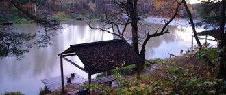
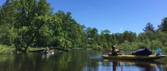
This water road is another “pearl of the Don Cossacks,” as if separating the highest terrace of the 2 regions listed below from the lower sections of their relief. She is the greenest here. But in terms of cleanliness it only ranks 3rd... As for its “passable” characteristics, the Medveditsa River is suitable even for “family” rafting. And you will get evidence of this below.
general description
The length of the Medveditsa River is 745 km. The area of its mirror is 34,700 square meters. km. Water consumption is 69 cubic meters per second. The reservoir belongs to the Don catchment area and flows to it through the southwestern edge of the Saratov region, as well as through the entire Volgograd region. The general direction is south-southwest. The river bed is winding. Its delta is not very deep. The bottom can be probed through a two-meter immersion, even in the very lower reaches.
Judging by the geological “biography”, the Medveditsa River was “born” in the Cenozoic era, when the appearance of the entire Russian Plain was finally formed. It began to play the role of a “separator” of the level of chestnut soils from the rising “floor” of the landscape. From older rocks formed in some sections of the riverbed. For many years, archaeologists have been finding traces of the people of the Khvalynsk culture (belonging to the Yamnaya community) in the upper river reaches. As well as the remains and utensils of their “relatives” from the Volgograd region - the tribes of the Srubnaya culture. Many references are also made in connection with the mysterious Burtases of the Middle Ages. By the way, the village located not far from the river “start” was named after them. As you know, the Bulgars pushed the people north in the 9th century. Most researchers classify the ethnic group as “wanderers.” They say that it was they who built the settlement of Uvek, right next to which the later Sara Tau (Saratov) grew up.
The first description of the Medveditsa River is contained in papers telling about the adventures of Metropolitan Pimen (1389). It turns out that no one lived on the river at that time. This was part of the “wild field” on which the “Donets” brutally sorted out relations with the Horde. Peaceful plowmen came here only at the end of the 16th century. Most of the settlements were formed in the 17th-19th centuries.
Many villages were associated with the “harboring” of Bulavin’s “army”. Since 1831, barges loaded with grain appeared at the mouth of the Medveditsa River. At that time it was partially navigable. Now it is no longer like that. Since 1856, the Medveditsa River has been in a new channel. Starting from some sections of the current Danilovsky district, the route of its movement changed, which made the work of barge haulers dragging wooden ships with grain very difficult. In the register of lands of the All-Great Don Army, most of the floodplain is listed as Cossack hunting and fishing grounds. No major battles took place in this region.
Economic use of the Medveditsa River has been practiced since Soviet times. Its channel is blocked by six dams. One of them is a hydroelectric power station (located near the village of Fomenkovo).
Where to fish
Review of reservoirs where you can go fishing in the Saratov region.
Fishing on the Volga
Mouth of the Ternovka River. A large bay at the confluence of the Ternovka and the Volga. There are places for fishing both from the village and from the fields. Mostly crucian carp, rudd and carp are caught. The crucian carp comes across quite decent sizes.
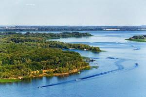
Volga river
The village of Berezovka, Engelsky district. Mostly crucian carp, rudd, bream, and perch are caught along the shore without a boat.
Podgornoye village. The entire bank upstream and downstream near the village all the way to Ternovka. There are deep holes along the shore here - these are great places for spinning anglers.
Krasnoyarsk (General) floodplain. One of the most remarkable hunting and fishing places in the Saratov region. - practically a place of pilgrimage. It is a floodplain overgrown with reeds, reeds and cattails with many channels and bays. The places are very similar to the Volga River delta in the Astrakhan region. A large number of different fish.
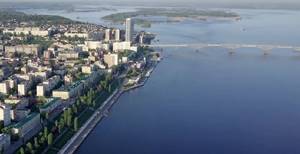
Volga river
Sazanka Archipelago. It is located near the city of Engels on the left bank of the Volga. A huge number of islands, picturesque channels, charming lakes create wonderful places for fishing.
Koshelevsky loan. A large massif of the floodplain part of the Volga. It is located between the villages of Usovka and Kosheli, Bereznyaki-Voskresensky district.
Volgograd Reservoir
The Volgograd reservoir was formed by the dam of the Volzhskaya Hydroelectric Power Station named after. 22nd Congress of the CPSU on the Volga River. Local residents call the Volgograd Reservoir a freshwater sea; its greatest width reaches 17 kilometers, its length is almost 540 kilometers, and its average depth is 10 m.
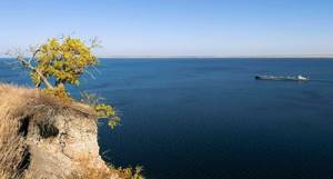
Volgograd Reservoir
There are enough fish in the reservoir, there are: bream, pike perch, pike, catfish, carp, silver bream, sorog, chub, ide, perch, silver carp, crucian carp, asp, bersh, bleak, bluefish, buffalo, dace, rudd, tench, etc. Volgogradskoe The reservoir is a very important recreational resource, a place of tourism and recreation.
Medveditsa River
Medveditsa is a river in the Saratov and Volgograd regions. The bear originates in the Saratov region from two streams near the village of Starye Burasy.
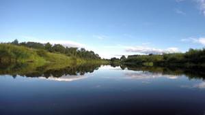
Medveditsa River
The river is very winding; in the upper and middle reaches there are rifts, shoals and fords, and there are stones. The riverbed is unstable, from year to year it moves in one direction or the other. In the upper reaches the river deepens it and in a number of places, mainly at sharp turns, destroys the bank.
Khoper River
Khoper is a large river in the Penza, Saratov, Voronezh and Volgograd regions, the largest left tributary of the Don.
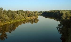
Khoper River
Fishermen are attracted here by the most beautiful places in the Khopra Valley: picturesque shores, pristine sandy beaches, crystal clear water.
Source and mouth of the Medveditsa River
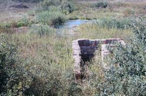
The source of the Medveditsa River is a stream lined with stones, beginning its journey one and a half kilometers west of the Galanino station (the rural settlement of Starye Burasy, Saratov region). In the east, the local landscape is decorated with a strip of small hills covered with coniferous-alder-aspen forest. But from the west, the designated point is surrounded by endless fields. The source of the Medveditsa River is a stream of water less than a meter wide. Only after 5 kilometers the water forms a “valley” of 3 meters in size, and in some places a little more... There are signs here.
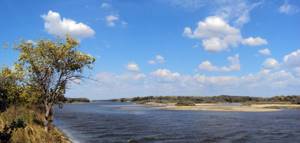
The mouth of the Medveditsa River is where it flows into the Don. Several kilometers separate it from Serafimovich. Medveditskaya Arm - outgoing water 290 meters wide. The depth in this place is 2 meters. A couple of islands have formed in the middle of the water, which local guides will tell you about. A trip to the junction of these reservoirs will allow you to see incredibly emerald meadows, appreciate the peace of quiet eriks, and a grove of oleaster, oak and aspen.
Description of the reservoir
Medveditsa is a left tributary of the Don. It originates in the Saratov region, and gives up its waters in the Volgograd region. It is considered a small river of the plain type. Its character is reminiscent of the more famous Hopper, only smaller. The length of the channel is 745 km, the area of the reservoir basin is 34,700 square meters. km.
For reference! The bear originates from two streams located near the village of Starye Burasy, Saratov region.
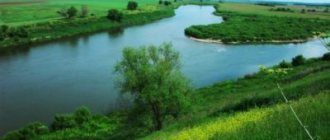
In the Volgograd region the riverbed is not as winding as in the upper reaches. The current calms down. The slope is directed to the southwest, and the average water flow is cubic meters. meters per second. The width of the river reaches 50, in some places 70 meters. The average depth is 2.8 meters, the maximum is 7 meters.
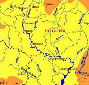
The Bear flows into the Don in the Serafimovichsky district of the Volgograd region
The banks of the Medveditsa in the lower reaches are gentle, there are many approaches to the water. Along the banks there are mainly shrubs, in some places deciduous, and less often pine forests. Aquatic vegetation is present in the coastal zone, as well as in shallow areas and branches from the main channel.
For reference! The Bear flows into the Don at 792 km of the river.
It freezes in the first ten days of December. Opens at the end of March. The peak of the flood occurs in mid-April. At this time, the river carries about 40–50% of its annual flow. At the end of May it returns to the shores. From July to September, summer-autumn low water is observed on Medveditsa.
In the Volgograd region, the Medveditsa receives the waters of small streams, rivulets and small rivers, which are displayed on maps of the region. The most significant are:
- Karamysh;
- Balanda;
- Itkarka;
- Idolga;
- Atkara;
- Pretty;
- Berezovka;
- Ursa Minor.
There are few settlements on the Medveditsa River. In the Volgograd region it is Zhirnovsk. A small hydroelectric power station was built near the village of Fomenkovo.
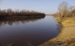
The banks of the Medveditsa in the lower reaches are mostly flat
The bear is not navigable, which makes it even more attractive for lovers of kayaking and rafting. There are many picturesque places to camp in the lower reaches. Fish stocks are rich. Clean, clear water allows you to do spearfishing.
Medveditsa River basin
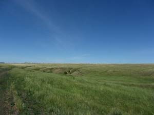
In the Bazarno-Karabulak district of the Saratov region, the Medveditsa River flows west, along a partially agricultural plain. And it is dotted with beams. Here is the Catherine “Sea” (the distance between the edges is up to a kilometer). It was specially built near the fields of the Merkulovsky farm. Further on are the villages of Sinenkiye (there are copses here). Petrovsk is the first city in the current. It is surrounded by a pine forest. Not far from it, the tourist will find the Alexander Reservoir, formed by the confluence of the Ursa Minor (but not at the very confluence of the rivers, but to the south). To the southwest, on the sides there are medium-sized “hills” covered with oak forests. Here the Kamyshinka joins the riverbed. Before Atkarsk the river becomes more winding. In the village, the stream is replenished by the Atkara branch.
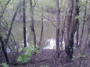
The regional center was named after him. The width of the Ursa becomes more stable. At least 10 meters. Sometimes expanding to 40. In the area of the Bald Mountains, it moves to the south much more decisively, absorbing Tavolozhka and Berezovka. Winding strongly with its wide leafy floodplain to the south, after 127 kilometers the river takes in the waters of Karamysh. The confluence point is the village of Maly Karamysh (its historical significance is described below). The waterway in question bypasses White Lake, taking Malaya Kopenka. There is a growth in width - up to 40 meters.
And here it is - Volgograd land. In the “foreign” area, the course of the Medveditsa River is surrounded at some distance by small mountains of the so-called Medveditskaya ridge - a ridge that is the western spur of the Volga Upland. The highest section of the regional relief (near the village of Serpokrylovo, 359 m) is located at the junction of the Zhirnovsky, Kamyshinsky and Kotovsky districts of the region. Moreover, the mentioned ridge is the most forested on the territory of the named administrative unit. Natural arboretums are located exclusively at higher elevations.
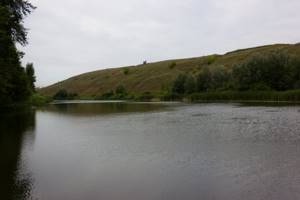
Only further, to the southwest, will the floodplain itself “dress” in a narrow but rather dense thicket. In region 34, deciduous semi-aquatic forest is also present on several other rivers. Even wider. However, in terms of “denseness” the Ursa Bear is in 1st position. The river basin, after joining several small tributaries and passing through bare places, rushes into the next piece of landscape. Already wooded. On one side the shore becomes slightly higher and steeper. But not for long. Then there is a smooth stretch again.
Where half of the wooded patches are called either Burnt or German? At Rudnya's. The flow of the Medveditsa River in the Rudnyansky region is of particular interest to the historical researcher. Just like for a scientist studying steppe biotopes. After all, where does the forest come from? Directly below Rudnya, the intricately curved Tersa joins the reservoir, cutting the “capital” of the region in half.
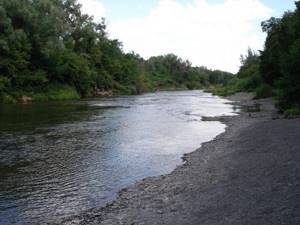
In the Kotovsky district, the Medveditsa River basin passes through translucent thickets of oleaster and silver poplar, but then, in Danilovsky, the river again dives into the thicket. The floodplain hides countless channels, lakes and oxbow lakes, heavily overgrown with willows, cattails, and sedges. There is also a skinny lake called Ilmen. Very swampy, but fishy. Residents of Pereshchipnoye have preserved a strange dialect, allowing ethnographers to think about the northern origin of the local population.
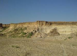
The lowest reaches of the Medveditsa River belong to the Frolovsky and Serafimovichsky districts. Here it confidently goes west along pine trees growing on the sands and wet emerald fields. The river “body” is already expanding to impressive values - 70 meters or more. The surrounding area of Serafimovich is the Don Lowland. Another “highlight” of this location is the protected oak forests, replacing the artificial pine planting of the protected Archedinskie Sands tract.
Sights of the Medveditsa River
City of Petrovsk
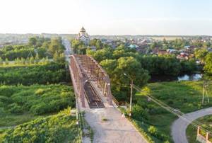
In the hilly Saratov region, the Medveditsa River will direct a lover of Orthodox history to an interesting ensemble of religious buildings - the Cathedral of the Intercession of the Mother of God. The temple was reconstructed relatively recently. Because of this it is bright. Nearby is a bust of Panfilov. It turns out that the commander of the military formation defending the Volokolamsk Highway was born in an urban village. Now it is a city. And its name is given in the title. Speaking about other high-rise buildings, we add that on one of the central streets there is a very “vintage” water tower. And, on the contrary, not far away there is a more avant-garde (in appearance) fire tower. Although the second one is older than the first one. And also look at the monument to Peter I. Remember the name of the town... Finally, you will learn everything else concerning the history of Petrovsk from the lips of the workers of the local history exhibition. They will also show you how to find memorial tanks and even a memorial plane. There are even... a screw-cutting lathe and a fire pump as monuments. The last one is horse-drawn. In general, a complete immersion into past centuries! For example, an abandoned iron bridge across the Bear dates back to 1901. It's rusty. And the river underneath is overgrown...
Atkarsk village
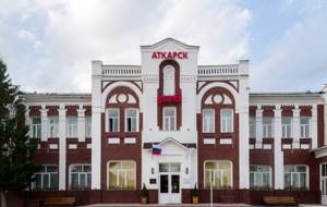
About 250 years ago, the Medveditsa River served for the movements of Russian patrols protecting this land from the Kyrgyz. Local historians of Atkarsk will talk about this, pointing to the model of the courageous settlement of Etkara and to the things that have come down to us from those times.
"German" Naked Karamysh
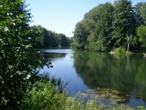
The Krasnoarmeysky district of the Saratov region and the adjacent north-eastern corner of the Volgograd region are the first line of settlement of the later inhabitants of the region - the Volga Germans. In the middle reaches, a visitor to the local steppes will find strange place names that include the adjective “German”. On the mentioned nickel, the Medveditsa River “greets” another strategic tributary - the branching Goly Karamysh River. On its shores, colonists from Europe established a colony specializing in the tanning of hides and the production of fat. But all reminders of her are in the Krasnoarmeysk museum. You will photograph the idyll of 2 villages - Small and Wide Karamysh.
City of Zhirnovsk
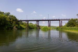
The regional center is considered the homeland of local oil and gas workers, since in the steppe expanses “headed” by it there are mining pumping stations, and among the city blocks there is an institution that trains specialists in this industry. It is here that light economic use of the Medveditsa River continues. She “gives” water to picturesque ponds. Zhirnovsk is notable for the Temple of the Holy Spirit-Comforter and the Worship Cross. Only in this town they managed to stick it on a TV tower...
The Blue Mountain tract and the highest point of the Volgograd region
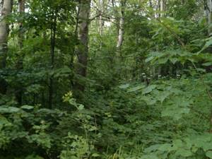
Although the Medveditsa River is (in most sections) 30 kilometers from the extremely forested belt of the Medveditskaya Ridge, you should break off your near-water (or water) wandering. In order to drive to the overgrown hills rising above the steppe. One of them received the popular toponym Blue (although the official mountain with that name is located a little to the south - don’t get confused). The tract appears in the media due to the fact that it is part of the Zhirnovsky Anomalous Zone. Moreover, she is the very epicenter of the mysterious ZHAZ energy, which attracts lightning and UFOs, and also forces grass, trees and the most common insects to grow to gigantic sizes. The spiders in this wonderful thicket are the size of a fist, the grass is the size of a man. The ants have already undermined and knocked down several huge birch trees. And someone (or something) twisted the rest into an arc... On the Slope of Crazy Lightning, a camp of ufologists “Cosmopoisk” was set up. We recommend getting there using these GPS coordinates: 64.43194, 39.39139.
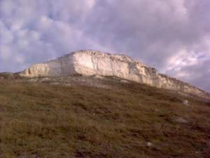
In Krasny Yar you will have an incentive to leave the river again. This time to head southeast and climb to the main "lookout" of the 34-region. The conversation turned to the highest peak of the Guselsko-Teterevyatsky ridge. A more majestic height is visible from the village of Serpokrylovo (Zhirnovsky district). But it’s more convenient to climb it by leaving the village of Pereshchepnoye (Kotovsky district). The dirt road, “shooting” up from the north-eastern end of the village, leads exactly there. By the way, here is a fairy forest again. Lopatin. Set up your tent. Enjoy peace and strange nature!
Beach near Krasny Yar
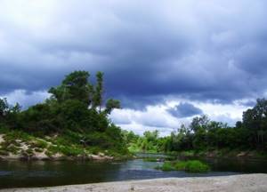
Rafting on the Medveditsa River usually consists of mooring to the banks most suitable for tourist stops. Even the natives respect many of them. For example, this piece of coastline is known to everyone. After all, here for the first time you will come across enough sand from the upper reaches. There is a point between Krasny Yar and the hydroelectric power station (dam near the village of Fomenkovo).
Stanitsa Berezovskaya
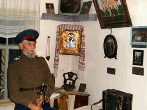
On the border of the Danilovsky and Mikhailovsky districts, parking lots on the Medveditsa River will become more reminiscent of rest stops near Moscow. Since there is the most tall flora here. And therefore you need to be more careful, looking out for dangerous rubble... Moreover, on the side of the settlement indicated in the title, the shore temporarily loses trees. You should definitely visit the village. Nearby is the birthplace of the Cossack Nedorubov, the most famous (during the First World War and the Patriotic War) Don Cossack. He was born on the Rubezhny farm (now part of the Lovyagin farm). What is he famous for? The house-museum, which preserves the memory of the hero of many battles, will tell about this. And his guides.
Mikhailovka city
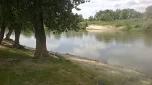
"Sprinkled with cement." This is the nickname given to this regional center - a town that ranks fourth in size in the region. However, in reality this is not the case. The Sebryakovcement enterprise is located to the side, near the Sebryakovo railway station. And the Medveditsa River flows directly through Mikhailovka, thereby freeing it from both cement dust and the noise of trains. What can you see here when you land on land? There is a temple in the center. He was christened in honor of St. Nicholas. There is also a local history museum with a collection of dried insects.
Archedinsky sands
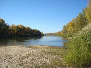
After a few kilometers, memorable for the intersection of two highways and one railway track, Archeda flows into the stream - the last significant branch of “our” object. The point is located on the eastern border of the village, named after this (heavily littered and shallow) river. Here the water traveler enters the kingdom of sands. Of course, it is not as huge as on the Tsimlyansk Reservoir, but the water edge can really be used as a comfortable beach.
District center Serafimovich
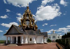
Pilgrimage leisure is primarily associated with the mouth of the described hydrological object. And no wonder. After all, the Ust-Medveditsky Spaso-Preobrazhensky Monastery is considered the most beautiful religious building near Volgograd. It is located on the territory of the regional center Serafimovich (in the far west of the Volgograd region). Once upon a time there stood the forerunner of the monastery, built in the 17th century. He was both male and female. But in the end it was washed away by the Don...
And the current complex began to be built in the century before last. Reconstructed already in this. Moreover, now it includes the very original Church of Seraphim of Sarov, which quickly became a brand of the town. By the way, about Serafimovich. This settlement received its name from the name of a once popular writer. We are talking about the author of the legendary work “Iron Stream,” Alexander Serafimovich. For a long time he lived and worked in this area. According to the writer himself, the local nature inspired him, “gave him the desire and strength to create.”
Welcome to the Serafimovich house-museum! In the old building, visitors will see a genuine homely atmosphere of a writer's home. Nearby is an exhibition of artifacts of the Ust-Medveditsky Cossacks. She will introduce guests to the ancient life and customs of the local Donets, their characteristics.
It remains to add about a very old church, also located on the territory of the city. It may not look as impressive, but it has better preserved the feeling of the era of which it is a part. Any elderly citizen will point it out to you. Named in honor of the Resurrection of Christ. The religious building was built back in 1782. This church is active.
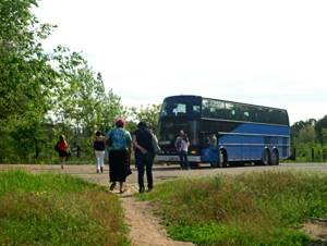
Organized tours are conducted from Volgograd, Volzhsky, Rostov-on-Don and Saratov. They also include a visit to the mysterious monastery caves. As for the first two agglomerations, trips from here are one-day trips, optimal in cost and route convenience. If you are by car and moving from the central or northern regions of the country, turn from M-6 onto highway 18A-2 (near Mikhailovka). After the tour, in the local church shop you can purchase a disk with a documentary film about this monastery or a paper edition. In order not to return to this location below, we will add something from “another opera”. As you guessed, the Medveditsa River is the widest here. Fishing will be good on any boat. Try yours. Especially if you find yourself in a protected area overgrown with relict oak forests.
Features of Saratov fishing and kayaking on the Medveditsa
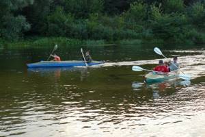
Fans of active recreation never tire of telling how good diving is in Turkey, rafting along the rivers of Switzerland and mountain bike tours in Italy. But you don’t have to go abroad for this; we also have adventure tourist routes in our region. New directions appear every year. You can order a tour from a company (today about 20 companies in the region are officially engaged in domestic tourism - author's note). However, many tourists are their own travel agencies, that is, they organize trips on their own for themselves, family or friends. And it's quite simple, especially if you know where to go. We will tell you about three of the most popular adventure routes.
Kayaking on the Medveditsa River
We have a large number of rivers in our region, which means that you won’t find rafting enthusiasts at home on weekends - everyone goes kayaking. One of the most popular water routes is the Medveditsa route, designed for 2-3 days. Tourists will be transported to the starting point by bus, and at the end of the boat trip they will be taken back to Saratov. There is a weekend kayaking route from the Krasavka railway station to the Ozernoye railway station, that is, you can get to the place on your own.
Companies that organize river rafting provide tourists not only with kayaks, but also tents, rugs, and sleeping bags. However, you shouldn’t go on such a trip empty-handed. Bring with you personal utensils, a waterproof backpack bag, a first aid kit, soap and a toothbrush, several sets of clothes (for sleeping, for rafting) and mosquito repellent.
You must undergo instruction and several training sessions. The instructor determines which route is right for you: for beginners - with a calmer current, and for experienced tourists - with sections of fast current, possibly even with obstacles.
It is better to plan your rafting a week in advance; if you use the services of a company, ask if meals are included in the price. The length of the route is about 40 kilometers.
Cost: Depends on the number of people in the group, on average the price for one adult is about 3,000 rubles, for children (from 12 years old) - about 2,500 rubles.
What else: The route along the Khoper River is no less popular. Saratov travel agencies offer a variety of options: from three-day weekend tours to a full-fledged trip lasting 10 days. You can also choose the “transport” you like. Not only high-speed kayaks, but also catamarans and rubber boats are available to tourists. The most popular route is from the village of Turki to Balashov (length about 100 km). The hike lasts 9-10 days.
Hunting and fishing tours
Why not turn fishing into a real trip? Not a spontaneous trip to the river with a fishing rod, but an organized and thoughtful tourist route!
“Relaxing the Russian way” means hunting or fishing tours in the Saratov region,” said the Ministry of Youth Policy, Sports and Tourism. — The Volga bays and reaches, as well as backwaters in areas bordering Kazakhstan, are wonderful places for amateur fishermen and athletes. Pike, asp, perch, carp, catfish, bream, rudd, tench, crucian carp are well caught here...
Tourists are not limited in their fishing method. You can fish with spoons, nets, or “kwok”. You will be given rubber or motor boats so that you can get to the middle of the river. The duration of the tour depends only on your desires: you can come for one day, or you can come for a week and spend the night in tents.
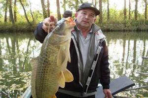
You can catch a real trophy on the rivers of the region
Saratov residents also love hunting. Tours are organized by request; the group should not contain more than two people. The price of the program includes: hunting, meeting participants at the railway station or at the Saratov airport (if the tour is booked by foreign tourists), accommodation (for example, in a wooden hut with a Russian stove) plus a sauna, barbecue - a fairy tale! You will be accompanied by an experienced hunter or huntsman. But you must bring weapons with you for hunting.
Cost: Accommodation at a fishing base - from 2,000 rubles per day (per person), rental of a boat and fishing rods is additionally paid. The cost of a hunting tour package is from 1,500 rubles per hour.
Visiting the ostriches
Today, the Lysogorsk region is known not only for its excellent swimming spots on Medveditsa, but also for its ostrich farm. Why isn't this an adventure?
And you can get to Bald Mountains on your own by car or bus in just an hour. You will be given an excursion on site (it is advisable to organize a group of 5 people or more), although this must be arranged in advance by telephone with the farm staff. They will tell you what these birds eat, how they are cared for, how ostriches hatch eggs and much more interesting things.
Ostriches always rejoice at tourists because guests often bring treats
Ostriches are very sociable creatures, so they are happy to approach tourists and take food from their hands. And you can take a couple of fun photos.
How to get there: By bus "Saratov - Bald Mountains", ticket price - from 167 rubles, or by car (distance 88 km), you will get there in about an hour.
Cost: The excursion costs from 50 to 100 rubles per person (depending on the composition of the group).
Tourism and recreation on the Medveditsa River
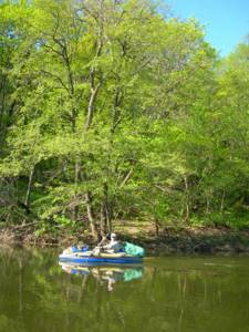
The Medveditsa River is located in the zone of steppes and small fragments of forest-steppe. Over all coastal tracts, the weather is determined by a dry temperate climate. As a result, you can relax on the river from May to mid-October (then the rainy season begins, which, however, is good for mushroom pickers). As for ecology, the Medveditsa River lies at some distance from large economic entities and roads with heavy traffic. The exceptions are: the Saratov-Borisoglebsk highway, the bridge of which covers a piece of the river behind the Bald Mountains in the shadow, and the “federal” M-6 “Caspian”, crossing the riverbed at the borders of the regional “capital” Mikhailovka. It smells like fumes...
We outlined cultural, historical and pilgrimage leisure in the section on attractions.
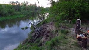
And here we’ll talk exclusively about the “tent”. Such a holiday on the Medveditsa River is ideal both in the Saratov and Volgograd regions. Because forests, forests and more forests! And they contain firewood, mushrooms, berries and tons of life-saving aromatic oxygen! You can also choose a recreation center. “Prirechnaya” (Atkarsky district, Saratov region) and “Medveditsa” (Mikhailovsky district, Volgograd region) - they are at your service from spring to autumn inclusive. Elite bungalows, fishing platforms, barbecue areas, well-groomed territory.
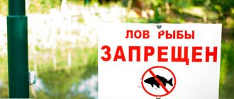
Do you have a tent? Suitable sites on the Medveditsa River can be found everywhere. As we emphasized in the chapter on the river basin, 80 percent of the Medveditsa Valley is covered with forest. Lands where it is forbidden to burn fires or conduct fishing will only be found in the vicinity of the Nizhne-Khopersky Natural Park and in the Archedinsky Sands Nature Reserve. The places are full of wild berries and fruits, medicinal herbs and rare flowering plants. It would be a shame not to capture yourself against this background! And the water is relatively clean everywhere.
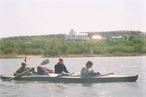
Extreme recreation on the Medveditsa River is also quite common among Russians. You can go sailing along this “artery” from any point, starting from Saratov Atkarsk. Region 34 is especially popular among tourists. 2 sections of shore. One is located in the Krasnoyarsk rural settlement (Zhirnovsky district). Fans of a shorter route start to the southwest - from the intersection of the river with the Moscow highway (Mikhailovsky district). You won’t find a calmer place than the shore near the village of Staroselye. You should press close to the right side, otherwise you can run aground. The depth of the stream here is less than a meter. But it is quite enough for sailing on a kayak or rubber boat. Thanks to the small size and with children, swinging the oars is not scary.
At the same time, there is enough safe extreme sports - the riverbed is very winding, there are rifts. In some places there are even rocks and fords, so you won’t be able to stay with the oars for long. Just have time to drag the boat... In the river floodplain, especially below Danilovka, lakes are quite common. You can set up tents on them - swim or fish. Along the route, which includes rafting along the Medveditsa River, the coastal landscapes quickly change - from densely forested hills in the Zhirnovsky district to the flat zone of deciduous forests in the Ust-Medveditsky and Nizhne-Khopersky natural parks.
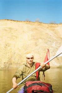
As you move downstream, there are fewer and fewer people and villages, the locals don’t litter, and the “northerners” are not visible at all. The banks of the river are steep in places. I remember the flow in the Zhirnovsky district - it is somehow serene and private. And, on the contrary, the path near Krasny Yar evokes completely different emotions. A feeling of “sliding down” is born. In this case, there is actually no slope. You can easily find this interesting place - near a small hydroelectric power station near the village of Fomenkovo.
Light rafting is organized in the Ust-Medveditsky natural park. The area is not of interest to experienced extreme sports enthusiasts, but it delights fans of family trips. It’s time for future travelers to prepare their kayaks and check the rest of their equipment. Beware of debris from fallen trees. They can spin and, even worse, puncture the kayak.
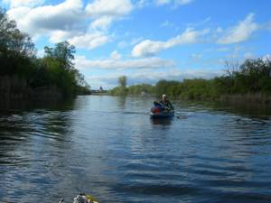
If you want to have a fun time with your children, you shouldn’t go rafting on the Medveditsa River until May 10th. During floods, a rapid stream is formed in its narrowed sections. The current speed here reaches 10 kilometers per hour. In such a situation, encountering protruding branches of a flooded forest can result in the boat capsizing. As a result of an accident, you can be injured and end up in icy water. Don't forget about the pontoon bridge near the village of Sennoy. You need to take out the kayak in front of it and walk around the building along the shore. There is no way to swim here.
Swimming holidays on the Medveditsa River are popular. And not only among those who live in the above-mentioned corners of Russia, but also among visiting automobile travelers. Here are the best places - Ekaterininsky settlement, Krasny Yar, Fomenkovo, Archeda, villages near Serafimovich. Everywhere there is a strip of sand and it is hollow.
Fishing and hunting on the Medveditsa River
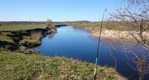
Where the Medveditsa River flows, fishing is widespread. These depths are home to the ubiquitous pike, perch, topwater, tench, as well as carp, pike perch and even catfish. When the Medveditsa River appears before the eyes of an avid amateur fisherman, fishing becomes his passion for the next few days. And he will try to spend these days in the tracts near the Ekaterininsky and Alexandrovsky reservoirs. And also on the spacious reaches at the river mouth, opposite the beautiful city of Serafimovich.
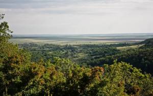
Be more careful with the ichthyofauna from the Red Book. And the Medveditsa River carries such fish. Fishing may result in a fine. Here you need to release the sterlet.
Be careful about the rules for shooting animals. Rare animals in the hilly forested steppes of the Saratov and Volgograd regions include red deer, red-breasted goose, bustard, swans, and Dalmatian pelican. There are no problems with wild boar, brown hare, fox, raccoon dog, wolf and polecat. As with swamp-meadow game, whose habitat is various fields. Come visit them in the fall... Once upon a time there were more forests in the region. And there was even a bear. From the tears of the mother of the killed bear cub, a river appeared, quite dramatically explaining the myth of its current name.
Fishing on the Medveditsa River
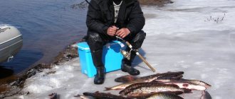
People fish on the Medveditsa River all year round. The best period for fishing is summer, especially August. Good results are observed in September–October, April and early May. In winter there is also fishing on the reservoir, but the catches are unstable; the most favorable time for ice hunting is the first ice.
One of the stable and catchy methods of fishing on the Bear is light spinning. With its help you can catch chub, ide, asp, pike and perch. Also in the bycatch are dace, rudd and small catfish; very rarely burbot can be tempted by jig bait.
To catch chub on Medveditsa, you need to use small wobblers. As a rule, these are miniature cranks up to 4 cm long with a stable action that allow you to fish in any current. During the cold season, it makes sense to try fishing with minnows. Their sluggish work has a positive effect on passive fish.
In addition to wobblers, bigheaded fish are caught using rotating spoons and micro-oscillators. Among the first, it is better to give preference to proven models:
- Smith Niakis;
- Mepps Black Fury;
- Myran Wipp.
From the variety of micro-oscillators, you should choose models with a length of 3–5 cm, designed for fishing in moderate and medium currents.
When hunting for chub on Medveditsa, an ide, which is not as common as the bighead, flies onto the fisherman’s hook. Also in the catches there is asp, reaching a size of up to 3 kg in this river. Sometimes a small-medium pike or striped robber sits.
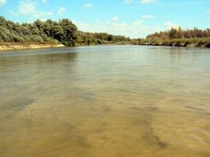
In the upper reaches of the river there are many riffles and shoals
By the way, it is advisable to catch perch with a microjig using small silicone baits. It is better to use edible “rubber”, which allows you to catch a predator anytime and anywhere. There is a possibility of a pike biting, so having a fluorocarbon leash will not hurt.
The best way to catch peaceful fish on Medveditsa is with a float rod. In many situations, a regular swing with a blind or sliding rig will do. Matcha is used for long-distance fishing, but the need for it rarely arises.
Traditionally, animal baits and plant baits can be used as bait. Among the former, the undoubted leader is the dung worm. They also use maggots, bloodworms, caddis and burdock larvae, and grasshoppers. Among the latter, we can mention dough, canned corn and mastyrka.
In winter, people fish on Medveditsa mainly in calm areas. These can be wide reaches, a coastal zone, or various closed branches from the main river bed, for example, oxbow lakes, branches and backwaters.
Note! The main types of fish caught in winter are perch, pike, roach and silver bream.
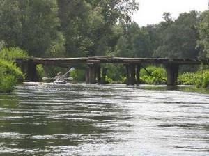
It is convenient to kayak along the Bear
The main methods of winter fishing are jigs and a regular nodding fishing rod for stand-up fishing. Vertical spoons and balancers are used to hunt predators. They often go out for pike with fishing poles and ice hooks.
Protection of the Medveditsa River
The protection of the Medveditsa River takes place as part of regional environmental activities in the 34th and 64th regions. They are associated with supervisory and inspection work, with the organization of clean-up work on the coasts, with the clearing of fragments of the riverbed. In the upper reaches, the protection of the Medveditsa River is based only on the creation of water protection zones near reservoirs, but on the rest of the course everything is much more serious. The last of the named subjects of the federation exercises strict supervision over the reservoir in areas of the Nizhne-Khopersky natural park. The protection of the Medveditsa River in some recreation areas of the Volgograd region is associated with strict monitoring of spawning pits.
We are sure that the presented description of the Medveditsa River will make lovers of water travel or hiking trips related to sites near the river “start” in the right direction. May-August is just around the corner. And this is the best time to honor with your presence the natural attractions on the banks of the described river.
