Geographical information
The total length of Tsna is 445 km, of which 325 km are within the Tambov region and 120 km within the Ryazan region. Tsna begins in the Sampursky district of the Tambov region from the confluence of two small water streams: Wet Vershina and Bely Plyos. The basin area is 21.5 thousand km2.
Tsna is a calm, flat river. The river bed is winding, width from 40 to 200 m. The depth of the river is 2-5 m, and in the whirlpools - up to 10 m. There are 5 dams on the section of the river between Tambov and Morshansk.
It receives numerous tributaries on the right and left: Karian - length 48 km, Lipovitsa - 52 km, Lesnoy Tambov - 89 km, Chelnovaya - 121 km, Kersha with Khmelina - 86 and 49 km, Kashma with Bolshoy and Maly Lomovis - 111, 106, respectively, 66 km, Serp - 66 km, etc.
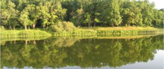
Below the village of Semikino there are lakes Lebyazhye and Orekhov Zaton - the largest floodplain lakes on the Tsna River.
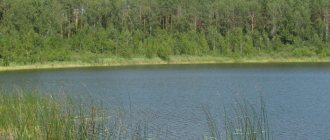
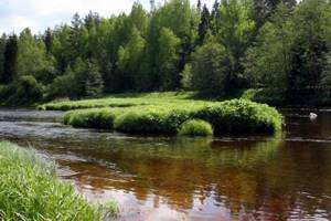
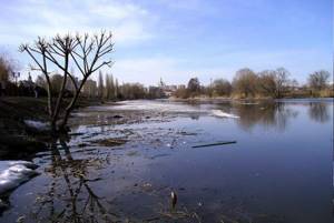
The left bank of the river is treeless and heavily populated. Along the right bank there is a strip of forest almost everywhere, but it comes out to the water only in certain places, since it was cut down during the Great Patriotic War.
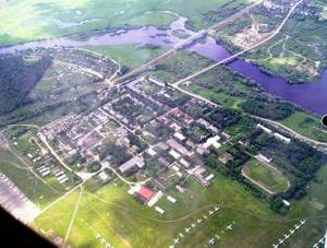
The cities of Kotovsk, Tambov, Morshansk, and Sasovo are located on the river.
The territory of the state nature reserve is located within the Meshchera Lowland in the zone of moraine-fluviglacial plains. The pre-Quaternary foundation here is represented by clays and sands of the Jurassic. The absolute heights of the territory vary from 134.5 m (the low-water mark in the Tsna River at the south-eastern end of the reserve) to 150 m at the top of the hill on the western border of the reserve.
The territory of the reserve includes flat and slightly undulating areas of the moraine-fluvioglacial plain, complicated by hollows, depressions and the valley of the Tsna River. The surfaces of the plains are composed of hydroglacial sands of different grains, under which lies a moraine. The slopes of flat surfaces are, as a rule, 1-2º, in some places up to 3-4º. The sources of the Tsna River formed in the northern part of the reserve within swampy drainage depressions connected by hollows up to 100 m wide.
The valley of the Tsna River within the reserve has an unclear profile shape. The width of the valley reaches 200-300 m. The sides of the valley are low and flat (3-5º). The river's floodplain is often swampy. The width of the floodplain in the southern part of the reserve is 60-80 m. The excess of the floodplain over the riverbed is 0.2-0.4 m.
In the northern part of the reserve, on the elevated part of the plain, a sand quarry with a depth of 3-5 m has been formed. The length of the quarry is 170 m, width is 120 m.
The hydrological flow in most of the territory is directed to the Tsna River (the left tributary of the Oka River). The river bed, which runs along the eastern border of the reserve, is straightened and canalized for a significant length. At the southern end of the reserve it is 2-3 m wide and 0.1-0.3 m deep. The bottom of the riverbed is composed of sand, silted in places. The average speed of the river flow is insignificant and is about 0.1 m/s. Groundwater seeps are observed in the valley; The river's tributaries are predominantly temporary. In the northern part of the reserve, in the upper reaches of the river, there is a swamp transformed by peat mining, on which a system of overgrown, flooded quarries has been formed. The length of the parallel reservoirs stretching from the north-northwest to the south-southeast reaches 200-250 m, the width is 5-10 m. The northwestern part of the reserve belongs to the Nerskaya River basin. The flow here is directed into the Shuvoika River, a right tributary of the Guslitsa River.
The soil cover of the plains of the reserve is represented by sod-podzols in elevated areas and gley sod-podzols in depressions. In wetlands, gley peat-podzols, eutrophic peat and oligotrophic peat soils are observed. Humus-gley and humus-gley soils formed along the bottoms of the hollows. On the floodplain of the Tsna River, alluvial humus-gley and alluvial light-humus soils were formed.
The vegetation cover of the reserve is dominated by pine and pine-spruce forests with the participation of birch, middle-aged and ripening, as well as derivative pine-birch forests in their place. There are old-growth spruce forests with the participation of broad-leaved species, pine forests with spruce undergrowth, as well as areas of damp middle-aged green moss-sphagnum birch forests. Small lowland and transitional cotton grass-sphagnum bogs with sparse pine and birch are noted. The banks of the upper reaches of the Tsna River are surrounded for a considerable length by damp willows and wet-grass black alder forests. More than 170 species of vascular plants grow on the territory of the reserve.
Almost throughout the entire territory, on light, poor sandy soils, there are well-preserved areas of pine blueberry-small grass, blueberry-grass and lily of the valley green moss forests, including old-growth (100-120 years), mostly sparse (crown density 0.2-0. 3) with Schreber's pleurosium, Hylocomium lucidum and Climacium arborescens, in places with a cover of lichens - Cladonia and Cetraria, with a characteristic set of herbaceous pine and taiga plant species. The height of the pines is about 30 m, the diameter of the trunks is about 35 cm. The undergrowth is formed by silver birch, pine (height 0.6-1.3 m) and individual spruce trees 5-7 m high. In the shrub layer, common juniper 0.5-7 m high 2.5 m (a rare and vulnerable species, not included in the Red Book of the Moscow Region, but requiring constant control and observation in the region), as well as buckthorn and raspberry. The herbaceous-shrub layer is dominated by lily of the valley, blueberries, lingonberries, and in some places tortuous lerchenfeldia (pike), sheep fescue, hairy and umbelliferous hawksbills, cat's foot, speedwell, and also grow: reed grass, wild strawberries, meadow bluegrass, fragrant spikelet , speedwell, oak veronica, forest cudweed, St. John's wort, common gum, Fischer's carnation, common yarrow, large sedum, silvery and erect cinquefoil, common blackcap, field bark.
In such forests one can find the umbelliferous winter-lover and the globe-bearing beard, or the juvenile shoot-bearing - species listed in the Red Book of the Moscow Region (blocks 10 and 11 of the Suburban district forestry of the Yegorievsky forestry), the annual moss, as well as the oblate and club-shaped mosses (the last two species are rare) and vulnerable species not included in the Red Book of the Moscow Region, but in need of constant control and observation in the region).
Pine-birch derivative forests are usually light, sparse, grass- or fern-grass-forb, with dense undergrowth of pine, birch, and less often aspen and broad-leaved species. There is a lot of bracken, carthusian shieldweed, lingonberry, and in some places - hairy and umbrella hawksbill, cat's paw, speedwell; there are fragrant spikelet, meadow timothy, dog violet, angelica, drooping gum, and spreading bluebell.
The reserve also contains areas of old spruce (over 100 years old) with linden and spruce-pine with undergrowth of oak, linden and maple, euonymus lily-of-the-bracken and blueberry-small-grass forests; short-legged cirrus is often found here. In the 23rd quarter, Lyubka bifolia and Gentian pulmonata were noted, rare and vulnerable species that are not included in the Red Book of the Moscow Region, but require constant control and observation in the region. Parts of such spruce forests were damaged in some places by the bark beetle.
There are old pine forest stands (about 25 m high), where the spruce has already reached the first tier or reaches half the height of the pine. The crown density here is 0.6-0.8. The dominant herbaceous-shrub layer of such transformed forest crops, as a rule, sorrel-blueberry-green moss, usually includes, in addition to blueberry and wood sorrel, northern linnaea, sedge palmate, goldenrod, lily of the valley, hairy grass, meadow grass, sometimes round-leaved wintergreen, ortilia lopsided and bracken. In damp depressions one can find blue molinia and burning buttercup (sometimes in large quantities).
Damp, middle-aged birch green moss-sphagnum forests surround lowland and transitional swamps or are found in depressions among the pine and spruce forests of the reserve.
Swamps occupy small areas in the reserve. There are areas of low-lying sedge-cinquefoil bogs with whitewing, three-leaved grass, meadowsweet, swamp grass, black sedge and swollen sedge, and transitional sedge-grayweed-sphagnum bogs with vaginal and multi-spike cotton grass, hairy sedge, racemosa. Here, blueberries and marsh myrtle grow on a few hummocks (quarter 10), but in general, marshes with the presence of marsh shrubs are rare. Sometimes swampy depressions overgrown with willows are covered with sphagnum, on which only rare blueberry bushes grow. More often, such depressions are overgrown with hairy, swollen, acute and black sedges, the latter is usually represented here by the long-leaved form, as well as vaginal cotton grass (quarter 11).
Black alder reed-wet grass forests along the Tsna River bed are overgrown with forest reeds and nettles. The trees reach a height of 25 m, the diameter of the trunks is 20-25 cm. Brittle buckthorn and raspberry are noted in the shrub layer. In the grass cover, common sedges are sharp and black, awnless brome, meadowsweet, creeping ranunculus, angelica, crowded and spreading rushes, river grass, three-parted string, cone-shaped brome, female kochedednik, ivy-shaped budra, marsh scurf, yarrow ptarmika, and in some places - cattail broadleaf, mint, peppermint.
In the eutrophic reservoirs at the headwaters of the Tsna River, duckweed, water pine, plantain chastuha, lesser hogweed, marsh whitewing, marsh marigold, and, less commonly, yellow egg capsule and floating manna grow. Small pemphigus, listed in the Red Book of the Moscow Region, was found in low-flowing channels (quarter 18).
Description
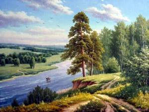
The Tsna River on the map permeates the entire territory of the Tambov region. It is the largest water artery in Tambovshina. The total length of Tsna is 445 kilometers, with a section of 291 kilometers crossing the regions of the region. The river begins on the southwestern slopes of the Volga Upland, near the village of Bakharevo, at an altitude of 190 meters above sea level. It then flows in a northerly direction, receiving water from various tributaries. The area of the Tsna drainage basin is more than 21 thousand square kilometers. Of these, about 42% are located in the Tambov region. The Tsna River is completely covered with ice by December, which breaks up in the second half of March or early April (depending on weather conditions). ON the left bank there are a huge number of settlements. The right bank is covered with forest, but the massif reaches the river only in some places, since it was completely cut down during the Great Patriotic War. The river is fed by mixed water: precipitation, snowmelt and groundwater. In spring, during the flood period, the Tsna level rises to 5 meters.
Places for successful fishing
The largest rivers suitable for fishing are the Tsna, Vorona, Voronezh, Savala, Bityug, as well as the Kershinskoye and Shushpanskoye reservoirs.
You can fish almost everywhere. Fishing is prohibited only in fish farms. These are artificial basins created to increase the fish population or commercial fishing, such as Chelnavsky, Bokinsky, Shushpansky and Kulevatovsky fish farms . All of them are privately owned. On some of them paid fishing is possible, on others fishing is considered illegal.
On the Chelnavsky, Kershinsky and Shushpansky reservoirs, fishing is available all year round, excluding spawning time.
Kershinskoye Reservoir
Located on the Dalnyaya Kersha River. The depth of this reservoir reaches 19 m, and the total area is 236 hectares. The fish population here is not too diverse: rudd, crucian carp, tench, pike, perch and roach - that’s probably all you can count on.
Roaches are caught in clear water, closer to the edges. Feeding improves the bite, but in the case of large individuals it does not help much. Experienced fishermen recommend using the “feeding method”: throwing a crust of bread. Stale bread does not produce turbidity and thus does not attract small fish. The method does not always work right away, since the bread is carried away by the current, but after several casts the fish begins to actively manifest itself and catching it remains only a matter of technique.
It is best to wait for tench, carp and crucian carp in the reeds on Kershi. For this purpose, it is worth choosing a feeder as .
For fans of spinning, the object of attention here will be pike, but a trophy specimen is rare here: medium-sized fish are used for lures. You can catch it everywhere, as the toothy beauty travels freely throughout the entire reservoir.
Locals recommend going out for pike in cloudy weather with little wind: the coastal dumps and hills at this time are full of weighty specimens, and local fishermen give their preference to spoon baits. During the hot season, the predator is active only before dawn and after sunset. At this time, she bites on a white or orange jig head.
If you catch pike from the shore, it is important to remember that these places are snarled. Most baits stay there forever, so it is best to use surface wobblers in this type of fishing, which will lure the toothy inhabitants into shallow water.
Shushpanskoye Reservoir
The main prey is bream , which willingly goes for donk and float tackle. Fishing in the Tambov region 68 rus on the Shushpansky reservoir is famous for its excellent bream with an average weight of up to 3 kg. In spring, fish are usually at half-water and gather en masse in well-ventilated areas. Like any linen, bream is crazy about plant baits; when it smells one, it immediately rushes to attack.
The reservoir is famous for its amazing catches, which attracts many amateurs and professionals. The reservoir is located in the Staroyurevsky district. It is inhabited by the following representatives:
- Pike.
- Perch.
- Roach.
- Sinets.
- Rudd.
- Ide.
- Guster.
Although the main gear for catching bream on this reservoir is a donka, a float rod is an excellent way to study in detail the topography of the bottom of the reservoir. It is better not to use a feeder for catching bream, since here it is very easy to make a mistake with the depth and instead of the desired fat handsome one, only small roach and silver bream will bite.
Rivers of the Tambov region
Very close to Tambov you can have excellent fishing near the villages of Bokino and Luchok on the Tsna River . Local fishermen say that an excellent bite can be found near the following settlements:
- Trinity.
- Stone ford.
- Dubrava.
- Goreloye.
- Znamenka.
Hospitable places also await you on the Vorona, Matyra and Kashma rivers, but they are located at a great distance and can be reached by car or regular bus.
In the Tambov rivers at dawn it is especially good to fish for asp. In this area, such spinners as “universal”, “spinner” and “Baikal” have proven themselves. The bite stops with the arrival of the sun's rays and resumes with the singing of nightingales.
Tsna (tributary of Moksha)
| This section is missing references to information sources. Information must be verifiable, otherwise it may be questioned and deleted. You can |
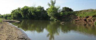
A calm, flat river, heavily regulated by dams, navigable in places from Tambov itself. The list of inland waterways of Russia includes a section from the mouth to the village of Tensyupino with a length of 47 km (2002). The left bank is treeless, heavily populated, but the villages are mostly 1-3 km from the river. Along the right bank there is a strip of forest almost everywhere, but it comes out to the water only in certain places, since it was cut down during the Great Patriotic War.
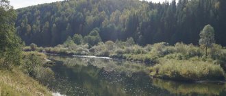
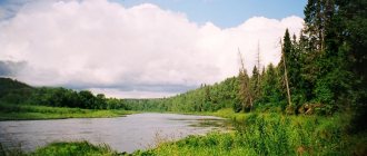
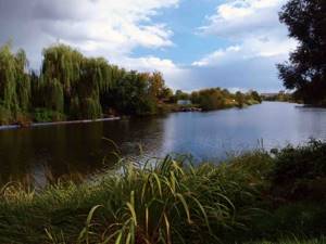
The Tsna below Tambov is a winding, calm river, 40-80 m wide, flowing through a wide valley with a large number of creeks, oxbow lakes, and channels. There are reeds and bushes along the banks.
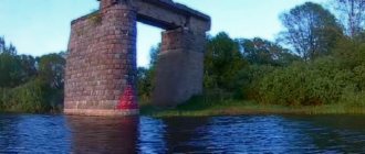
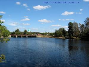
From Tambov to Morshansk there are 5 dams with locks. The first is in the village of Tambov Forestry. The second is near the village of Goreloye. Beyond it the river makes a long loop. Near the village of Troitskaya Dubrava there is a third gateway. Behind the village of Kuleshovo there is an oak forest. The forest approaches the shore and near the village of Perkino. The first small hydroelectric power station in the Tambov region was built within the city of Tambov in 1912.
Below Perkino, the Semikinsky Canal begins, significantly shortening the route along Tsna. In the Tsna floodplain at Perkino, Semikino and below there are labyrinths of oxbow lakes overgrown with reeds.
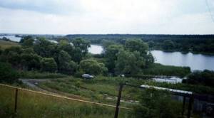
Below the village of Semikino are lakes Lebyazhye and Orekhov Zaton - the largest floodplain lakes on the Tsna River. Below Lake Orekhov Zaton on the high right bank is a natural viewing platform, from where a panorama of the village of Kulevatovo, the floodplain of the Tsna River, and the mouth of the Chelnova River can be seen.
The fourth dam is behind the village of Mamontovo, the fifth is in Morshansk.
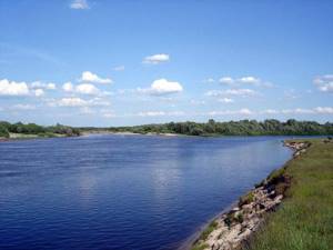
Below Morshanska Tsna it becomes wider, the current becomes faster, and beaches with fine, sometimes silty, sand appear. The banks are mainly meadow, only near Mutasyevo on the right bank a forest approaches like a wedge, to which a creek leads.
In front of the village of Serpovoye is the sixth dam. Ten kilometers from the dam after the mouth of the Serp tributary, on the right high bank there is a pine forest. Local residents call this tract Serpovsky Utes.
There is a pine forest facing the river in front of Rysla; behind the village there is a floating bridge. There is a dam near the village of Chernitovo. Behind the dam along the banks there are again meadows. The river becomes wide (from 100 to 200 m).
Before the last dam (hydroelectric power station), the river forms a reservoir about 6 km long and 0.5 km wide.
There is also a dam in the area of the villages of Aglomazovo and Tensyupino, where the river overflows for about 1 km. But after the reconstruction, the dam began to collapse year after year, and currently the river has become very shallow.
Below the dam, the Tsna channel narrows to 40-50 m, the current accelerates, sandy rifts and shoals appear. The forest approaches the water in the form of separate islands. During Soviet times, the river was used for navigation along the entire length of the navigable section starting from Tambov. For passenger shipping, hovercraft of the Zarnitsa type were used.
Widely used by tourists for rafting.
Reservoirs of Tambov and Tambov region
Rivers
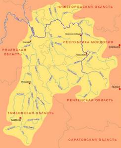
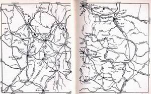
Map of rivers of the Tambov region According to the existing classification, there are no large rivers in the region, only small and medium ones.
- Tsna River
. Third-order tributary, river basin Volga. The total length of the river is 446 km, of which more than 300 km flows through the Tambov region. The river originates in the southwest of the region, flows north and goes into the territory of the Ryazan region.
- Karachan River
. Second-order tributary, Don River basin. The river originates in the Tambov region and goes to the Voronezh region. Currently, the Karachan River is shallow. In the spring, during the flood period, the river does not even overflow its banks. In summer, Karachan becomes so shallow that in most places you can ford it. Among the fish species found in the river are: chub, rudd, gudgeon, roach, bleak, pike, and ide.
- Crow River
. Second-order tributary, Don River basin. It starts in the Penza region, flows in the Tambov region and goes to the Voronezh region. The length of the river is 454 km, of which 216 km is in the Tambov region. In the Vorona River there are such fish as: chub, ruffe, perch, pike perch, rudd, tench, gudgeon, carp, catfish, pike, bream, silver bream, roach, asp, ide, podust and fisherman.
- Savala River
(border of Tambov region and Voronezh region). Second-order tributary, Don River basin. The length of the river is 285 km, of which 119 km are within the Tambov region, the rest of the river is located on the territory of the Voronezh region. The riverbed is winding and the current is calm. There is a lot of fish in the river, of which pike, perch, roach, rudd, crucian carp, bream, and carp predominate.
- Bityug River
. First order tributary, left tributary of the Don River. The length of the river is 379 km. In the Tambov region, the length of the river is 99 km. It flows from east to west and goes into the territory of the Voronezh region. Its waters are home to rudd, roach, ruff, chub, pike, ide, bream, perch, crucian carp, tench, and burbot.
- Voronezh River
. First order tributary, left tributary of the Don River. Within the Tambov region, the length of the river is 22 km. The river flows from east to west and goes into the territory of the Lipetsk region. The Voronezh River is inhabited by fish: Ukrainian lamprey, sterlet, pike, bream, asp, silver bream, Volga podust, grass carp, gudgeon, chub, dace, ide, sabrefish, minnow, roach, rudd, tench, char, catfish, burbot, ruff, river perch, pike perch, bleak, verkhovka, crucian carp, carp.
- Matyra River
. Second-order tributary, Don River basin. The length of the river is 180 km. The length of the river within the Tambov region is 120 km. It originates within the Tambov region and goes to the territory of the Lipetsk region.
- Chamlyk River
. Right tributary of the Bityug River. Don's pool. Length 51 km, basin area 518 km². Fishing on the Chamlyk River is open to the public.
- River Polka (Melisya)
. Flows in the Ryazan region, Tambov region. The mouth of the river is located 17 km along the left bank of the Istya River. Istya is the right tributary of the river. Okie. The length of the river is 18 km, the drainage basin area is 101 km². R. This is a flat river with high spring floods. In recent years, the ecology of the river has improved, catfish and rotan goby have appeared. Fishing is popular all year round, but in winter the fish suffer from death, so most of the fish migrate to the Oka River in the fall, and in the spring they rise again from the Oka and feed and spawn here.
Lakes
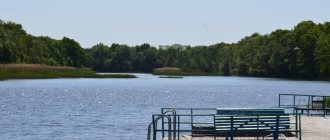
There are about 300 lakes on the territory of the Tambov region, with a total area of 88.6 km2. The lakes are small in size and are located on floodplains, occasionally on river terraces and watersheds. Large floodplain lakes are located in the river valley. Crows. Lake Ramza is the largest in the Tambov region (area 250 hectares, depth up to 2 m, about 60 years ago it was more than 4 m). The bottom of the lake is covered with a layer of black, greasy silt (sapropel) with the smell of hydrogen sulfide. In 1990, white swans, water hens, and several species of ducks settled on Ramza. The lake is rich in fish. Below are the fish-rich lakes Kipets, Ilmen, and Semerka. At the bottom of Lake Ilmen there are 40-50 thousand tons of sapropel. Smaller lakes are oxbow lakes on the river. Vorona is Prorva, Lebyazhye, Zverinoye, Kurganskoe, etc. In the river valley. Tsna also has small lakes: Knyazhevo, Chistoe, Orekhovoe, Krutoe, Tyoploe, etc. Some of the Tsna lakes became shallow, and they turned into swamps. Some lakes are quite deep and drain into the river. Tsnu. Thus, Lake Svyatovskoye near the city of Tambov has a depth of 12-13 m. On the terraces of Tsna the lakes Chistoe, Krugloye, Berezovoye, and Karasevo stretch out in a chain. Lake Chistoe has been declared a natural monument.
Ponds and reservoirs
In addition to natural surface water bodies, there are 901 ponds and reservoirs in the region, with a total water reserve of 534.5 million m3. Of these, 764 are ponds and 237 reservoirs, including 21 fish farms. They retain up to 40% of spring and up to 80% of storm runoff from the gullies and rivers on which they are built. The largest reservoirs are Tambov on the river. Lesnoy Tambov, Chelnavskoye, Shushpanskoye, Kershinskoye, Yaroslavskoye. To artificial structures on water bodies that partially regulate river flow. Tsna also includes 10 waterworks of the Tsna lock system, which serve to supply water to industrial enterprises in the cities of Tambov, Morshansk and Kotovsk, irrigate land and create a favorable water-air regime for floodplain agricultural land. The total volume of water regulated by hydraulic structures is 57.8 million m3.
Team Nomads
Tsna is a river in the Tambov and Ryazan regions of Russia, a left tributary of the Moksha River (Oka-Volga basin). The cities of Kotovsk, Tambov, Morshansk, and Sasovo are located on the river. It begins in the Sampursky district from the confluence of the Bely Plyos and Mokraya Vershina rivers. Receives numerous tributaries on the right and left: Karian - length 48 km, Lipovitsa - 52 km, Lesnoy Tambov - 89 km, Chelnovaya 121 km, Kersha with Khmelina - 86 and 49 km, Kashma with Bolshoy and Maly Lomovis - 111, 106, 66 respectively km, Serp - 66 km, etc.
Tambov city and its environs Tsna River
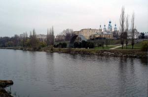
Tsna River
Tsna River
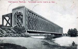
The first small hydroelectric power station in the Tambov region was built within the city of Tambov in 1912. Widely used for names of cafes, hotels and other objects.
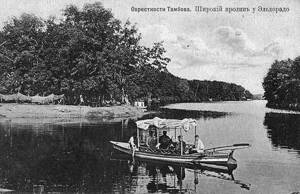
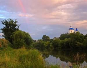
Description A calm, flat river, heavily regulated by dams, navigable in places from Tambov itself. The list of inland waterways of Russia includes a section from the mouth to the village of Tensyupino with a length of 47 km (2002). The left bank is treeless, heavily populated, but the villages are mostly 1-3 km from the river. Along the right bank there is a strip of forest almost everywhere, but it comes out to the water only in certain places, since it was cut down during the Great Patriotic War. On the banks of the Tsna River there is a famous Holy Spring in Tambov and nearby regions, located in the village of Tregulyai. In summer, many people come there to drink from the spring or take bath.
The Tsna below Tambov is a winding, calm river, 40-80 m wide, flowing through a wide valley with a large number of creeks, oxbow lakes, and channels where you can go fishing. There are reeds and bushes along the banks. The water is noticeably polluted. From Tambov to Morshansk there are 5 dams with locks. The first is in the village of Tambov Forestry (village). The second is near the village of Goreloye. Beyond it the river makes a long loop. Near the village of Troitskaya Dubrava there is a third gateway. Behind the village of Kuleshovo there is an oak forest. The forest approaches the shore and near the village of Perkino.
Below Perkino, the Semikinsky Canal begins, significantly shortening the route along Tsna. In the Tsna floodplain at Perkino, Semikino and below there are labyrinths of oxbow lakes overgrown with reeds. Tsna River
Below the village of Semikino are lakes Lebyazhye and Orekhov Zaton - the largest floodplain lakes on the Tsna River. Below Lake Orekhov Zaton on the high right bank is a natural viewing platform, from where a panorama of the village of Kulevatovo, the floodplain of the Tsna River, and the mouth of the Chelnova River can be seen. The fourth dam is behind the village of Mamontovo, the fifth is in Morshansk.
Below Morshanska Tsna it becomes wider, the current becomes faster, and beaches with fine, sometimes silty, sand appear. The banks are mainly meadow, only near Mutasyevo on the right bank a forest approaches like a wedge, to which a creek leads. In front of the village of Serpovoye is the sixth dam. Ten kilometers from the dam after the mouth of the Serp tributary, on the right high bank there is a pine forest. Local residents call this tract Serpovsky Utes. There is a pine forest facing the river in front of Rysla; behind the village there is a floating bridge. There is a dam near the village of Chernitovo. Behind the dam along the banks there are again meadows. The river becomes wide (from 100 to 200 m).
Before the last dam (hydroelectric power station), the river forms a reservoir about 6 km long and 0.5 km wide. There is also a dam in the area of the villages of Aglomazovo and Tensyupino, where the river overflows for about 1 km. But after the reconstruction, the dam began to collapse year after year, and currently the river has become very shallow. Below the dam, the Tsna channel narrows to 40-50 m, the current accelerates, sandy rifts and shoals appear. The forest approaches the water in the form of separate islands. During Soviet times, the river was used for navigation along the entire length of the navigable section starting from Tambov. For passenger shipping, hovercraft of the Zarnitsa type were used. Widely used by tourists for rafting.
Tsna river - Sasovo city
Tributaries (km from the mouth] 22 km: Aleshnya River 31 km: Vyalsa River 67 km: Vysha (Noksa) River 74 km: Aza River 98 km: Shacha River 187 km: Kashma River 200 km: Piterka River 222 km: Kersha River 246 km: Chelnovaya River 365 km: Lesnoy Tambov River 375 km: Lipovitsa River 381 km: unnamed river, near the village of Vorontsovka 386 km: Karian River 406 km: Antyushevka Stream 420 km: Osinovka River 425 km: Ponzari River Tsna River
LARGE TRITUTARIES OF THE TsNA RIVER Lesnoy Tambov is a river in the Tambov region of Russia, a right tributary of the Tsna (Volga basin). The length of the river is 89 km. According to the State Water Register of Russia, it belongs to the Oka Basin District, the water management section of the river is Tsna from the source to the city of Tambov, the river sub-basin of the river is Moksha . The river basin is Oka. The city of Rasskazovo is located on the river. Tributaries (distance from the mouth): Pechera (74 km), Arzhenka (47 km), Shevyrlyai (31 km), Tsarevka (4 km) - right; Naru-Tambov (5.2 km) - left. Moksha river basin Tsna river
Chelnovaya is a river in the Tambov region of Russia, a left tributary of the Tsna (Volga basin). It originates in a beam near the village. Neznanovka, Tambov district, then flows through Sosnovsky and Morshansky districts; length 121 km; the current is tortuous; the direction is meridional, from south to north, near Sosnovka it turns sharply to the east and for the last 40 km it flows in this latter direction. The shores of Chelnova are densely populated. Not navigable. Tributaries (distance from the mouth): Gryaznushka (16.8 km), Lamochka (35 km), Izovka (52 km), Gryaznushka (56 km), Kriusha (106 km), Dvoinya (115 km) - left; Pishlyayka (17.1 km), Sourava (72 km) - right. Lipovitsa is a river in the Tambov region of Russia, a left tributary of the Tsna (Volga basin). The Lipovitsa River is formed by the confluence of the Bolshaya Lipovitsa and Sukhaya Lipovitsa rivers. In some sources, Sukha Lipovitsa[3] or Bolshaya Lipovitsa can be considered as the upper reaches of the Lipovitsa. The river flows in a southeast direction. The mouth of the river is located 375 km along the left bank of the Tsna River. The length of the river is 11 km (52 km from the source of Bolshaya Lipovitsa and 52 km from the source of Sukha Lipovitsa). According to the State Water Register of Russia, it belongs to the Oka Basin District, the water management section of the river is Tsna from the source to the city of Tambov, the river sub-basin of the river is Moksha. The river basin is Oka.
Tsna river near Morshansk
Karian is a river in Russia, flowing in the Tambov region. Left tributary of the Tsna. The river originates in the village of Filimonovka, Tokarevsky district. Flows north across open areas. Near the village of Aleksandrovka it receives the waters of its right tributary, the Klyuch River. The mouth of the river is located near the village of Znamenka, 386 km along the left bank of the Tsna River. The length of the river is 48 km. According to the State Water Register of Russia, it belongs to the Oka Basin District, the water management section of the river is Tsna from the source to the city of Tambov, the river sub-basin of the river is Moksha. The river basin is Oka. According to the geoinformation system for water management zoning of the territory of the Russian Federation, prepared by the Federal Agency for Water Resources: Water body code in the state water register - 09010200212110000028731 Code for hydrological knowledge (HI) - 110002873 Basin code - 09.01.02.002 Volume number for GI - 10 Issue for GI - 0 Tributaries (km from the mouth] 2 km: Shebolda stream 20 km: river without name, near the village of Aleksandrovka River Tsna
Kersha is a river in the Tambov region of Russia, the right tributary of the Tsna (Volga basin). It is formed by the confluence of the Dalnyaya Kersha and Nizhnyaya Kersha rivers. The length of the river is 53 km (86 km including Near Kersha). The Kershi Valley opens with a majestic panorama, consisting of steep banks, wide water meadows and the river itself, narrow, meandering like a snake, carrying its purple waters towards the Arable Corner, to the east. In some places the banks of the river were so steep that Kersha seemed like a mountain river rustling at the bottom of a deep gorge. We approached the edge of the steep bank and cautiously looked down, where the water flow was seething and swirling. In Pakhotny Uglu, the Kersha is a fairly shallow river, 10-15 m wide, flows in a deep ravine and forms a waterfall about 2 m high. From Pakhotny Uglu to the village of Krivopolyanya, the flow is average, there are many small sections, along the river there are trees and shrubs. In front of Krivopole, under the cliff on the right bank, there is a spring with good water. After Krivopolyanya the current is fast, the channel is very winding, narrow and deep enough for a kayak. Near the village of Fedorovskoye, on the high right bank, a forest begins. Further to the very mouth of the Kersh it flows through the forest; The floodplain is swampy, there are few places to stay overnight. Beyond Fedorovsky, the river winds strongly, and there are constantly forest rubbles, which take a lot of time and effort to overcome. The river has this character for about 15 km, after which Kersha expands to 30 - 50 m - the Steklyanny Reach begins. Behind it, the river narrows again, winds strongly, but there are no blockages. 5 - 7 km from the reach on the left high bank there is a cordon called Ugol. After the cordon, the Kersha flows through a swamp; The channel is 5 - 7 m wide, the current is fast, there are few turns, it resembles a canal. 3 km after the cordon, the river widens sharply, and the Khmelina River flows into it from the left, on the bank of which, 200 m from the mouth, is the Prokudinskie Mosty cordon. After merging with Khmelina, the character of Kersha changes dramatically: the river is wide - 20 - 30 m, the current is weak, there are no blockages. The floodplain is swampy. Only in three places does dry pine forest approach the left bank. Reaches are common. In the future, the character of the river is constant. Approximately 25 km from the mouth of the Khmelina, on the left bank, the structure of the Vyunsky forestry appears - the Borkovsky cordon and the village of Kershinsky Borki. After 1.5 - 2 km there is a bridge. Soon the river expands sharply, forming a huge backwater, dammed by dams, through which Kersha flows into Tsna. At the mouth of the Kersha there is a camp site for the Morshansky locomotive depot. In the Tsna basin there is the largest forest area in the central black earth district, its total area is 210 thousand hectares, which is 73% of the region’s forest area. In the Tsninsky forest, it is possible to organize a reserve in the lower reaches of the Kersha and Khmelina rivers, a national park in the Tsna floodplain (“Ivensky Razlivy”) with an adjacent forest area in the Sokolnicheskoye forestry of the Morshansky district, a natural park in the valley of the Tsna river from the city of Kotovsk to the village of Perkino. The river is home to the fast grass (Alburnoides bipunctatus), listed in the Red Book of the Russian Federation as a declining species. Until the 1990s, there was a decline in numbers in the rivers of the European part of Russia. Similar trends were also observed in all European countries. However, over the past 10-15 years, due to a decrease in anthropogenic pressure on river ecosystems, there has been an increase in the number of this species and an increase in its findings in rivers.
Tsna River near Morshansk
Tributaries Tributaries (distance from the mouth): Khmelina (13 km), Dalnyaya Kersha (53 km) - left; Kazychka (48 km), Nizhnyaya Kersha (53 km) - right. Etymology In the name Kersh, the root “ker” is apparently associated with the form “ker’” preserved in the Ryazan region, which means “village”. The ending "sha" of words of Mordovian origin means "river" or "water". Also, the Mordovian-Erzya “kersh” means left.
Serp (Vobsha) is a river in the Tambov region of Russia, a left tributary of the Tsna (Volga basin). The mouth of the river is located 160 km along the left bank of the Tsna River. The length of the river is 66 km. Before the confluence of the Razazovka River, 19 km from the mouth it is called Vobsha. Tributaries (from the mouth): Razazovka (19 km), Kuneva (45 km) - right. Tsna River
LOCATION OF THE TSNA RIVER Tsna is a left tributary of the Moksha , a calm flat river, heavily regulated by dams, navigable all the way to Tambov. The left bank is treeless, heavily populated, but the villages are mostly 1-3 km from the river. Along the right bank there is a strip of forest almost everywhere, but it comes out to the water only in certain places.
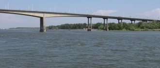
Length of route sections: Tambov—Morshansk—145 km, Morshansk—Sasovo—190 km.
mouth of the Tsna River - Moksha River
The journey around Tsna begins from Tambov, a large industrial and cultural center of the country. The city was founded in 1636 as a fortress on the abatis line. In Tambov you can visit the local history museum, art gallery, see the Gostiny Dvor building (18th century), and the Lukyanenko mansion (1815), built in the Empire style. During the Great Patriotic War, residents of the Tambov region initiated the collection of funds to assist the front. The monument-tank “Tambov Collective Farmer” reminds of this initiative. The Tsna below Tambov is a winding, calm river, 40-80 m wide, flowing through a wide valley with a large number of creeks, oxbow lakes, and channels where you can go fishing. There are reeds and bushes along the banks. The water is noticeably polluted. When passing a tug with a barge, you must be careful: the barge can push you to the shore.
Tambov - flood on the Tsna River
From Tambov to Morshansk there are 4 dams with locks. The first of them is 40 km from Tambov. Beyond it the river makes a long loop. Near the village of Troitskaya Dubrava there is a second lock (the drift is along the left bank). Behind the village of Kuleshovo in the oak forest is a good place for a camp. The forest approaches the shore and near the village of Perkino. Below Perkino, the Semikinsky Canal begins, significantly shortening the route along Tsna. In the floodplain of Tsna near Perkino, Semikino and below there are labyrinths of oxbow lakes overgrown with reeds. The third dam is behind the village of Mamontovo, the fourth is in Morshansk (the runoff is on the right side). In Morshansk you can interrupt your trip or sail further. The city has a local history museum (it has a good art department), among the attractions is the Trinity Cathedral (mid-19th century), and the pillars of the Tambov outpost. Below Morshanska Tsna it becomes wider, the current becomes faster, and beaches with fine, sometimes silty, sand appear. The banks are mainly meadow, only near Mutasyevo on the right bank a forest approaches like a wedge, to which a creek leads. In front of the village of Serpovo is the fifth dam. You can go around it along the old channel (it approaches the canal itself about a hundred meters in front of the lock). Two hours away from the dam on the right high bank there is a pine forest. There is a pine forest facing the river in front of Rysla; behind the village there is a floating bridge. There is a dam near the village of Chenitov, the diversion is inconvenient, it is better to use a sluice. Behind the dam along the banks there are again meadows. The river becomes wide (from 100 to 200 m). Before the last dam, the river forms a reservoir about 6 km long and 0.5 km wide (the drift is on the left side near the hydroelectric power station building). Below the dam, the Tsna channel narrows to 40-50 m, the current accelerates, sandy rifts and shoals appear. The forest approaches the water in the form of separate islands, so a place for a bivouac must be chosen in advance. The trip around Tsna usually ends in Sasovo. The boats are being dismantled on the left bank in front of the railway bridge. From the river to the station it is about 1 km.
____________________________________________________________________________________________
SOURCE OF INFORMATION AND PHOTO: Team Nomadic Tsna // Encyclopedic Dictionary of Brockhaus and Efron: In 86 volumes (82 volumes and 4 additional). - St. Petersburg, 1890-1907. Tsna (a river in the Tambov and Ryazan regions) - an article from the Great Soviet Encyclopedia Tsna in the “Dictionary of Modern Geographical Names” State Water Register of the Russian Federation: Tsna. https://www.skitalets.ru/books/korobkov_miheev/18_tsna.htm Geographical and local history auto expedition “TsNA-2012” Tambov, Tsna River Embankment on the Yandex.Panorama service. https://tambovia.ru/reka_tsna.html https://lipfish.ucoz.ru/