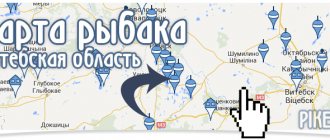
Fishing satellite map of lakes in Moscow and the Moscow region watch online
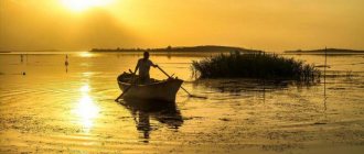
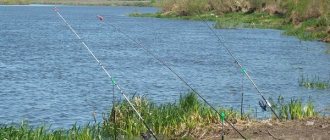
Due to certain circumstances, fishermen often have to look for new places for fishing. Doing this is not as easy as it seems at first glance. Come and wind many kilometers along the coast in search of promising fishing spots. And this task often takes more than one day. That is, the fisherman, instead of fishing, spends his time searching for a place.
Satellite maps can make it easier for fishermen to find fishing spots. This material contains an interactive fishing satellite map of lakes in Moscow and the Moscow region. Satellite maps will allow you to navigate the area, find the optimal path to a body of water, identify landmarks, find promising fishing spots and much more.
The peculiarity of satellite maps is their accuracy and interactivity. In fact, a satellite map is a set of photographs taken from a satellite. And because these photographs are taken at high resolution, satellite maps provide fantastic detail and accuracy of information. And if we add interactivity to this, that is, it is possible to zoom in and out of the map image, the possibilities of such maps are simply unlimited. Many fishermen have already begun to use satellite maps to search and explore promising fishing spots. We invite you to start using this excellent tool for the modern fisherman.
An interactive satellite map of lakes in Moscow and the Moscow region will allow you to obtain the most accurate information about the reservoir and directions to it. A special feature of the map is that you can change its scale at your discretion. The map shows all the largest lakes in Moscow and the Moscow region. A complete list of reservoirs indicated on the map is located in the form of a list under the map itself. An interactive satellite map of reservoirs is available for viewing online on our fishing portal absolutely free.
In addition, if you are interested in other reservoirs of this region in addition to the lakes of Moscow and the Moscow region, you can familiarize yourself with the material “Fishing satellite map of Moscow and the Moscow region.” This material contains an interactive satellite map of reservoirs in Moscow and the Moscow region, on which all the largest reservoirs in this region are marked. This map is available for viewing online absolutely free of charge, without registration and without SMS.
Enjoy watching and happy fishing!
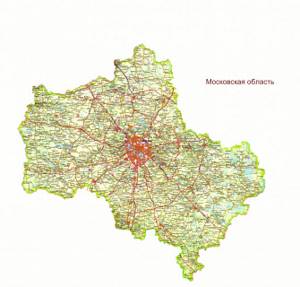
Districts of the Moscow region on the map
The entire territory of the region is divided into 29 districts, which are grouped around Moscow. If you zoom in, you can view all the districts on the map of the Moscow region in detail, including their cities, streets, houses, bus stations and other objects. The largest districts in terms of population are located in the northeast of the region - Pushkinsky and Sergiev Posad. The fewest people live in the Volokolamsk, Zaraisk and Lotoshinsky districts.
Highways and federal highways diverge from the center of the region in a radial direction - they are shown on a map of the Moscow region with diagrams. In the region, highways are highly congested. The highest transport activity is observed in the southern regions of the region. Less congested areas include:
- Shatursky;
- Klinsky;
- Lotoshinsky;
- Sergiev Posadsky.
In the north-west of the region, using a detailed road map of the Moscow region, you can consider the location of the Moscow-St. Petersburg expressway.
There are 2 international airports in the region. Freight and passenger traffic is also carried out via river canals. The main ports in the region are located in Kolomna and Serpukhov.
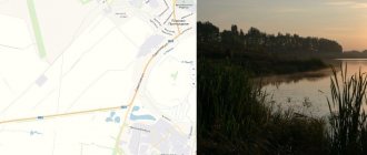
Interactive satellite map of lakes in Moscow and the Moscow region watch online:
Scale: variable.
Lakes and ponds of Moscow and the Moscow region marked on the map:
- Lake Aplatovo;
- Lake Baboshkino;
- Lake Bezdonnoe (Lake Forest Park);
- Lake Beloye (Kosinsky Three Lakes);
- Lake Biserovo;
- Lake Bolshoye Sokolovo;
- Lake Velikoye (Shatura Lakes);
- Lake Glubokoe (Shatura Lakes);
- Lake Glubokoe (Ruzsky district);
- Lake Dolgoye (Myshetsk lake group);
- Lake Dolgoye (Shatura Lakes);
- Lake Dilevo (Lake Forest Park);
- Lake Dubovoe (Klepikovskaya system of lakes);
- Lake Imles (Klepikovskaya system of lakes);
- Lake Karasovo (Shatura Lakes);
- Lake Kiyovo;
- Lake Krugloye (Myshetskaya lake group);
- Lake Krugloye (Lotoshinsky district);
- Lake Likharevo (Klepikovskaya system of lakes);
- Lake Lukovo;
- Lake Maryino;
- Lake Mazurinskoye (Lake Forest Park);
- Lake Muromskoe (Shatura Lakes);
- Lake Nerskoye (Myshetsk lake group);
- Lake Pavlenskoe;
- Lake Panino;
- Lake Poletskoe;
- Lake Senezh;
- Lake Svinoshnoye (Shatura lakes);
- Lake Svyatoe (upper) (Klepikovskaya system of lakes);
- Lake Svyatoe (lower) (Klepikovskaya system of lakes);
- Lake Svyatoe (Shatura Lakes);
- Lake Svyatoe (Kosinsky Three Lakes);
- Lake Torbeevskoe;
- Lake Trostenskoye;
- Lake Black (Kosinsky Three Lakes);
- Lake Yushino (Lake Forest Park);
- Bezmenovsky quarry;
- Bear Lakes;
- Nara Ponds;
- Tsaritsyn Ponds.
Rivers and lakes of the Moscow region
The last glaciation, which ended about 10-12 thousand years ago, formed the river network of the Moscow region : more than two thousand large and small rivers, numerous glacial lakes, gradually turning into swamps.
♦ On the topic: One-day excursions from Moscow: cities, estates, temples and monasteries
Valley of the Uchi River in Fedoskino
The rivers of the Moscow region belong to two basins: Volzhsky and Oksky . The watershed between them runs along the Smolensk-Moscow Upland and the Klinsko-Dmitrovskaya ridge .
The Volga flows in the very north of the Moscow region, on the border with the Tver region . There, near the city of Dubna , the Moscow Canal begins , connecting the Moscow River with the Volga. The largest tributaries of the Volga within the boundaries of the Moscow region are the Dubna and Sestra . They originate on the northern slopes of the Klinsko-Dmitrovskaya ridge; in the upper reaches they flow in deep valleys, often without terraces. In some places there are rapids and rifts. When reaching the Upper Volga Lowland, the current becomes calmer.
In the south of the region flows the Oka , a tributary of the Volga (which flows into the latter near Nizhny Novgorod ). Here lies the border between the Moscow, Kaluga and Tula regions. The Oka flows freely through a wide terraced valley, its banks are sometimes steep, and landslides occur. Oka is also a natural border between two natural zones. To the north of it, mixed forests grow; to the south, in the ravines and ravines of the Central Russian Upland, remnants of once numerous broad-leaved forests have been preserved.
Another important river in the Moscow region is the Moskva River . It originates near the village of Starkovo in the Mozhaisk region, and near the city of Kolomna it flows into the Oka. For a long time, the Moscow River was characterized by inconsistent flow, sometimes almost drying up, and sometimes sweeping away everything in its path. Now the water level in the Moscow River is regulated: the riverbed has been straightened, a system of reservoirs and locks has been built, and the flow of Volga water is ensured through the Moscow Canal.
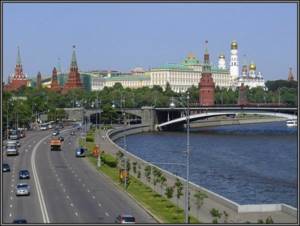
Moscow River and Moscow Kremlin
In the west and south of the region flow the main tributaries of the Moscow River: Ruza, Ozerna, Istra, Pakhra, Koloch . Sloping and soft banks give way to steep and steep ones, and among the low hills the rivers form wide bends.
The largest tributaries of the Oka are the Nara, Klyazma, and Lopasnya .
The Tsna, Nerskaya, and Yalma rivers flow through the Meshcherskaya lowland . Their shores are often muddy and marshy, and the water has a reddish tint due to iron impurities.
Another river in the Moscow region, but this time man-made, is the Moscow Canal , the length of which reaches 128 km. Dmitlag prisoners in 1932-1937. Thanks to the canal, Volga water began to flow into the Moscow River, and the problem of water supply to the capital was solved. Moscow became a port of five seas, gaining access to the Baltic, White, Caspian, Azov and Black seas. In place of lowlands, swamps, rivers and streams, picturesque reservoirs were formed: Ikshinskoye, Pestovskoye, Pyalovskoye, Klyazminskoye, Khimkinskoye . Currently, they have become popular recreation areas for Muscovites and residents of the Moscow region. Boarding houses, holiday homes, yacht clubs, sports and fitness centers, etc. have been built here. Unfortunately, the shores are being actively built up with elite cottage villages, almost blocking access to the water.
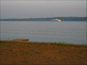
At the Ikshinskoye Reservoir
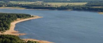
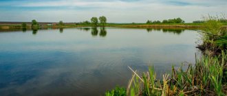
Among the numerous lakes in the Moscow region, the largest is Senezhskoye , which is located near the city of Solnechnogorsk . It is of artificial origin. Its area is 15.4 sq. km.
Entire “constellations” of lakes have formed in the Meshcherskaya Lowland The largest are located near Shatura (Lake Svyatoe) and near the village of Cherusti (Lake Velikoye and Dolgoe).
© Website “On the Roads of the Middle Way”, 2009-2021. Copying and reprinting of any materials and photographs from the site anashina.com in electronic publications and printed publications is prohibited.
Online services that help me travel:
- Cheap flights: Aviasales
- Hotels and recreation centers: Booking
- Travel insurance: Cherehapa
- Excursions in Russian: Tripster and Sputnik8
View all
Map of the Moscow region
map of the Moscow region with roads and cities:
The relief of the Moscow region is clearly flat, with small hilly hills. The climate of the region is temperate continental with a clearly defined change of seasons; High temperatures in the summer months lead to large peat fires. The basis of the forest belt is made up of coniferous (spruce) and broad-leaved (alder, birch) plantings. All water arteries of the Moscow region belong to the Volga and Oka river basins; the northern part of the region is crossed by the Moscow Canal, which forms numerous reservoirs and supplies drinking water to the entire region. Shallow lakes and swamps are also varied. More than two hundred specially protected natural areas have been created in the region, the most significant of which are the Zavidovo National Park, the Lake Kiyovo monument, botanical gardens and dendrological parks. Mineral resources are represented by quartz and glass sands, deposits of clay, limestone, phosphorites, peat and mineral springs.
The national composition of the subject is diverse: the main ethnic group is Russians, the next in number are Ukrainians and Tatars. Every year the number of illegal labor migrants from Uzbekistan, Tajikistan, Moldova, Armenia, Azerbaijan and other republics, forming places of compact residence, is increasing. Leading industries are mechanical engineering and metalworking, chemical, food, light, as well as construction of buildings and structures; Traditional arts and crafts are developed. A large number of enterprises of the country's defense complex are concentrated in the Moscow region. Agriculture is represented by crop production (cereals, potatoes) and livestock farming (dairy and meat production). The largest transport hubs pass through the territory of the region. Rail transportation is carried out in 11 different directions, the network of highways is overloaded with a huge flow of cars; There are two international-class passenger airports (Domodedovo and Sheremetyevo), the Bykovo helipad and the Chkalovsky military airfield. Passenger and freight transportation is carried out along the Volga, Oka and Moscow Rivers. In terms of the number of attractions and memorable places, the region occupies a leading place in Russia and attracts a huge number of tourists from all over the world. Estate complexes, architectural monuments, ancient cities, places of worship, monuments of military glory, museums and theaters are guardians of unique cultural, historical and archaeological values.
Also, interesting information about the cities of the Moscow region can be found in our articles:
Map of the borders of the Moscow region Moscow on the map of Russia Road map of the Moscow region Map of Kievsky station Map of Moscow with house numbers Large map of Moscow Map of Moscow roads Tourist map of the Moscow River Wi-Fi map of Russian cities Moscow from satellite in real time 3D map of Moscow Virtual walks around Moscow Video on Google Maps Moscow churches on the Moscow Metro map
Satellite maps of cities in the Moscow region:
Moscow from the satellite Aprelevka from the satellite Balashikha from the satellite Bronnitsy from the satellite Vereya from the satellite Vidnoye from the satellite Volokolamsk from the satellite Voskresensk from the satellite Vysokovsk from the satellite Golitsyno from the satellite Dedovsk from the satellite Zhukovsky from the satellite Dzerzhinsky from the satellite Dmitrov from the satellite Dolgoprudny from the satellite Domodedovo from the satellite Drezna from satellite Dubna from the satellite Yegoryevsk from the satellite Satellite map of Zhukovsky Zheleznodorozhny from the satellite Zaraysk from the satellite Zvenigorod from the satellite Ivanteyevka from the satellite Kashira from the satellite Klimovsk from the satellite Klin from the satellite Kolomna from the satellite Kotelniki from the satellite Korolev from the satellite Krasnoarmeysk from the satellite Krasnogorsk from the satellite Krasnozavodsk from the satellite Krasnoznamensk from the satellite Kubinka from the satellite Mytishchi from the satellite Kurovskoye from the satellite Noginsk from the satellite Odintsovo from the satellite Likino-Dulevo from the satellite Lobnya from the satellite Losino-Petrovsky from the satellite Lukhovitsy from the satellite Lytkarino from the satellite Satellite map of Lyubertsy Mozhaisk from the satellite Satellite map of Mytishchi Naro-Fominsk from the satellite Satellite map of Noginsk Satellite map of Odintsovo Ozherelye from the satellite Lakes from the satellite Sergiev Posad from the satellite Orekhovo-Zuevo from the satellite Pavlovsky Posad from the satellite Peresvet from the satellite Podolsk from the satellite Satellite map of Serpukhov Protvino from the satellite Pushkino from the satellite Pushchino from the satellite Ramenskoye from the satellite Reutov from the satellite Ruza from the satellite Satellite map of Sergiev Posad Serpukhov from the satellite Khimki from the satellite Solnechnogorsk from the satellite Staraya Kupavna from the satellite Stupino from the satellite Taldom from the satellite Troitsk from the satellite Satellite map of Shchelkovo Fryazino from the satellite Satellite map of Khimki Khotkovo from the satellite Chernogolovka from the satellite Chekhov from the satellite Shatura from the satellite Shchelkovo from the Shcherbinka satellite from the Elektrogorsk satellite from the Elektrostal satellite from the Elektrougli satellite from the Yubileiny satellite from the Yakhroma satellite from the satellite