What data does the map of holes, depths and fishing spots convey?
The fishing depth map is based on a complex system based on Yandex.Maps, combining a combination of 3 cartography services, this gives a more accurate result on river depths and the search for promising fishing spots.
At the moment, the Russian.Fishing depth map accurately conveys the parameters of the depths of navigable rivers, seas and oceans, shows the fishing spots of all participants and calculates potentially interesting places for fishing in the form of holes - the deepest points of a reservoir or river. ▲ 3.7 (example of depth) - display of depth in units (meters), it is important to know that the exact depth indicator is located exactly at the point where the arrow points.
How to use the fishing card?
We tried to simplify the use of the depth map and reduce all the complexities to simple controls. So, let's begin:
- When you first visit the page, enter the name of the desired location in the search field.
- Pits button, a very complex system for automatically identifying holes with a depth of 3 meters in a particular reservoir, in some cases the depth of the holes will be from 2.5 meters, this is due to the surrounding bottom topography, for example, if there is a bottom topography with a depth of up to 1 meter around, then the system will define a depth of 2.5 meters as a hole, which is natural for fishing. When you press the button, areas with the depths of all holes known to the system will be displayed. It is very important to know that the holes are displayed outside the fairway area, that is, the depths will be natural.
- The Coordinates button displays the latitude and longitude of the selected point, press, then click on the desired location, information with data will open. This is necessary for several purposes, for example, you are going fishing with a boat, enter the data of the selected hole into your GPS receiver, echo sounder, chart plotter and follow to the required point. Or you have chosen a point with the depth of the river you like in a place without an address, enter the received coordinates into the navigator and follow the route.
- The Where Am I button was primarily created to determine your geolocation; it may not work on some devices, in which case use the search.
- The Distance button allows you to find out any distance between two or more points. After clicking, click on the map to the desired location, by moving the line, click again to determine the final result. It was specially developed to determine the distance of the fisherman to a specific hole, for example, you are sitting fishing, the depth is visible on the map, by simple manipulations, you can find out the distance from you to the desired place.
- The Whole World button allows you to see the depths of seas, oceans and rivers around the globe. By default it opens in the Primorsko-Akhtarsk area.
- The Places button allows you to see all the fishing spots that our bloggers have added; when clicked, it shows markers with fishing coordinates and a link to the description of this fishing spot.
It is important to understand!!! River depths and automatic determination of hole depths are provided at their maximum point from the water surface; the service cannot correctly determine the exact length of the hole, its direction along the coastline, a waterfall, a spit or a riffle, and cannot accurately indicate the entrance and exit from the hole. To do this, you need to learn on your own, and most importantly, to read the river correctly and correctly use your knowledge in conjunction with the depth map data.
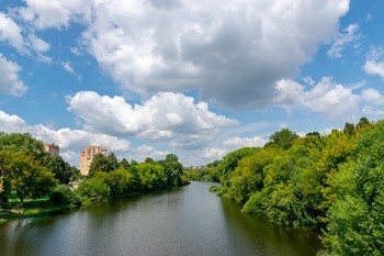
Free fishing in the Moscow region
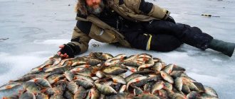
The abundance of bodies of water around Moscow is a real haven for tourists vacationing with fishing rods. But only experienced lovers of quiet hunting know that the fish do not bite everywhere. And this does not always depend on the variety of gear, much less on its cost. Good luck will visit those fishermen who know “cool” places. Attention! Here is the most accurate selection of places in the capital region where the fish themselves ask to be in your fish tank.
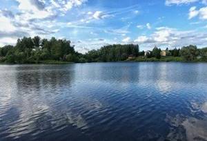
Here are the TOP 10 best places where you can fish for free in the Moscow region:
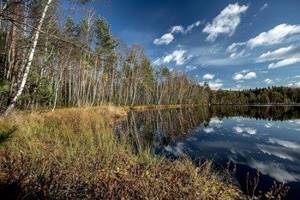
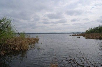
Black Lake
Description of what kind of fish is found:
An excellent place for successful fishing is Black Lake. It was formed on the site of a former peat quarry, so the purity of the water allows you to even safely swim in it. Black Lake is located among a beautiful mixed forest. Trees, birdsong and the murmur of water make Black Lake an excellent place not only for fishing, but also for relaxing with the family. And fishermen will be pleased with the pond with crucian carp and rotan.
How to get there:
By car: Along Shchelkovskoe or Yaroslavskoe highway, exiting onto Fryanovskoe highway, a little over an hour from Moscow. The lake is located 38 kilometers from the Moscow Ring Road near the intersection of the A107 highway and the Fryanovskoe highway.
By public transport: From Shchelkovskaya metro station by bus 335K (Moscow-Fryanovo) to the Betonka stop (39 stops), approximately 1:30 hours on the way. Then cross the A107 highway for 500 meters (about 8 minutes on foot from the stop).
GPS coordinates: 56.040902, 38.204376
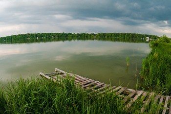
Lake Biserevo
Description of what kind of fish is found:
Experienced fishermen often visit this reservoir, as it is rich in a variety of prey. Fans of predators can try their hand at fishing for striped robber or pike, and for lovers of peaceful fishing, cupid, carp and crucian carp, and bighead carp will be excellent prey. Biserevo is a picturesque lake with shallow depth. The vast territory occupied by the reservoir will provide accommodation for a large number of vacationers. The bottom is usually muddy, but the southern coast has sand.
How to get there:
By car: Along the Entuziastov Highway (hereinafter referred to as Gorkovskoe Highway), or Nosovikhinskoe Highway to Biserevskoe Highway, approximately 30 minutes on the road from Moscow. The lake is located 22 km from the Moscow Ring Road, next to Biserevskoye Highway.
By public transport: From Kursky station by train to Kupavna station (48 minutes on the way), then either 2 km on foot, or after 1 stop by bus 37, or minibus 29, 57 to the “Cafe” stop, from the stop just cross the road to lake.
GPS coordinates: 55.766177, 38.116377
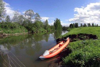
Molokcha River
Description of what kind of fish is found:
You will have to get to the river by car, going towards Makhra through the village of Karabanovo. In the summer you can catch silver bream, roach and pike from the shore, and in the fall it makes sense to come hunting for burbot. Fishing from a boat is made difficult by the presence of obstructions of branches and snags. However, near the shores it is too shallow for float fishing. The water in Molokcha is often cloudy, especially in summer, when the water area begins to bloom. Along the banks of the reservoir there is a dense forest, and on the southern side there is a small swamp.
How to get there:
By car: Take the Yaroslavskoe highway to the A-108 highway, turn onto it towards Dmitrov, get there, turn towards Strunino at the traffic light, drive along Shosseynaya street and turn towards the village of Lizunovo, then follow the road to the village of Perematkino. The distance from Mkada is 94 km and an hour and a half on the road.
By public transport: Getting to the river by public transport will not be very easy, but if you decide, the easiest way will be to get from the Yaroslavsky railway station to the Strunino station (2 hours on the way), then it is best to take a taxi and indicate the direction to side of the river, or the village of Perematkino. The taxi ride takes about 20 minutes.
GPS coordinates: 56.291923, 38.571790
4. Pakhra River
Description of what kind of fish is found:
Muddy water with riffles, in which asp, ide and chub are found, attracts anglers from all over the region. It is best to stop at widenings, as well as gentle turns of the river. You can get there by heading towards the village of Novlenskoye. Many anglers park their vehicles right next to the dam, but fishing is prohibited in this area. Above the dam there is a deeper water area with sandy shores and a calm flow of water. After passing the dam, large stones begin to lie in shallow water. It is in this turbulent stream that the white predator often bites.
How to get there:
By car: Along the Kaluzhskoe highway in front of the village of Vatutinki, take the alternate and turn onto Vlasyevskaya street, drive along this street to the village of Polivanovo. The river is located near the Polivanovo estate, 28 km from the Moscow Ring Road and half an hour’s drive. An alternative option is to drive along the Warsaw highway to the village of Oznobishino and turn towards the village of Shchapovo. Travel time will be approximately 35-40 minutes.
By public transport: You can get to the river on your own from the Kursky railway station to the Podolsk station (1 hour on the way), from the station wait for bus 1034 to the village of Polivanovo, the travel time will be 40 minutes (19 stops).
GPS coordinates: 55.450490, 37.391486
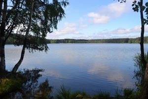
Lykovsky Pond
Description of what kind of fish is found:
The reservoir is surrounded on almost all sides by forest and only on one side by meadow. The water area is rich in carp fish species, as well as predators. Fishermen often visit Lykovsky Pond with a spinning rod, tempting perch and pike to bite.
How to get there:
By car: The pond is located 2 km from Vasyunino in the village of Lykovka. Travel time increases by only 10 minutes.
By public transport: You can repeat the route to the “Turn on Vasyunino” stop, but then you will have to walk about 6 km. Therefore, if you want to get to the pond without a car, then it is better to get from the Teply Stan metro station on minibus 887 to Voronovo station (a little over an hour on the road, 42 stops), and from there call a taxi to the village of Lykovka (about 20 minutes drive)
GPS coordinates: 55.248028, 36.972808
Bear Lakes
Description of what kind of fish is found:
If you want to fish from a boat, then Bear Lakes is your best choice. You can get to them either by your own transport or by bus, heading along Shchelkovskoye Highway. There is a private farm on a large lake, so fishing here is paid. However, you can fish in a nearby reservoir without paying any money. There you can catch crucian carp, roach, and on spinning rods – perch and pike. They fish on the lake both with spinning rods and with live bait. Among the usual prey there is also an eel, which will be a real crown of the fishing day. Fishing from the shore is not the best idea, since the lake is surrounded by a dense wall of reeds, and there are few approaches to the water.
How to get there:
By car: Bear Lakes are located 12 km from Moscow along Shchelkovskoye Highway. You need to get to the village “Bear Lakes”, the time in Pui will be 22 minutes.
By public transport: From the Shchelkovskaya metro station by bus (320, 321, 335k, 349, 361, 371, 378, 380, 429 - 11 stops), or by minibus 485k to the Medvezhye Ozera stop, the travel time will be 27- 30 minutes. From the stop you will immediately see the lakes; you can walk to them in 5-15 minutes.
GPS coordinates: 55.864334, 37.997368
Holy Lake
Description of what kind of fish is found:
The main feature of this reservoir is its non-freezing water surface. Fans of fishing with summer gear can enjoy their favorite activity all year round. The lake is quite deep, so there is a minimal amount of vegetation in its waters. Bream, crucian carp, pike perch and pike are not the only representatives of this water area. A vast water area with an area of 1200 hectares is surrounded by trees, as well as industrial complexes, which slightly spoils the overall landscape. This place is not suitable for those who like fishing alone, far from civilization, but fans of fishing from a boat can always use the services of rental companies who rent out boats right on the shore of the lake.
How to get there:
By car: The lake is located 2.5 km from the Moscow Ring Road along Novoukhtomskoye Highway, exit onto Kosinskoye Highway and after a Shell gas station (nearby is the Dmitrievskogo Street metro station), turn left onto Saltykovskaya Street and drive to Kosinsky Park. (An alternative option is to turn from Novoukhtomskoye Highway onto Bolshaya Kosinskaya Street, passing Kosinskoye Highway, or go straight to Kosinskoye Highway)
By public transport: Due to the opening of the metro in the summer of 2019, getting to the place has become very easy. Get to the metro station “Ulitsa Dmitrievskogo” and walk towards Kosinsky Park (about 800 m and 11 minutes).
GPS coordinates: 55.715170, 37.868984
Murom Lake
Description of what kind of fish is found:
Not far from the previous fishing spot is the Muromsky reservoir. It is known to experienced fishermen for its abundance of peaceful fish. Today's catches include bream, roach, carp and even ide. Nature is not much different from the landscapes on Holy Lake. The same trees and the top of the local power plant are visible to the eye. Vacationers are often found along the shores, so you should choose a place for fishing away from noisy companies.
How to get there:
By car: The lake is located in Shatura, about 130 km from the Moscow Ring Road. From the Moscow Ring Road you need to turn onto Lermontovsky Prospekt, then you need to turn onto Yegoryevskoye Shosse (towards Yegoryevsk, the sign will point directly to Zhukovsky). Then, before reaching Yegoryevsk, turn towards Antsiferovo (the sign will indicate that it is 33 km to Yegoryevsk). Passing Antsiferovo we will get onto the A-108 highway, turn right and go to the Shatura highway (there will be a sign for Shatura), pass Shatura and continue driving along the highway after the railway crossing there will be a left turn into the forest (with a large banner “Save the forest!”) . Then we follow this road to the lake. Travel time will be about 2.5-3 hours.
By public transport: The easiest way to get from the Kazansky railway station is to the Shatura or Botino stop (about 2.5 hours on the road). From Shatura you can call a taxi (the journey is 10 km, 25 minutes, but after entering the forest the road will not be paved), or from Botino station you can walk 2.7 km (about a half-hour walk).
GPS coordinates: 55.572255, 39.585898
9. White Lake
Description of what kind of fish is found:
The free reservoir is located above the local thermal power plant. Bottom fishing methods are popular there: feeder and cast. Carp often sit on the hook, so you need to arm yourself with powerful tackle. Fine groundbait will attract small roaches, so when fishing for carp it is worth using a mixture of broken peas, corn and other relatively large particles. Sloping banks with a hard bottom make it possible to place a large amount of gear. White Lake is perfect for both amateur fishing and a family picnic.
How to get there:
By car: The lake is located 13 km from the Holy Lake. Driving as before the Holy Lake, but without turning off, continue driving along the Shatura highway, after the village of Borduki (before reaching the village of Vlasovo) you will see a large lake to the left of the road, immediately after the lake there will be a turn to the left.
By public transport: The easiest way to get from the Kazansky railway station to the Shatura stop (about 2-2.5 hours on the way). From Shatura, take bus 26, 32, 32/26, 369m, 376, 376b, 47 and go 16 stops to the “White Lake” stop (about 40 minutes on the way).
GPS coordinates: 55.634039, 39.739734
Moscow Canal
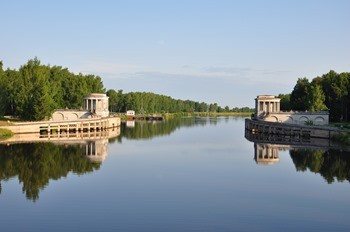
Description of what kind of fish is found:
A long canal connects two reservoirs. Along the bank of the canal you can find countless promising places where perch, silver bream, bream, as well as other types of fish that are popular in the Moscow region bite. A feeder or match is perfect for fishing, since the edge, as a rule, is located away from the shore. The best results were shown by animal types of baits, such as maggots, bloodworms and red worms. There are large stones on the bank of the canal, and the average depth of the water area is 4-5 meters. Running water quickly carries away a light load, so experienced fishermen use a lead weight of 80 grams or more. And if you love airplanes, you can also take a ride to the Sheremetyevo glide path, which is a 15-minute drive away (glide path coordinates - 55.979001, 37.453913). Where you can see planes landing from the very first row.
How to get there:
By car: From the Moscow Ring Road, turn onto Leningradskoye Shosse, then follow towards Sheremetyevo Airport (turning onto Mezhdunarodnoye Shosse). Right in front of the airport, turn onto Sheremetyevskoye Highway, driving along it after the Lukoil gas station, turn right, driving straight towards the Bereg residential complex. When you reach the junction near the Bereg residential complex, you need to turn left towards Ivakino. On the right side you will already be able to see the Canal named after them. Moscow. From the Moscow Ring Road the distance is 17 km and 26 minutes drive. Since the Leningradskoye Highway has been heavily loaded and jammed lately, there are 2 alternative routes: a toll road to St. Petersburg and through the Dmitrovskoye Highway (turn onto the New Highway towards Sheremetyev Airport, then you get to the Sheremetyevskoye Highway (also a Lukoil gas station, only now on the right side) turn left.
By public transport: From Leningradsky railway station you get to Khimki station (22 minutes travel time). Next, take bus 11 or 17 and get to the “Magazin” stop (14 stops and 22 minutes travel time). Then walk about 800 meters to the Moscow Canal.
GPS coordinates: 55.957336, 37.484516
Do you know any other good places for fishing in the Moscow region - write in the comments