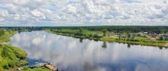
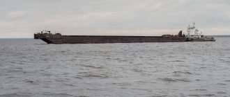
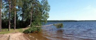
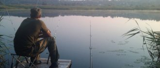
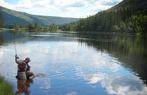
The reservoirs of the Kurgan region are constantly on the lips of amateur fishermen and athletes. Most of the local reservoirs are part of the Kara Sea. And the largest rivers in the region are the Iset and Tobol. There are more than enough places for fishing.

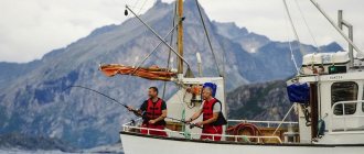
The region has all the conditions for ideal fishing and active recreation, both on a paid and free basis. A lot of different fish, beautiful reservoirs, excellent nature - all this makes fishing in the region excellent and promising.
What kind of fish is found in the Kurgan region
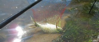
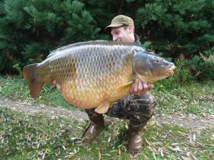
There is a lot of fish in the Kurgan region, they are large and can be caught very well. The presence of a large species composition opens up great opportunities for lovers of fishing in all its manifestations. Very often found in local reservoirs:
- Sturgeon;
- Sterlet;
- Whitefish;
- Trout;
- Nelma;
- Peled;
- Pike;
- Verkhovka;
- Minnow;
- Gudgeon;
- Roach;
- Dace;
- Ide;
- Bream;
- crucian carp;
- Carp;
- Tench;
- White amur;
- Silver carp;
- Pinching;
- Catfish;
- Burbot;
- Ruff;
- Perch;
- Zander;
- Rotan.
As you can see, the fish of the Kurgan region is very diverse. Starting from small and frequently encountered ruffs, and ending with large sterlet, which some have never seen in their lives. This entire impressive list of fish can be caught in local reservoirs, but sturgeon fishing is prohibited, so you should think twice before putting sturgeon in a fish tank.
Satellite map of the Kurgan region
Kurgan region is a territorial unit that is part of the Russian Federation. It lies in the Trans-Ural region on the Asian part of the country and is part of the Ural Federal District. The region includes part of the West Siberian Plain and has a flat, flat topography. From the west it adjoins the Ural Mountains, and in the east it borders on the territories of Siberia.
The satellite map of the Kurgan region is a high-resolution satellite photo Use + and – in the left corner of the map to enlarge the satellite image of the Kurgan region.
Kurgan region. Satellite view
The map of the Kurgan region from a satellite can be viewed both in schematic map mode and in satellite view mode by switching viewing modes on the right side of the map.
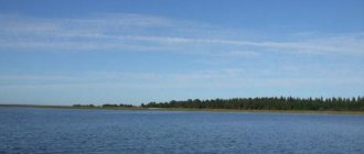
Water resources are represented by the large rivers Tobol and Iset and a significant number of lakes and small rivers. The number of lakes, a little less than two hundred of them, are located mainly in the east. Some of them have mineralized healing properties: Gorkoe, Medvezhye. Large cities in the region: Kurgan, Shadrinsk, Shumikha.
Mound. Satellite map online (The map is controlled using the mouse, as well as signs in the right corner of the map)
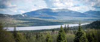
The remoteness from the world ocean causes the territory to have a sharply continental climate with cool summers and cold winters. The territory of the region is occupied by the forest-steppe zone. Birch groves and pine forests alternate with areas of steppe and floodplain meadows. One of the features of the vegetation is the combination of coniferous forests and cherry thickets. More than half of all lands are occupied by agricultural land. Among the forest areas, you can most often find birch forests and areas with coniferous trees. In the area of the healing Bear Lake there are pine and linden forests. In the forests of the Kurgan region you can find typical inhabitants: squirrels, hares, wolves, foxes, roe deer. The Kurgan region is famous for its healing springs. The most famous is Gorky Lake, not far from which there are springs with mineral water. The water of Lake Medvezhye is used to treat a number of diseases. Due to its properties, it is recognized as more valuable than the mud of the Dead Sea. On the territory there are historical monuments: St. Nicholas Church, Dolmatovsky Assumption, Chimeevsky monasteries. Historical museums: House-Museum of the Decembrists, Kurgan Aviation Museum.
Map of fishing spots
Among local fishermen, the left tributary of the Irtysh River, the Tobol River, is quite famous. The river begins on the territory of Kazakhstan, after which it smoothly flows into the territory of the Kurgan region. The diverse composition of the inhabitants, as well as the winding channel and clean bottom are ideal conditions for fishing.
Official sources claim that about 30 fish live in the reservoir. But only 15 of the species live in the reservoir permanently, the rest swim for the spawning or wintering period. This only increases the interest of fishermen in fishing.
Typically, anglers come across roach, perch, carp, crucian carp and bream. But local fishermen, who know where to fish and what gear to do it with, very often catch other inhabitants of water bodies.
Winter fishing on Tobol also takes place. Local fishermen recommend using bloodworms or maggots as bait. But, you shouldn’t get too carried away with small fractions in the bait, as there is a high probability of luring ruff to the fishing spot. Large fractions in the groundbait do an excellent job with brushes.
In the spring, it is customary to catch bream in local reservoirs; on Tobol, everything happens according to tradition. Classic feeders are used as equipment. But in autumn and summer everything is not so specific; here the volume and variety of gear can significantly affect the outcome of fishing. Baits of plant origin, porridge, pasta - all this is used by local fishermen to catch bream.
Some fishermen prefer to put earthworms on a hook, not just one, but a whole bunch. This bait is perfect for autumn bream fishing.
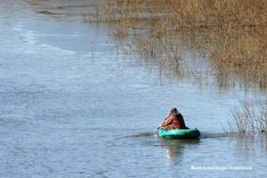
The Iset River, the second largest river in the Kurgan Region, originates in the Sverdlovsk region. Sharp changes in depth, whirlpools and an abundance of snags at the bottom only contribute to fishing. For lovers of float fishing, finding promising places on the reservoir will be easy.
Kilometers of beauty
About small rivers of the Trans-Urals
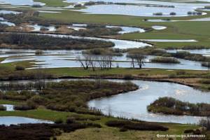
The Kurgan region is one of those regions of the Russian Federation where water resources are extremely limited in both quantity and quality. In the Ural Federal District, the Kurgan region ranks last in terms of water availability. However, in the Kurgan region there are 449 watercourses with a total length of 5175.6 km.
Only numbers
There are 114 large, medium and small rivers with a length of more than 10 km in our region. The three largest water arteries with a length of over 500 km are Tobol, Iset and Miass, their sources are located outside the Kurgan region. The total length of the three largest rivers within the region is 955 km.
There are seven medium-sized rivers with a length from 101 to 500 km in the Kurgan region - these are Uy, Ubagan, Kurtamysh, Yurgamysh, Suer, Sinara, Techa. Their length within the region is 594.4 km.
There are 38 small rivers with a length from 26 to 100 km in the Kurgan region. Their total length is 1629 km. There are 68 smallest rivers from 10 to 25 km, the total length of these rivers is 1034.7 km. There are 333 smallest watercourses less than 10 km long in the Kurgan region. Their total length is 932.5 km. It is small rivers that give the nature of the Trans-Urals its unique charm. Each of them has its own history, its own character.
Black River
Every resident of Kurgan knows a small river called Chernaya. It is in honor of this small (37 km long) water artery that one of the streets in the regional center is named – Chernorechenskaya. The Chernaya River flows through the territory of the Ketovsky district and the city of Kurgan; its source is located in the Iletsk-Ikovsky forest, west of the village of Vvedenskoye. The path of the river is not easy - in Vvedensky the Chernavka River flows into the Chernaya River. Then the Chernaya flows under the P-254 Irtysh highway, then its path for more than two kilometers goes through a swamp called Zaymishche.
After this, Chernaya meets the Kurgan microdistrict of Zaykovo on its way, then flows into a swamp, then flows for two kilometers and again flows into the Ostrovskoye swamp. Having passed under the Kurgan - Yekaterinburg railway, the Chernaya flows through a lake with the same name Chernoe (Kurgan residents often call it “Glass”), in which there is a settling tank, flows through such areas of the city of Kurgan as Severny and Ryabkovo, again crosses the Irtysh highway and flows through the village of Bolshoye Chausovo, Ketovsky district, through Lake Chernoye and after four kilometers finally flows into the Tobol. The Black River is not particularly clean, however, anglers claim that it contains bleaks, minnows, perches and roaches.
92 kilometers of beauty
The Ik River is a left tributary of the Tobol River, 92 kilometers long. It flows through the territories of the Kargapol, Ketovsky and Belozersky districts of the Kurgan region. Ik originates in swamps in the Kargapol district of the Kurgan region near the Zmeinaya zaimka, north of the Toropkovskaya Pad swamp at an altitude of approximately 119 meters above sea level. After passing through the picturesque Ikovsko-Iletsk forest, near the village of Ikovskoye, Ik flows into the Tobol.
At first, this river looks like the most ordinary stream with low and marshy banks, but after 30 kilometers the Ik becomes a real river with high steep banks, cool pools and deep black pools, and the path of this river is whimsical and winding. In summer, the Ica riverbed is overgrown with lush aquatic vegetation. The average width of the river is small - 3-4 meters, but in some places the Ik overflows to 20 meters. Pike, perch, roach, ruff, and chebak are found here.
The Ik has several picturesque tributaries: Deulka, Maly Ik, Chernaya, Cheremshanka, Plotinka, Michal. Along the banks of the Ika are the village of Bolshoye Bannikovo, the village of Maloye Bannikovo, the rural village of Chashinsky, the village of Iletsky (just below this settlement there are good places for fishing), the rural village of Stary Prosvet, the rural village of Chistoprudny, the village of Redkino (there is a children's health center camp named after Alyosha Rogachev), the village of Rusakovo, the village of Rychkovo, the village of Govorukhino, the village of Koshkino. Not far from the confluence of the Michal River, the Ik River is crossed by the P-254 highway, and near the village of Iletsky - by the P-354 road.
Despite the fact that the banks of the river are quite inhabited, those who like to splash around in the water, and even more so, swim, will not have fun on Ica - there are very few places suitable for swimming, the bottom is mostly muddy. And the water remains cold even in the hot summer months. But tourists, who have long chosen the banks of Ika for their hiking and cycling (and in winter, skiing) trips, set up tourist dugout bathhouses along this river.
Along the banks of Ika there are bird cherry trees, apple trees and wild rose hips, pine forests, sometimes trees break or bend strongly and fall on the opposite bank. The beavers that live on this river love to gnaw tree trunks and build dams. It is because of the furry four-legged builders that Ik is not navigable - numerous dams prevent movement on boats and rafts.
Traces of human activity also give the river landscape a peculiar charm - earlier, in the era of the USSR, there were many pioneer camps along the banks of the Ica, from which now only iron bridges and the remains of various buildings remain. If we turn to more ancient times, it is worth remembering that once upon a time on Ica, Timofey Nevezhin himself, the founder of Kurgan, founded a water mill.
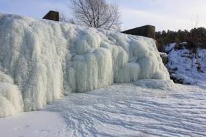
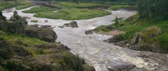
Trans-Ural waterfalls
On several small rivers of the Kurgan region you can admire picturesque waterfalls. The Trans-Ural attractions are, of course, far from the famous Niagara Falls, but our waterfalls are also worth visiting. In the area of the village of Verkhnyaya Techa on the Baskazyk River there is a dam and a dam, thanks to this, on the river, especially in spring, you can see a real artificial waterfall. First, the water flows down the four wide and gentle spans of the dam, and then violently rushes down from a height of about five meters.
The Baskazyk River with steep banks flows through the territory of the Chelyabinsk and Kurgan regions. This is the right tributary of the Techa River. The length of the river is 28 kilometers, it flows from Lake Belikul and flows into the Techa River on the right side, below the village of Verkhnyaya Techa, Katai district, Kurgan region.
Another small river with a waterfall is Utyak, the right tributary of the Tobol with a total length of 29 kilometers. The Utyak River begins five kilometers from the village of Rovnoye, flows through the village of Mitino, flows into the Tobol near the village of Ust-Utyak and the village of Lesnikovo. On Utyak there are two dams with reservoirs: Mitinsky and a reservoir in the area of the village of Balki, behind which you can observe an artificial waterfall. In winter it is much more impressive than in summer, as it freezes colorfully.
If you witness an interesting event, send messages, photos and videos to Viber and WhatsApp to phone number. : +79195740453, in our group “VKontakte”
Our Telegram channel
Vkontakte community
Yandex.Zen channel
Free fishing spots in the Kurgan region
On the territory of the Kurgan region there is an excellent lake called Bolshie Shtanki. There are a lot of crucian carp in the reservoir. Fish can be found in absolutely any size, from small ones to kilogram specimens. They catch it with a float rod and use earthworms as bait.
Lake Indysyak also attracts many fishing enthusiasts. The main object of fishing is the minnow, which is so loved by local and visiting fishermen. Some even go to the Kurgan region only for the purpose of such fishing. In addition to this fish, crucian carp, perch or pike are often caught.
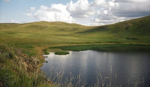
Lake Big Shtanki
Lake Nyukhalovo is famous among carp fishermen; it has brought many trophy specimens to fans of such fishing. Classic feeder rigs are used as gear. In addition to carp, you can catch minnow, crucian carp and perch in the pond.
Lake Uglovoye attracts lovers of catching predatory fish. Their main goal is pike fishing. The toothy fish is caught on various spinning baits, as well as live bait. Less commonly, crucian carp and minnow are caught using a feeder and float rod.
Bear Lake
Lake Medvezhye is located in the Petukhovsky district of the Kurgan region. It is a famous health tourism destination. But people come here not only for health. Peace reigns here, you can wander in complete solitude through forests untouched by man, breathing air unspoiled by civilization. The history of the birth of the name of the lake and the idea of founding a sanatorium here are more like a legend. They say that once a wounded bear came to the lake. He put his sore paw into it. Over time, the natural reservoir took on the shape of a wild animal. In Russia, Bear Lake is considered an analogue of the Dead Sea of Israel. But treatment here is much cheaper and more pleasant. In the sanatorium, for treatment they use everything that the lake can provide - mineral water, silt mud and brine.
The water in the lake is so salty that it can keep a person on the surface.

In the Trans-Urals, this is one of the oldest balneological mud resorts, accommodating up to 200 vacationers. The main treatment profile is diseases of the gastrointestinal tract, circulatory system, and endocrine system. It is believed that a holiday on Bear Lake benefits people suffering from nervous system and metabolic disorders. Kurgan region , or rather this particular resort, is a center of attraction for residents of all corners of Russia and neighboring countries for the treatment of allergies, skin, gynecological, and joint diseases. The sanatorium practices mud and water treatment, physiotherapy, magnetic therapy, ultrasound, UHF, and speleotherapy. Tourists who come not to a sanatorium, but simply for a wild holiday, always take canisters with them, collecting healing mud from the lake.